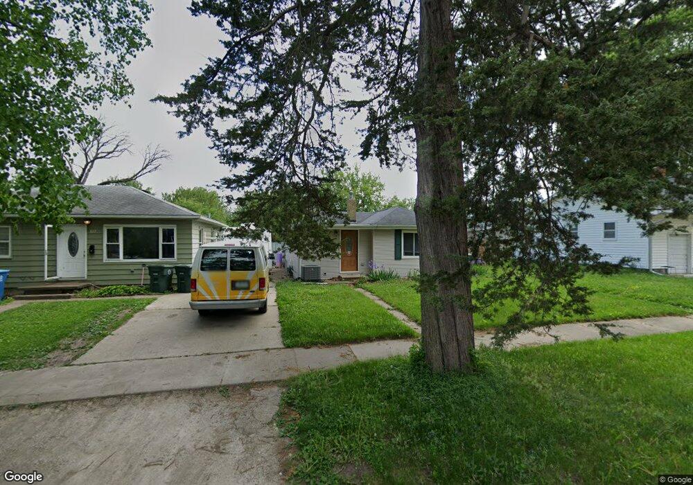
808 Forest Ave Waterloo, IA 50702
Neighbors Helping Neighbors NeighborhoodEstimated Value: $100,000 - $125,611
2
Beds
1
Bath
840
Sq Ft
$134/Sq Ft
Est. Value
About This Home
This home is located at 808 Forest Ave, Waterloo, IA 50702 and is currently estimated at $112,153, approximately $133 per square foot. 808 Forest Ave is a home located in Black Hawk County with nearby schools including Irving Elementary School, Central Middle School, and West High School.
Ownership History
Date
Name
Owned For
Owner Type
Purchase Details
Closed on
Nov 25, 2009
Sold by
Alagic Osman and Alagic Senija
Bought by
Baethke Cameron S and Baethke Jessi R
Current Estimated Value
Home Financials for this Owner
Home Financials are based on the most recent Mortgage that was taken out on this home.
Original Mortgage
$79,365
Outstanding Balance
$51,690
Interest Rate
4.95%
Mortgage Type
FHA
Estimated Equity
$60,463
Create a Home Valuation Report for This Property
The Home Valuation Report is an in-depth analysis detailing your home's value as well as a comparison with similar homes in the area
Home Values in the Area
Average Home Value in this Area
Purchase History
We collect this data history from publicly available records. To have your information removed, we recommend requesting removal directly through your county’s website.
| Date | Buyer | Sale Price | Title Company |
|---|---|---|---|
| Baethke Cameron S | $84,000 | None Available |
Source: Public Records
Mortgage History
We collect this data history from publicly available records. To have your information removed, we recommend requesting removal directly through your county’s website.
| Date | Status | Borrower | Loan Amount |
|---|---|---|---|
| Open | Baethke Cameron S | $79,365 |
Source: Public Records
Tax History
| Year | Tax Paid | Tax Assessment Tax Assessment Total Assessment is a certain percentage of the fair market value that is determined by local assessors to be the total taxable value of land and additions on the property. | Land | Improvement |
|---|---|---|---|---|
| 2025 | $1,768 | $106,930 | $17,020 | $89,910 |
| 2024 | $1,768 | $100,150 | $17,020 | $83,130 |
| 2023 | $1,480 | $100,150 | $17,020 | $83,130 |
| 2022 | $1,438 | $79,630 | $17,020 | $62,610 |
| 2021 | $1,494 | $79,630 | $17,020 | $62,610 |
| 2020 | $1,464 | $77,870 | $13,100 | $64,770 |
| 2019 | $1,464 | $77,870 | $13,100 | $64,770 |
| 2018 | $1,468 | $77,870 | $13,100 | $64,770 |
| 2017 | $1,468 | $77,870 | $13,100 | $64,770 |
| 2016 | $1,494 | $77,870 | $13,100 | $64,770 |
| 2015 | $1,494 | $77,870 | $13,100 | $64,770 |
| 2014 | $1,440 | $74,280 | $13,100 | $61,180 |
Source: Public Records
Map
Nearby Homes
- 1324 W 6th St
- 925 Forest Ave
- 1712 W 7th St
- 1017 Forest Ave
- 1219 W 7th St
- Lot #17 Denver St
- Lot #15 Denver St
- Lot # 13 Denver St
- Lot #10 Denver St
- 500 Johnson St
- 611 Johnson St
- 301 Bertch Ave
- 1013 W 6th St
- 814 E Mitchell Ave
- 524 Vermont St
- 2012 W 7th St
- 922 E Mitchell Ave
- 908 Grant Ave
- 151 Hawthorne Ave
- 915 W 5th St
- 812 Forest Ave
- 1511 W 6th St
- 1505 W 6th St
- 824 Forest Ave
- 0 W 6th St
- 815 Hawthorne Ave
- 803 Forest Ave
- 826 Forest Ave
- 1500 W 6th St
- 817 Hawthorne Ave
- 811 Hawthorne Ave
- 807 Forest Ave
- 819 Hawthorne Ave
- 801 Hawthorne Ave
- 815 Forest Ave
- 1506 W 6th St
- 819 Forest Ave
- 828 Forest Ave
- 825 Hawthorne Ave
- 1512 W 6th St
Your Personal Tour Guide
Ask me questions while you tour the home.