Estimated Value: $379,000 - $574,000
--
Bed
--
Bath
2,050
Sq Ft
$218/Sq Ft
Est. Value
About This Home
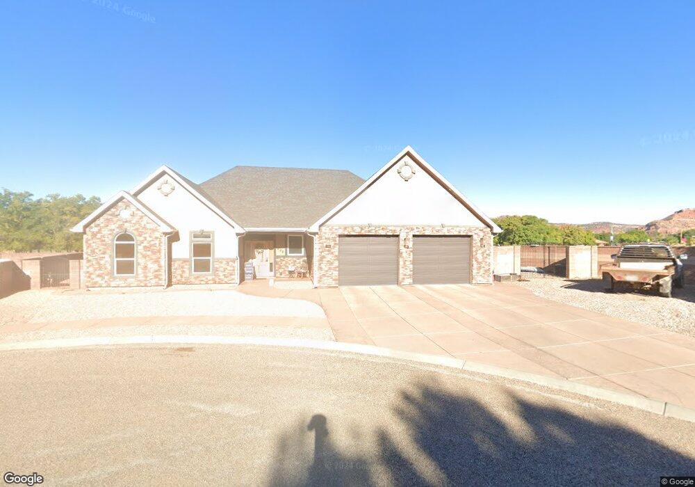
This home is located at 808 S Peartree, Kanab, UT 84741 and is currently estimated at $447,871, approximately $218 per square foot. 808 S Peartree is a home located in Kane County with nearby schools including Kanab Elementary School, Kanab Middle School, and Kanab High School.
Ownership History
Date
Name
Owned For
Owner Type
Purchase Details
Closed on
Jan 22, 2020
Bought by
Rodriguez Ferdinand Entrada and Rodriguez Kristy Mary
Current Estimated Value
Purchase Details
Closed on
Feb 2, 2007
Sold by
Heerdt Christopher and Heerdt Peggy
Bought by
Virostko David J and Virostko Taleana R
Home Financials for this Owner
Home Financials are based on the most recent Mortgage that was taken out on this home.
Original Mortgage
$264,595
Interest Rate
6.11%
Purchase Details
Closed on
May 24, 2005
Sold by
Vision South Inc
Bought by
Heerdt Christopher and Heerdt Peggy
Create a Home Valuation Report for This Property
The Home Valuation Report is an in-depth analysis detailing your home's value as well as a comparison with similar homes in the area
Home Values in the Area
Average Home Value in this Area
Purchase History
| Date | Buyer | Sale Price | Title Company |
|---|---|---|---|
| Rodriguez Ferdinand Entrada | -- | -- | |
| Virostko David J | -- | -- | |
| Heerdt Christopher | -- | -- |
Source: Public Records
Mortgage History
| Date | Status | Borrower | Loan Amount |
|---|---|---|---|
| Previous Owner | Virostko David J | $264,595 |
Source: Public Records
Tax History Compared to Growth
Tax History
| Year | Tax Paid | Tax Assessment Tax Assessment Total Assessment is a certain percentage of the fair market value that is determined by local assessors to be the total taxable value of land and additions on the property. | Land | Improvement |
|---|---|---|---|---|
| 2025 | $2,392 | $289,149 | $54,253 | $234,896 |
| 2024 | $2,392 | $277,936 | $48,897 | $229,039 |
| 2023 | $2,140 | $254,785 | $46,568 | $208,217 |
| 2022 | $1,860 | $219,332 | $30,044 | $189,288 |
| 2021 | $1,678 | $296,953 | $42,020 | $254,933 |
| 2020 | $1,648 | $283,104 | $42,020 | $241,084 |
| 2019 | $1,818 | $304,127 | $52,536 | $251,591 |
| 2018 | $1,781 | $295,371 | $43,780 | $251,591 |
| 2017 | $1,695 | $268,484 | $39,800 | $228,684 |
| 2016 | $1,499 | $230,530 | $39,800 | $190,730 |
| 2015 | $1,359 | $213,415 | $39,800 | $173,615 |
| 2014 | $1,359 | $207,975 | $40,257 | $167,718 |
| 2013 | -- | $114,386 | $0 | $0 |
Source: Public Records
Map
Nearby Homes
- 818 S Highway 89a
- 80 E Red Shadow Cir
- 26 E Sedona Valley Rd
- 425 S Moki Dr Unit I-1
- 425 S Moki Dr Unit 117
- 931 S Hillside Dr
- 1117 S Terrel Dr
- 300 S 300 E Unit I-7
- 300 S 300 E Unit A5
- 325 S Main St
- 580 S Cedar Cir
- 786 Cedar Cir
- 559 S Cedar Cir
- 176 S 100 E
- 346 E 150 S
- 107 S 300 E
- 0 U S Highway 89
- 143 E 100 S Unit 2
- 143 E 100 S Unit 1
- 442 E 100 S