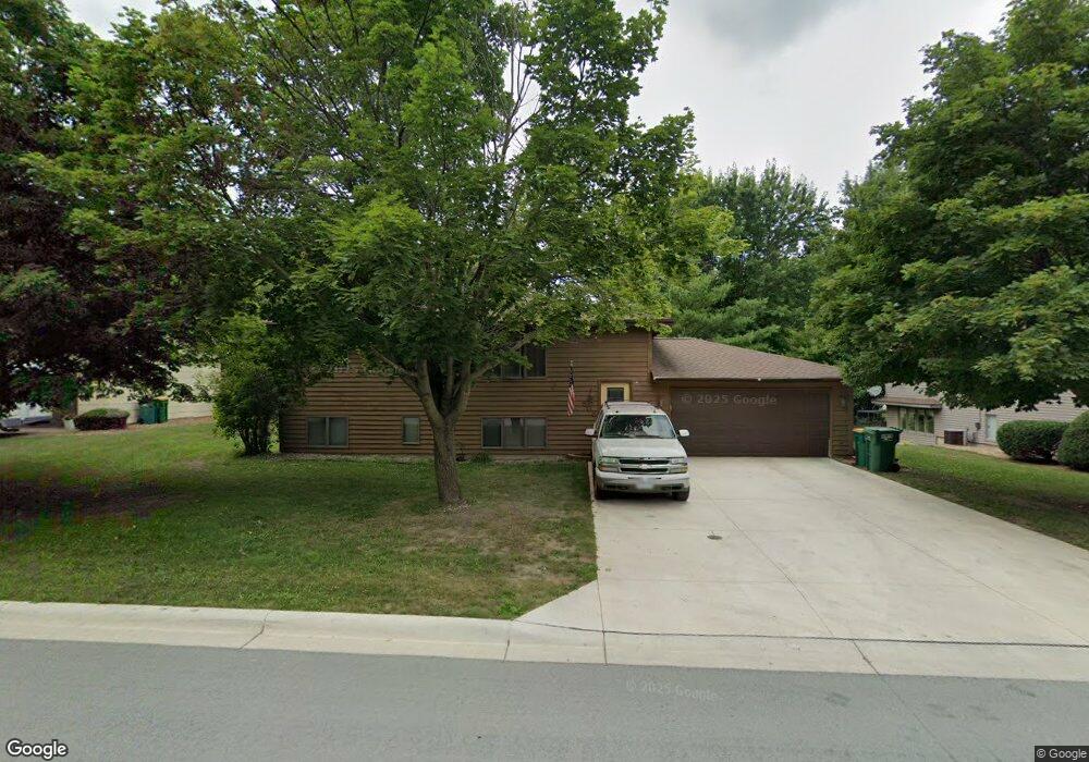
808 W Circle Dr Montgomery, MN 56069
Estimated Value: $275,740 - $308,000
4
Beds
2
Baths
1,326
Sq Ft
$217/Sq Ft
Est. Value
About This Home
This home is located at 808 W Circle Dr, Montgomery, MN 56069 and is currently estimated at $287,935, approximately $217 per square foot. 808 W Circle Dr is a home located in Le Sueur County with nearby schools including Tri-City United Montgomery PreK-8, Tri-City United Lonsdale PreK-6 Elementary School, and Tri-City United High School.
Ownership History
Date
Name
Owned For
Owner Type
Purchase Details
Closed on
Jul 21, 2017
Sold by
Casey Colin and Casey Chelsea
Bought by
Stephens Mark
Current Estimated Value
Home Financials for this Owner
Home Financials are based on the most recent Mortgage that was taken out on this home.
Original Mortgage
$162,011
Outstanding Balance
$136,343
Interest Rate
4.37%
Mortgage Type
FHA
Estimated Equity
$151,592
Purchase Details
Closed on
Mar 1, 2013
Sold by
Casey Patrick
Bought by
Casey Colin
Home Financials for this Owner
Home Financials are based on the most recent Mortgage that was taken out on this home.
Original Mortgage
$96,000
Interest Rate
3.49%
Purchase Details
Closed on
Nov 21, 2011
Sold by
Hsbc Bank Usa Na
Bought by
Casey Colin and Casey Patrick
Create a Home Valuation Report for This Property
The Home Valuation Report is an in-depth analysis detailing your home's value as well as a comparison with similar homes in the area
Home Values in the Area
Average Home Value in this Area
Purchase History
| Date | Buyer | Sale Price | Title Company |
|---|---|---|---|
| Stephens Mark | $165,000 | -- | |
| Casey Colin | -- | Nations Title Agency Of Minn | |
| Casey Colin | $100,000 | -- |
Source: Public Records
Mortgage History
| Date | Status | Borrower | Loan Amount |
|---|---|---|---|
| Open | Stephens Mark | $162,011 | |
| Previous Owner | Casey Colin | $96,000 |
Source: Public Records
Tax History
| Year | Tax Paid | Tax Assessment Tax Assessment Total Assessment is a certain percentage of the fair market value that is determined by local assessors to be the total taxable value of land and additions on the property. | Land | Improvement |
|---|---|---|---|---|
| 2025 | $4,678 | $261,600 | $57,400 | $204,200 |
| 2024 | $4,426 | $261,600 | $57,400 | $204,200 |
| 2023 | $4,266 | $261,600 | $57,400 | $204,200 |
| 2022 | $3,846 | $245,000 | $57,400 | $187,600 |
| 2021 | $2,938 | $198,600 | $53,400 | $145,200 |
| 2020 | $2,850 | $189,300 | $50,400 | $138,900 |
| 2019 | $2,732 | $162,200 | $44,671 | $117,529 |
| 2018 | $2,717 | $148,400 | $43,919 | $104,481 |
| 2017 | $2,467 | $132,800 | $40,351 | $92,449 |
| 2016 | $2,456 | $118,500 | $35,990 | $82,510 |
| 2015 | $2,441 | $118,500 | $35,990 | $82,510 |
| 2014 | $2,043 | $90,800 | $29,674 | $61,126 |
| 2013 | $2,040 | $90,800 | $29,674 | $61,126 |
Source: Public Records
Map
Nearby Homes
- 105 N Circle Dr
- 712 W Circle Dr
- 675 E Welco Dr
- 609 E Welco Dr
- 507 Welco Ln W
- 408 5th St NW
- 406 5th St NW
- 201 Boulevard Ave NE
- 213 Boulevard Ave NE
- 913 Mulberry Ave NE
- 917 Mulberry Ave NE
- 921 Mulberry Ave NE
- 922 Mulberry Ave NE
- 906 Mulberry Ave NE
- 1003 Mulberry Ave NE
- 220 6th St NE
- 218 6th St NE
- 1201 Meadow St NW
- 216 Fischer Ct NW
- 900 Mulberry Ave NE
- 810 W Circle Dr
- 806 W Circle Dr
- 812 W Circle Dr
- 804 W Circle Dr
- 805 W Circle Dr
- 100 N Circle Dr
- 803 W Circle Dr
- 98 N Circle Dr
- 807 W Circle Dr
- 814 W Circle Dr
- 802 W Circle Dr
- 809 W Circle Dr
- 101 Inner Dr
- 96 N Circle Dr
- 800 W Circle Dr
- 811 W Circle Dr
- 103 Inner Dr
- 802 Hillcrest Dr
- 99 N Circle Dr
- 101 N Circle Dr
Your Personal Tour Guide
Ask me questions while you tour the home.