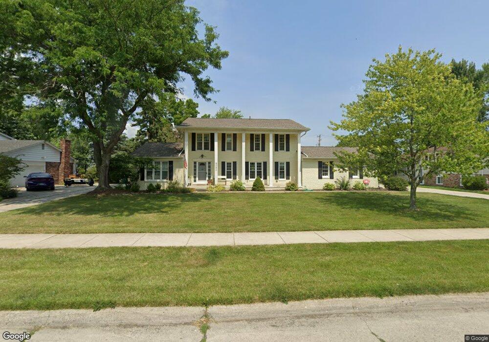
8082 Berkshire Dr Grosse Ile, MI 48138
Estimated Value: $420,086 - $528,000
--
Bed
1
Bath
2,693
Sq Ft
$172/Sq Ft
Est. Value
About This Home
This home is located at 8082 Berkshire Dr, Grosse Ile, MI 48138 and is currently estimated at $463,022, approximately $171 per square foot. 8082 Berkshire Dr is a home located in Wayne County.
Ownership History
Date
Name
Owned For
Owner Type
Purchase Details
Closed on
Oct 7, 2015
Sold by
Bolthouse Linda and Bolthouse Terry
Bought by
Weise John and Weise Kelly
Current Estimated Value
Purchase Details
Closed on
May 18, 2015
Sold by
Bolthouse Linda
Bought by
Bolthouse Todd
Create a Home Valuation Report for This Property
The Home Valuation Report is an in-depth analysis detailing your home's value as well as a comparison with similar homes in the area
Home Values in the Area
Average Home Value in this Area
Purchase History
| Date | Buyer | Sale Price | Title Company |
|---|---|---|---|
| Weise John | $257,000 | Michigan Title Ins Agency In | |
| Bolthouse Todd | -- | None Available |
Source: Public Records
Tax History Compared to Growth
Tax History
| Year | Tax Paid | Tax Assessment Tax Assessment Total Assessment is a certain percentage of the fair market value that is determined by local assessors to be the total taxable value of land and additions on the property. | Land | Improvement |
|---|---|---|---|---|
| 2025 | $2,226 | $194,300 | $0 | $0 |
| 2024 | $2,226 | $171,200 | $0 | $0 |
| 2023 | $2,547 | $157,100 | $0 | $0 |
| 2022 | $5,927 | $145,000 | $0 | $0 |
| 2021 | $5,669 | $142,800 | $0 | $0 |
| 2019 | $5,623 | $124,500 | $0 | $0 |
| 2018 | $2,479 | $128,600 | $0 | $0 |
| 2017 | $6,402 | $123,600 | $0 | $0 |
| 2016 | $5,665 | $122,900 | $0 | $0 |
| 2015 | $10,591 | $111,500 | $0 | $0 |
| 2013 | -- | $107,000 | $0 | $0 |
| 2012 | $2,183 | $101,000 | $23,700 | $77,300 |
Source: Public Records
Map
Nearby Homes
- 21599 Parke Ln
- 22015 Ember Ct
- 8258 Concord Rd
- 21604 E River Rd
- 22220 E River Rd
- 7806 Island Blvd
- 8232 Island Blvd
- 21644 Knudsen Dr
- 8614 Island Blvd
- 21321 Knudsen Dr
- 21071 Thorofare Rd
- 21819 Meridian Rd
- 22133 Meridian Rd
- 20633 Canal Dr
- 9281 Island Dr
- 21438 Meridian Rd
- 8855 Ferry Rd
- Lot 503 Gi Pkwy
- 00000 Magnolia Ln
- VACANT Oriole Ave
- 8060 Berkshire Dr
- 8104 Berkshire Dr
- 8146 Berkshire Dr
- 8038 Berkshire Dr
- 8093 Berkshire Dr
- 8071 Berkshire Dr
- 8115 Berkshire Dr
- 8049 Berkshire Dr
- 21733 Canterbury Ave
- 8137 Berkshire Dr
- 21749 Canterbury Ave
- 8016 Berkshire Dr
- 8027 Berkshire Dr
- 21717 Canterbury Ave
- 8062 Burning Bush Rd
- 8159 Berkshire Dr
- 8084 Burning Bush Rd
- 8040 Burning Bush Rd
- 8106 Burning Bush Rd
- 21701 Canterbury Ave