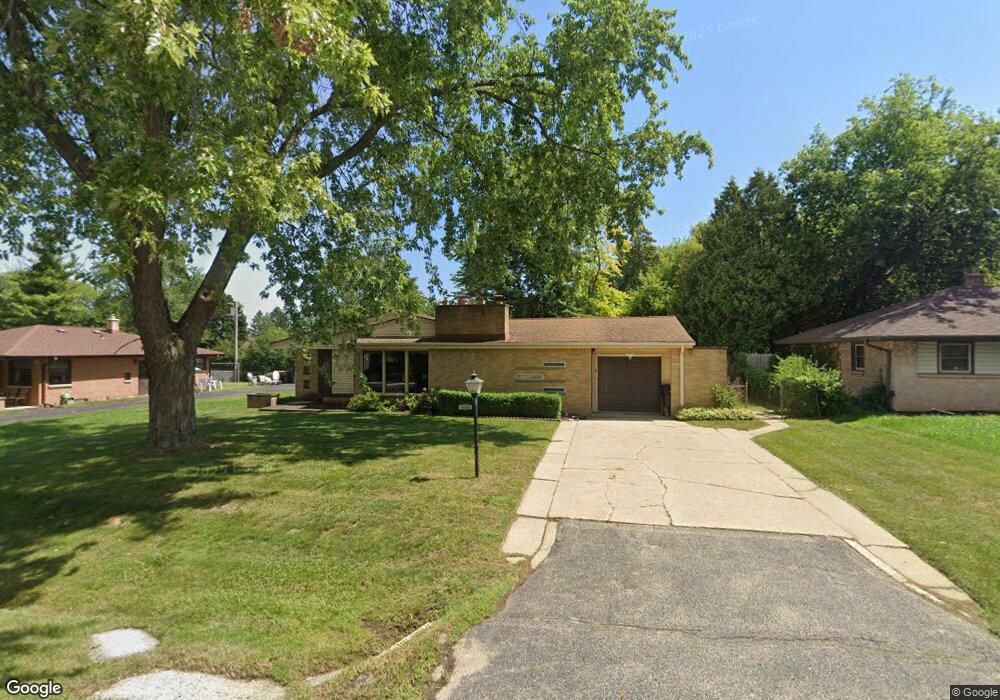
8084 N 62nd St Milwaukee, WI 53223
Estimated Value: $267,000 - $309,775
--
Bed
--
Bath
--
Sq Ft
10,106
Sq Ft Lot
About This Home
This home is located at 8084 N 62nd St, Milwaukee, WI 53223 and is currently estimated at $281,194. 8084 N 62nd St is a home located in Milwaukee County with nearby schools including Brown Deer Elementary School, Brown Deer Middle/High School, and Early View Academy of Excellence.
Ownership History
Date
Name
Owned For
Owner Type
Purchase Details
Closed on
May 22, 2002
Sold by
Mcgovern Marguerite P
Bought by
Evans Helen C
Current Estimated Value
Home Financials for this Owner
Home Financials are based on the most recent Mortgage that was taken out on this home.
Original Mortgage
$119,000
Outstanding Balance
$50,320
Interest Rate
6.95%
Mortgage Type
Purchase Money Mortgage
Estimated Equity
$230,874
Purchase Details
Closed on
Feb 26, 2001
Sold by
Mcgovern Michael J
Bought by
Mcgovern Marguerite P and Marguerite Mcgovern Trust
Create a Home Valuation Report for This Property
The Home Valuation Report is an in-depth analysis detailing your home's value as well as a comparison with similar homes in the area
Home Values in the Area
Average Home Value in this Area
Purchase History
| Date | Buyer | Sale Price | Title Company |
|---|---|---|---|
| Evans Helen C | $139,000 | -- | |
| Mcgovern Marguerite P | -- | -- |
Source: Public Records
Mortgage History
| Date | Status | Borrower | Loan Amount |
|---|---|---|---|
| Open | Evans Helen C | $119,000 |
Source: Public Records
Tax History Compared to Growth
Tax History
| Year | Tax Paid | Tax Assessment Tax Assessment Total Assessment is a certain percentage of the fair market value that is determined by local assessors to be the total taxable value of land and additions on the property. | Land | Improvement |
|---|---|---|---|---|
| 2024 | $5,512 | $283,100 | $33,000 | $250,100 |
| 2023 | $5,512 | -- | -- | -- |
| 2022 | $5,512 | $253,000 | $33,000 | $220,000 |
| 2021 | $5,264 | $218,100 | $33,000 | $185,100 |
| 2020 | $5,033 | $193,000 | $33,000 | $160,000 |
| 2019 | $4,599 | $154,500 | $33,000 | $121,500 |
| 2018 | $5,195 | $154,500 | $33,000 | $121,500 |
| 2017 | $4,333 | $154,500 | $33,000 | $121,500 |
| 2016 | $4,447 | $154,500 | $33,000 | $121,500 |
| 2015 | $4,550 | $154,500 | $33,000 | $121,500 |
| 2014 | $4,384 | $150,000 | $42,600 | $107,400 |
| 2013 | $4,767 | $150,000 | $42,600 | $107,400 |
Source: Public Records
Map
Nearby Homes
- 6039 W Tower Ave
- 8025 N 62nd St
- 6206 W Fairlane Ave
- 7871 N 60th St
- 7979 N 66th St
- 8067 N 54th St
- 8254 N 55th St
- 7901 N 66th St
- 8274 N 55th St
- 6293 W Port Ave Unit E13
- 6254 W Port Ave Unit C18
- 7731 N 60th St Unit G
- 7769 N Delta Place
- 5400 W Dean Rd
- 8267 N 52nd St
- 6081 W Calumet Rd
- 8574 N 58th St
- 7744 N Fairway Place
- 7658 N Delta Place
- 5665 W Range Ave
- 8074 N 62nd St
- 8094 N 62nd St
- 8085 N 61st St
- 8064 N 62nd St
- 8104 N 62nd St
- 8095 N 61st St
- 8077 N 62nd St
- 8065 N 61st St
- 8105 N 61st St
- 8093 N 62nd St
- 8054 N 62nd St
- 8114 N 62nd St
- 8065 N 62nd St
- 8103 N 62nd St
- 8055 N 61st St
- 8115 N 61st St
- 8055 N 62nd St
- 8113 N 62nd St
- 8044 N 62nd St
- 6155 W Tower Ave