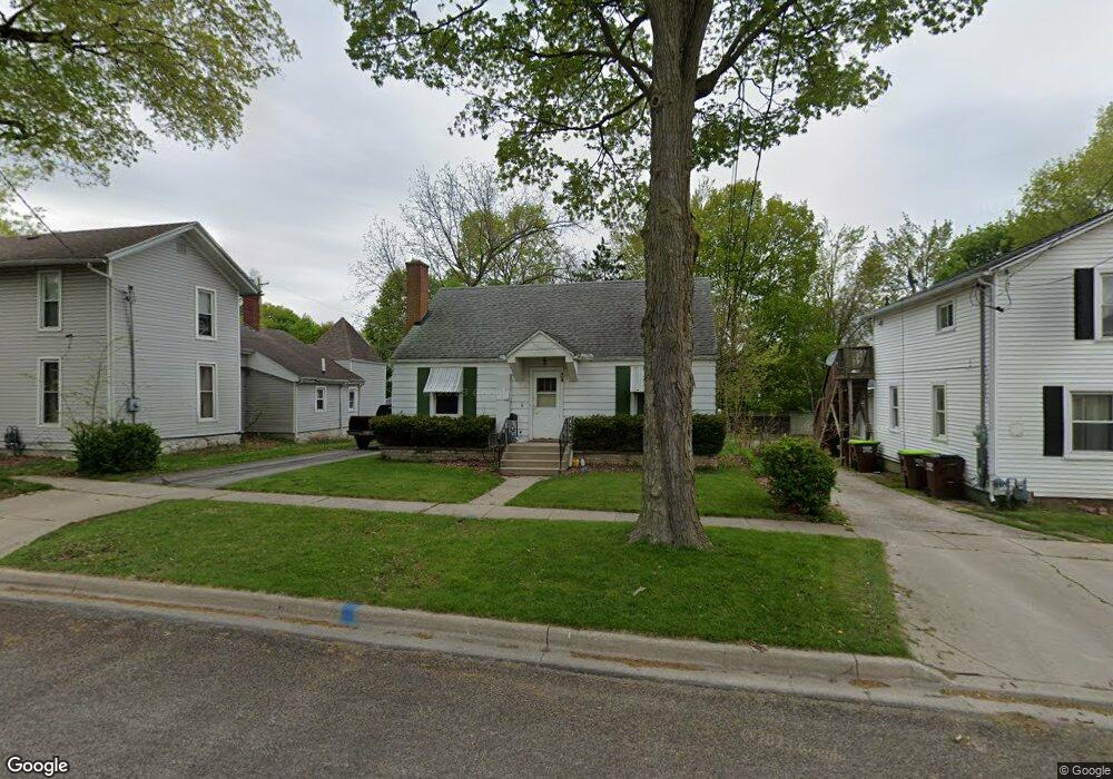
809 Clinton St Unit CLINT Adrian, MI 49221
Estimated Value: $123,000 - $141,000
2
Beds
1
Bath
910
Sq Ft
$146/Sq Ft
Est. Value
About This Home
This home is located at 809 Clinton St Unit CLINT, Adrian, MI 49221 and is currently estimated at $132,863, approximately $146 per square foot. 809 Clinton St Unit CLINT is a home located in Lenawee County with nearby schools including Adrian High School, St. Joseph Academy, and St. Joseph's Academy.
Ownership History
Date
Name
Owned For
Owner Type
Purchase Details
Closed on
Mar 6, 2007
Sold by
Deutsche Bank Trust Company Americas
Bought by
Nixon Barry L and Nixon Mary L
Current Estimated Value
Home Financials for this Owner
Home Financials are based on the most recent Mortgage that was taken out on this home.
Original Mortgage
$67,000
Outstanding Balance
$40,576
Interest Rate
6.27%
Mortgage Type
New Conventional
Estimated Equity
$92,287
Purchase Details
Closed on
May 4, 2006
Sold by
Whitehead Gary R and Whitehead Kimberlei R
Bought by
Deutsche Bank Trsut Comapny Americas and Bankers Trust Co
Create a Home Valuation Report for This Property
The Home Valuation Report is an in-depth analysis detailing your home's value as well as a comparison with similar homes in the area
Home Values in the Area
Average Home Value in this Area
Purchase History
| Date | Buyer | Sale Price | Title Company |
|---|---|---|---|
| Nixon Barry L | $67,000 | Attorneys Title Agency Llc | |
| Deutsche Bank Trsut Comapny Americas | $86,097 | None Available |
Source: Public Records
Mortgage History
| Date | Status | Borrower | Loan Amount |
|---|---|---|---|
| Open | Nixon Barry L | $67,000 |
Source: Public Records
Tax History
| Year | Tax Paid | Tax Assessment Tax Assessment Total Assessment is a certain percentage of the fair market value that is determined by local assessors to be the total taxable value of land and additions on the property. | Land | Improvement |
|---|---|---|---|---|
| 2025 | $1,969 | $43,100 | $0 | $0 |
| 2024 | $15 | $39,600 | $0 | $0 |
| 2023 | $1,880 | $35,500 | $0 | $0 |
| 2022 | $3,063 | $32,200 | $0 | $0 |
| 2021 | $1,547 | $29,300 | $0 | $0 |
| 2020 | $1,537 | $27,300 | $0 | $0 |
| 2019 | $70,109 | $24,800 | $0 | $0 |
| 2018 | $1,482 | $28,947 | $0 | $0 |
| 2017 | $1,551 | $26,207 | $0 | $0 |
| 2016 | $1,428 | $24,398 | $0 | $0 |
| 2014 | -- | $25,600 | $0 | $0 |
Source: Public Records
Map
Nearby Homes
- 612 N Clinton St
- 417 E Hunt St
- 423 E Butler St
- 803 Ormsby St
- 717 Bristol St
- 822 Elm St
- 229 Clinton St
- 820 Mulberry St
- 418 E Church St
- 371 Riverside Ave
- 306 Summer St
- 228 W Church St
- 924 Frank St
- 333 Greenly St
- 227 Greenly St
- 453 Riverside Ave
- 547 Riverside Ave
- 2550 Bent Oak Ave
- 559 Northwestern Dr
- 703 Company St
- 809 Clinton St
- 809 Clinton St Unit CLINTON ST
- 813 Clinton St
- 225 Bristol St
- 819 Clinton St
- 810 N Broad St
- 812 N Broad St
- 804 Clinton St
- 802 N Broad St
- 823 Clinton St
- 818 N Broad St
- 222 Bristol St
- 814 Clinton St
- 724 N Broad St
- 208 Seeley St
- 208 Seeley St Unit SEELEY
- 818 Clinton St
- 824 N Broad St
- 822 Clinton St
- 720 N Broad St
Your Personal Tour Guide
Ask me questions while you tour the home.