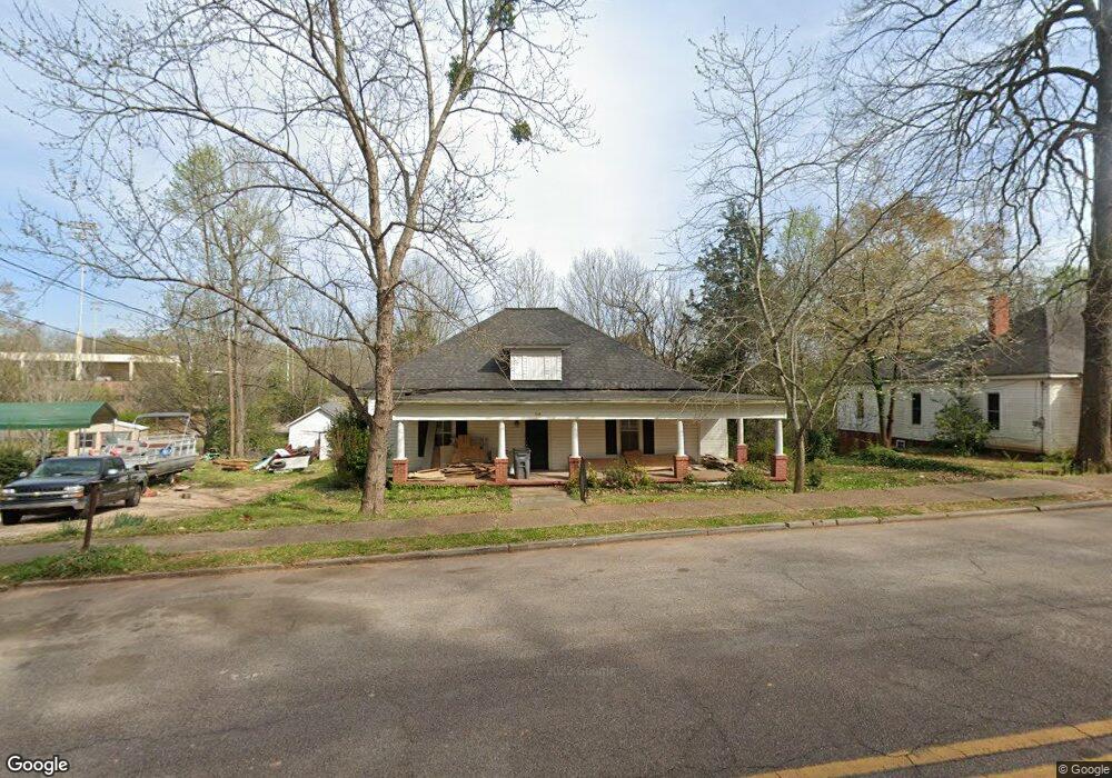
809 Forrest Ave Lagrange, GA 30240
Estimated Value: $92,000 - $147,983
3
Beds
2
Baths
2,028
Sq Ft
$55/Sq Ft
Est. Value
About This Home
This home is located at 809 Forrest Ave, Lagrange, GA 30240 and is currently estimated at $111,746, approximately $55 per square foot. 809 Forrest Ave is a home located in Troup County with nearby schools including Berta Weathersbee Elementary School, Whitesville Road Elementary School, and Rosemont Elementary School.
Ownership History
Date
Name
Owned For
Owner Type
Purchase Details
Closed on
Feb 11, 2021
Sold by
Collier Danny Lee
Bought by
Adams C R
Current Estimated Value
Purchase Details
Closed on
Oct 30, 2015
Sold by
Collier Danny Lee
Bought by
Collier Danny Lee and Harris Meredith Ridlin
Purchase Details
Closed on
Sep 16, 1991
Sold by
Loyd Lena
Bought by
Donaldson Carolyn J
Purchase Details
Closed on
Jan 11, 1975
Sold by
Prestridge Dian Rice and Prestridge William
Bought by
Loyd Lena
Purchase Details
Closed on
Sep 14, 1971
Sold by
Keeble Curtis and Keeble Agnes
Bought by
Prestridge Dian Rice and Prestridge William
Purchase Details
Closed on
Jun 1, 1951
Sold by
Ussery Charles B
Bought by
Keeble Curtis and Keeble Agnes
Create a Home Valuation Report for This Property
The Home Valuation Report is an in-depth analysis detailing your home's value as well as a comparison with similar homes in the area
Purchase History
| Date | Buyer | Sale Price | Title Company |
|---|---|---|---|
| Adams C R | $71,100 | -- | |
| Collier Danny Lee | -- | -- | |
| Donaldson Carolyn J | $33,000 | -- | |
| Loyd Lena | $17,800 | -- | |
| Prestridge Dian Rice | $17,000 | -- | |
| Keeble Curtis | -- | -- |
Source: Public Records
Tax History
| Year | Tax Paid | Tax Assessment Tax Assessment Total Assessment is a certain percentage of the fair market value that is determined by local assessors to be the total taxable value of land and additions on the property. | Land | Improvement |
|---|---|---|---|---|
| 2025 | $889 | $32,612 | $4,840 | $27,772 |
| 2024 | $410 | $15,044 | $4,840 | $10,204 |
| 2023 | $388 | $14,244 | $4,840 | $9,404 |
| 2022 | $794 | $38,364 | $4,840 | $33,524 |
| 2021 | $868 | $28,764 | $4,840 | $23,924 |
| 2020 | $731 | $24,252 | $4,840 | $19,412 |
| 2019 | $699 | $23,168 | $4,840 | $18,328 |
| 2018 | $677 | $22,458 | $4,890 | $17,568 |
| 2017 | $677 | $22,458 | $4,890 | $17,568 |
| 2016 | $662 | $21,953 | $4,890 | $17,063 |
| 2015 | $662 | $21,914 | $4,851 | $17,063 |
| 2014 | $636 | $21,015 | $4,851 | $16,164 |
| 2013 | -- | $21,815 | $4,851 | $16,964 |
Source: Public Records
Map
Nearby Homes
- 812 Elm St
- 517 Jefferson St
- 613 S Lee St
- 1304 Forrest Ave
- 1405 Forrest Ave
- 1402 Forrest Ave
- 606 S Lee St
- 109 Garfield St
- 606 Poplar St
- 600 Park Ave
- 202 Parker Ln
- 1205 Park Ave
- 900 B N Pkwy
- 1308 Forrest Ave
- 1004 Callaway Ave
- 1520 Brownwood Ave
- 1015 Stonewall St
- 1017 Stonewall St
- 1005 Callaway Ave
- 1308 Park Ave
- 807 Forrest Ave
- 811 Forrest Ave
- 813 Forrest Ave
- 815 Forrest Ave
- 803 Forrest Ave
- 817 Forrest Ave
- B Brownwood Ave
- 801 Forrest Ave
- 900 Forrest Ave
- 901 Washington St
- 902 Forrest Ave
- 402 Lincoln St
- 900 Washington St
- 903 Forrest Ave
- 904 Forrest Ave
- 902 Washington St
- 606 Lincoln St
- 604 Lincoln St
- 1200 1st Ave
- 1105 1st Ave
Your Personal Tour Guide
Ask me questions while you tour the home.