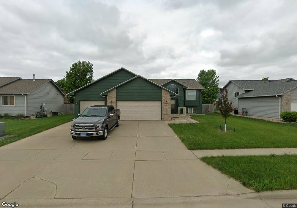
809 S Clearbrook Ave Sioux Falls, SD 57106
Northwest Sioux Falls NeighborhoodEstimated Value: $351,000 - $372,646
4
Beds
3
Baths
1,864
Sq Ft
$194/Sq Ft
Est. Value
About This Home
This home is located at 809 S Clearbrook Ave, Sioux Falls, SD 57106 and is currently estimated at $362,412, approximately $194 per square foot. 809 S Clearbrook Ave is a home located in Minnehaha County with nearby schools including Discovery Elementary School, Memorial Middle School, and Jefferson High School - 67.
Ownership History
Date
Name
Owned For
Owner Type
Purchase Details
Closed on
Apr 22, 2015
Sold by
Sean T Sean T and Mceneaney Danielle
Bought by
Hanson Cody E and Hanson Mckenzie R
Current Estimated Value
Home Financials for this Owner
Home Financials are based on the most recent Mortgage that was taken out on this home.
Original Mortgage
$212,472
Interest Rate
3.85%
Mortgage Type
New Conventional
Create a Home Valuation Report for This Property
The Home Valuation Report is an in-depth analysis detailing your home's value as well as a comparison with similar homes in the area
Home Values in the Area
Average Home Value in this Area
Purchase History
| Date | Buyer | Sale Price | Title Company |
|---|---|---|---|
| Hanson Cody E | $208,000 | First Dakota Title |
Source: Public Records
Mortgage History
| Date | Status | Borrower | Loan Amount |
|---|---|---|---|
| Closed | Hanson Cody E | $212,472 |
Source: Public Records
Tax History
| Year | Tax Paid | Tax Assessment Tax Assessment Total Assessment is a certain percentage of the fair market value that is determined by local assessors to be the total taxable value of land and additions on the property. | Land | Improvement |
|---|---|---|---|---|
| 2024 | $4,447 | $327,400 | $29,600 | $297,800 |
| 2023 | $4,254 | $301,300 | $29,600 | $271,700 |
| 2022 | $4,426 | $296,400 | $29,600 | $266,800 |
| 2021 | $3,315 | $235,000 | $0 | $0 |
| 2020 | $3,315 | $211,200 | $0 | $0 |
| 2019 | $3,151 | $196,860 | $0 | $0 |
| 2018 | $2,899 | $192,759 | $0 | $0 |
| 2017 | $2,776 | $181,757 | $32,832 | $148,925 |
| 2016 | $2,776 | $173,987 | $32,832 | $141,155 |
| 2015 | $2,729 | $164,393 | $31,008 | $133,385 |
| 2014 | -- | $164,393 | $31,008 | $133,385 |
Source: Public Records
Map
Nearby Homes
- 8009 W Stoney Creek St
- 824 S Tanglewood Ave
- 7816 W Kelsey Cir
- 811 S Discovery Ave
- 1209 S Wheatland Ave
- 1301 S Hyannis Port Ln
- 8709 W Rathburn St
- 1201 S Montpelier Ave Ave
- 7525 W Stoney Creek St
- 516 S Mary Gene Ave
- 8016 W Browning St
- 1501 S Wheatland Ave
- 1100 S Maria Ave
- 7512 W Stoney Creek St
- 521 S Big Stone Ave
- 1516 S Kinderhook Ave
- 7505 W 15th St
- 8101 W 24th St
- 8105 W 24th St
- 701 S Gill Ave
- 805 S Clearbrook Ave
- 804 S Whitewood Ave
- 800 S Whitewood Ave
- 808 S Clearbrook Ave
- 817 S Clearbrook Ave
- 817 S Clearbrook Ave Ave
- 808 S Whitewood Ave
- 801 S Clearbrook Ave
- 720 S Whitewood Ave
- 804 S Clearbrook Ave
- 812 S Whitewood Ave
- 819 S Clearbrook Ave
- 713 S Clearbrook Ave
- 716 S Whitewood Ave
- 800 S Clearbrook Ave
- 816 S Whitewood Ave
- 816 S Clearbrook Ave
- 712 S Whitewood Ave
- 805 S Whitewood Ave
- 801 S Whitewood Ave
Your Personal Tour Guide
Ask me questions while you tour the home.