809 Upland Blvd Las Vegas, NV 89107
Buffalo NeighborhoodEstimated payment $3,686/month
Highlights
- Accessory Dwelling Unit (ADU)
- RV Access or Parking
- View of Las Vegas Strip
- In Ground Pool
- Wind Turbine Power
- 1-minute walk to Gary Dexter Park
About This Home
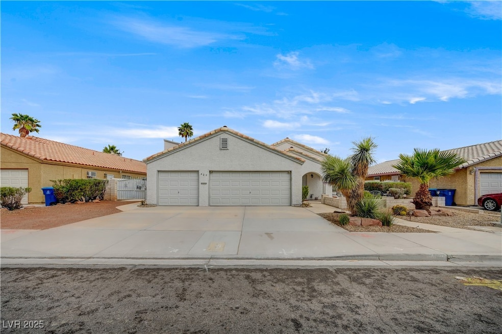
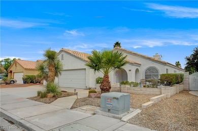
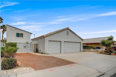
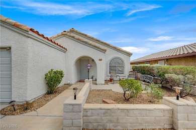
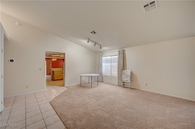
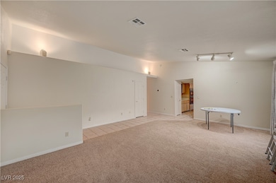
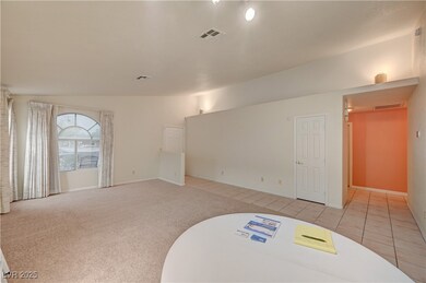
Airbnb Potential.....Stunning 1,698 sq ft main home + 900 sq ft 2-story guest house with 1 Bedroom, one full bathroom and one-half bath, with full kitchen, private entrance & rooftop deck w/ Strip views! Ideal for multigenerational living, or home office/studio. Features include an upgraded kitchen, spa-like master bath with walk-in shower & jacuzzi tub. Enjoy a private pool with a raised spa, a 5-hole putting green, and fully landscaped grounds (see photos). Rare 3-car garage + RV/boat parking. Located across from a brand-new park & near two new elementary schools + junior high. A true lifestyle home with income potential! Contact Terry to show .
Listing Agent
Investors Realty Group Brokerage Phone: 702-304-1947 License #B.0012136 Listed on: 09/13/2025
Home Details
Home Type
- Single Family
Est. Annual Taxes
- $2,257
Year Built
- Built in 1990
Lot Details
- 9,148 Sq Ft Lot
- West Facing Home
- Back Yard Fenced
- Block Wall Fence
- Desert Landscape
- Artificial Turf
- Front Yard Sprinklers
Parking
- 3 Car Attached Garage
- Parking Storage or Cabinetry
- Inside Entrance
- Open Parking
- RV Access or Parking
Home Design
- Frame Construction
- Tile Roof
- Stucco
Interior Spaces
- 2,596 Sq Ft Home
- 1-Story Property
- Ceiling Fan
- Wood Burning Fireplace
- Double Pane Windows
- Tinted Windows
- Blinds
- Drapes & Rods
- Family Room with Fireplace
- Views of Las Vegas Strip
Kitchen
- Built-In Gas Oven
- Gas Cooktop
- Microwave
- Dishwasher
- Disposal
Flooring
- Carpet
- Linoleum
- Vinyl
Bedrooms and Bathrooms
- 3 Bedrooms
- Soaking Tub
Laundry
- Laundry Room
- Laundry on main level
- Gas Dryer Hookup
Eco-Friendly Details
- Energy-Efficient Windows
- Wind Turbine Power
Pool
- In Ground Pool
- In Ground Spa
- Gas Heated Pool
Outdoor Features
- Deck
- Covered Patio or Porch
- Outdoor Grill
Additional Homes
- Accessory Dwelling Unit (ADU)
Schools
- Red Rock Elementary School
- Garside Frank F. Middle School
- Western High School
Utilities
- Central Heating and Cooling System
- Multiple Heating Units
- Underground Utilities
- 220 Volts in Garage
Community Details
- No Home Owners Association
- Eadwood Subdivision
Map
Home Values in the Area
Average Home Value in this Area
Tax History
| Year | Tax Paid | Tax Assessment Tax Assessment Total Assessment is a certain percentage of the fair market value that is determined by local assessors to be the total taxable value of land and additions on the property. | Land | Improvement |
|---|---|---|---|---|
| 2025 | $2,257 | $141,409 | $38,500 | $102,909 |
| 2024 | $2,192 | $141,409 | $38,500 | $102,909 |
| 2023 | $2,192 | $130,541 | $32,725 | $97,816 |
| 2022 | $2,128 | $118,574 | $28,875 | $89,699 |
| 2021 | $2,066 | $110,962 | $25,410 | $85,552 |
| 2020 | $2,003 | $109,360 | $24,255 | $85,105 |
| 2019 | $1,945 | $106,686 | $22,715 | $83,971 |
| 2018 | $1,888 | $100,322 | $19,250 | $81,072 |
| 2017 | $3,193 | $97,400 | $15,015 | $82,385 |
| 2016 | $1,788 | $89,118 | $13,090 | $76,028 |
| 2015 | $1,785 | $64,750 | $9,625 | $55,125 |
| 2014 | $1,732 | $59,905 | $6,160 | $53,745 |
Property History
| Date | Event | Price | List to Sale | Price per Sq Ft |
|---|---|---|---|---|
| 10/29/2025 10/29/25 | Price Changed | $669,000 | -4.3% | $258 / Sq Ft |
| 10/27/2025 10/27/25 | Price Changed | $699,000 | +4.3% | $269 / Sq Ft |
| 09/13/2025 09/13/25 | For Sale | $670,284 | -- | $258 / Sq Ft |
Purchase History
| Date | Type | Sale Price | Title Company |
|---|---|---|---|
| Interfamily Deed Transfer | -- | Old Republic Title Company | |
| Interfamily Deed Transfer | -- | Old Republic Title Company |
Mortgage History
| Date | Status | Loan Amount | Loan Type |
|---|---|---|---|
| Closed | $114,000 | Stand Alone First |
Source: Las Vegas REALTORS®
MLS Number: 2718883
APN: 138-36-403-007
- 709 Evergreen Cir
- 5425 Evergreen Ave
- 5412 Cory Place
- 800 S Mallard St
- 808 S Mallard St
- 5412 Gipsy Ave
- 417 Wisteria Ave
- 6204 W Charleston Blvd
- 5412 Holmby Ave
- 468 Fallwood Ln
- 5317 Lytton Ave
- 429 Mill Hollow Rd
- 5425 Del Rey Ave
- 517 Berry Cir
- 329 Wisteria Ave
- 352 Mill Hollow Rd
- 5132 Harvest Moon Ln
- 421 Wonderstone Dr
- 5304 Mountain View Dr
- 22 Mountain View Dr
- 5800 W Charleston Blvd
- 5905 W Charleston Blvd
- 5205 Alta Dr
- 800 Slayton Dr
- 349 Upland Blvd
- 333 S Mallard St
- 501 Slayton Dr
- 5309 Longridge Ave
- 901 Brush St
- 319 Yosemite St
- 6232 Blair Way
- 5229 Mountain View Dr
- 5260 Mission Monterey Ln Unit 105
- 5260 Mission Monterey Ln Unit 102
- 103 S Mallard St
- 6328 Alta Dr
- 5250 Mission Carmel Ln Unit 101
- 5250 Mission Carmel Ln Unit 103
- 6401 Evergreen Ave
- 6413 Bannock Way
