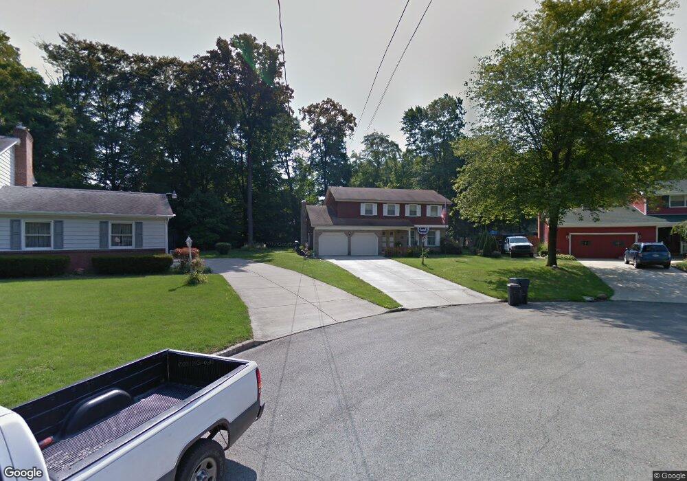
8091 Deerpath Dr Youngstown, OH 44512
Estimated Value: $284,816 - $356,000
4
Beds
4
Baths
2,198
Sq Ft
$143/Sq Ft
Est. Value
About This Home
This home is located at 8091 Deerpath Dr, Youngstown, OH 44512 and is currently estimated at $314,954, approximately $143 per square foot. 8091 Deerpath Dr is a home located in Mahoning County with nearby schools including Stadium Drive Elementary School, Boardman Center Middle School, and Boardman High School.
Ownership History
Date
Name
Owned For
Owner Type
Purchase Details
Closed on
Jun 14, 2004
Sold by
Duponty James J and Duponty Betty Jean
Bought by
Fernback Daniel J and Fernback Gina M
Current Estimated Value
Home Financials for this Owner
Home Financials are based on the most recent Mortgage that was taken out on this home.
Original Mortgage
$116,800
Interest Rate
4.87%
Mortgage Type
Purchase Money Mortgage
Purchase Details
Closed on
Nov 9, 1966
Bought by
Duponty Betty Jean
Create a Home Valuation Report for This Property
The Home Valuation Report is an in-depth analysis detailing your home's value as well as a comparison with similar homes in the area
Home Values in the Area
Average Home Value in this Area
Purchase History
| Date | Buyer | Sale Price | Title Company |
|---|---|---|---|
| Fernback Daniel J | $146,000 | -- | |
| Duponty Betty Jean | -- | -- |
Source: Public Records
Mortgage History
| Date | Status | Borrower | Loan Amount |
|---|---|---|---|
| Previous Owner | Fernback Daniel J | $116,800 |
Source: Public Records
Tax History
| Year | Tax Paid | Tax Assessment Tax Assessment Total Assessment is a certain percentage of the fair market value that is determined by local assessors to be the total taxable value of land and additions on the property. | Land | Improvement |
|---|---|---|---|---|
| 2025 | $3,962 | $79,920 | $11,240 | $68,680 |
| 2024 | $4,054 | $79,920 | $11,240 | $68,680 |
| 2023 | $4,000 | $79,920 | $11,240 | $68,680 |
| 2022 | $4,145 | $63,410 | $11,570 | $51,840 |
| 2021 | $4,147 | $63,410 | $11,570 | $51,840 |
| 2020 | $4,169 | $63,410 | $11,570 | $51,840 |
| 2019 | $3,835 | $51,970 | $9,480 | $42,490 |
| 2018 | $3,333 | $51,970 | $9,480 | $42,490 |
| 2017 | $3,310 | $51,970 | $9,480 | $42,490 |
| 2016 | $3,181 | $49,450 | $9,480 | $39,970 |
| 2015 | $3,118 | $49,450 | $9,480 | $39,970 |
| 2014 | $3,127 | $49,450 | $9,480 | $39,970 |
| 2013 | $3,087 | $49,450 | $9,480 | $39,970 |
Source: Public Records
Map
Nearby Homes
- 8068 Deerpath Dr
- 8161 Glenwood Ave
- 123 Mayflower Dr
- 156 Roche Way
- 8460 Crystal Dr
- 139 Roche Way
- 8218 Maramont Dr Unit B
- 454 Garver Dr
- 674 Angiline Dr
- 179 Southwoods Ave
- 547 Squirrel Hill Dr
- 7619 Red Fox Dr
- 524 Berklee Dr
- 1242 W Western Reserve Rd
- 1594 W Western Reserve Rd
- 221 Stafford Ave
- Lot 36 Berklee Dr
- 62 E Western Reserve Rd Unit 3
- 218 Boardman Blvd
- 0 W Western Reserve Rd Unit 5188999
- 8095 Deerpath Dr
- 8085 Deerpath Dr
- 8092 Glenwood Ave
- 8098 Glenwood Ave
- 8099 Deerpath Dr
- 8086 Glenwood Ave
- 410 Glenwoods Ct
- 414 Glenwoods Ct
- 8077 Deerpath Dr
- 8080 Glenwood Ave
- 418 Glenwoods Ct
- 8103 Deerpath Dr
- 8082 Deerpath Dr
- 406 Glenwoods Ct
- 8074 Glenwood Ave
- 8071 Deerpath Dr
- 8107 Deerpath Dr
- 8074 Deerpath Dr
- 8068 Glenwood Ave
- 413 Glenwoods Ct
Your Personal Tour Guide
Ask me questions while you tour the home.