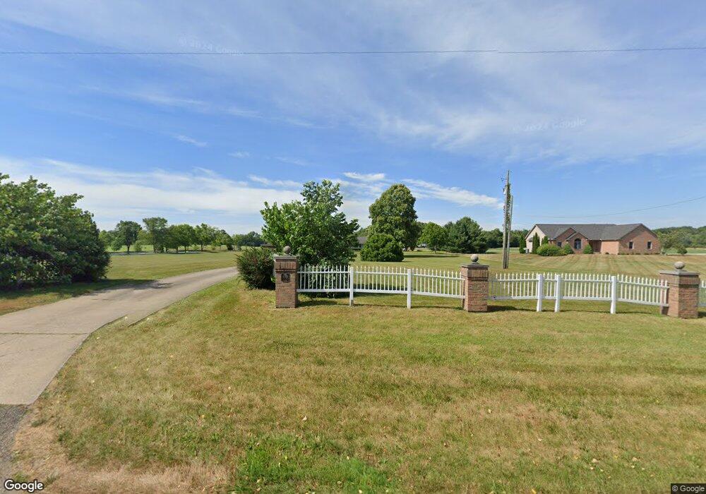
8095 Allen Dr NE Alliance, OH 44601
Estimated Value: $428,000 - $457,000
2
Beds
3
Baths
2,585
Sq Ft
$171/Sq Ft
Est. Value
About This Home
This home is located at 8095 Allen Dr NE, Alliance, OH 44601 and is currently estimated at $441,478, approximately $170 per square foot. 8095 Allen Dr NE is a home located in Stark County with nearby schools including Marlington High School.
Ownership History
Date
Name
Owned For
Owner Type
Purchase Details
Closed on
May 25, 2009
Sold by
Wise Helen M and Wise David S
Bought by
Wise Helen M and Helen M Wise Revocable Trust
Current Estimated Value
Purchase Details
Closed on
May 12, 2007
Sold by
Wise David S and Wise Helen M
Bought by
Wise Helen M
Purchase Details
Closed on
Aug 28, 2002
Sold by
Wise David S and Wise Helen M
Bought by
Wise David S and Wise Helen M
Create a Home Valuation Report for This Property
The Home Valuation Report is an in-depth analysis detailing your home's value as well as a comparison with similar homes in the area
Home Values in the Area
Average Home Value in this Area
Purchase History
| Date | Buyer | Sale Price | Title Company |
|---|---|---|---|
| Wise Helen M | -- | Attorney | |
| Wise Helen M | -- | Attorney | |
| Wise David S | -- | -- |
Source: Public Records
Tax History Compared to Growth
Tax History
| Year | Tax Paid | Tax Assessment Tax Assessment Total Assessment is a certain percentage of the fair market value that is determined by local assessors to be the total taxable value of land and additions on the property. | Land | Improvement |
|---|---|---|---|---|
| 2025 | -- | $127,685 | $35,985 | $91,700 |
| 2024 | -- | $127,685 | $35,985 | $91,700 |
| 2023 | $3,004 | $102,555 | $30,205 | $72,350 |
| 2022 | $3,030 | $90,620 | $18,270 | $72,350 |
| 2021 | $3,963 | $115,190 | $34,160 | $81,030 |
| 2020 | $3,474 | $94,750 | $28,740 | $66,010 |
| 2019 | $3,449 | $94,760 | $28,740 | $66,020 |
| 2018 | $3,293 | $94,760 | $28,740 | $66,020 |
| 2017 | $3,189 | $85,830 | $21,530 | $64,300 |
| 2016 | $3,191 | $85,830 | $21,530 | $64,300 |
| 2015 | $3,122 | $85,830 | $21,530 | $64,300 |
| 2014 | $958 | $74,740 | $18,740 | $56,000 |
| 2013 | $1,447 | $74,740 | $18,740 | $56,000 |
Source: Public Records
Map
Nearby Homes
- 7377 Pontius St NE
- 167 State Route 44
- 8736 Lynn Park St NE
- 3952 Laubert Rd
- 0 New Milford Rd Unit 5119787
- 4829 Laubert Rd
- 0 Pontius St NE
- 14265 Reeder Ave NE
- 12200 Marlboro Ave NE
- 6180 Edison St NE
- 5615 Laubert Rd
- 1026 Hartville Rd N
- 1291 State Route 44
- 12561 Duquette Ave NE
- 3990 Edison St NE
- 3705 Alexander Rd
- 14920 Mccallum Ave NE
- 3381 Alexander Rd
- 0 Waterloo Rd
- 14162 Congress Lake Ave NE
- 8115 Allen Dr NE
- 8047 Allen Dr NE
- 8003 Allen Dr NE
- 8076 Allen Dr NE
- 8141 Allen Dr NE
- 8106 Allen Dr NE
- 7979 Allen Dr NE
- 8110 Allen Dr NE
- 8056 Allen Dr NE
- 7959 Allen Dr NE
- 8237 Allen Dr NE
- 7960 Allen Dr NE
- 7925 Allen Dr NE
- 8140 Allen Dr NE
- 8206 Allen Dr NE
- 7922 Allen Dr NE
- 8315 Allen Dr NE
- 7862 Allen Dr NE
- 8272 Allen Dr NE
- 8108 Allen Dr NE