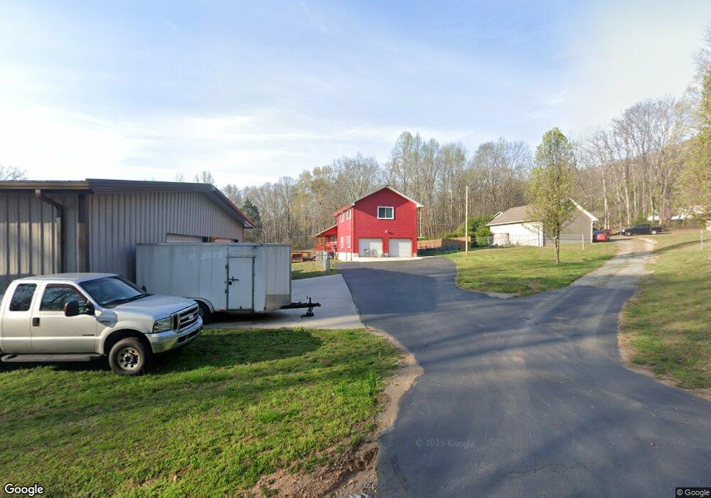
81 Arwin Johnson Rd Dunlap, TN 37327
Estimated Value: $435,397 - $653,000
Studio
2
Baths
1,872
Sq Ft
$300/Sq Ft
Est. Value
About This Home
This home is located at 81 Arwin Johnson Rd, Dunlap, TN 37327 and is currently estimated at $561,132, approximately $299 per square foot. 81 Arwin Johnson Rd is a home located in Sequatchie County with nearby schools including Griffith Elementary School, Sequatchie County Middle School, and Sequatchie County High School.
Ownership History
Date
Name
Owned For
Owner Type
Purchase Details
Closed on
Aug 19, 2010
Sold by
Johnson Jody A
Bought by
Johnson Jody A
Current Estimated Value
Purchase Details
Closed on
Sep 22, 2008
Purchase Details
Closed on
Nov 19, 2007
Purchase Details
Closed on
Jan 19, 1993
Bought by
Johnson Jody A
Purchase Details
Closed on
Jul 7, 1989
Bought by
Johnson Jody A and Wife Jennifer D
Create a Home Valuation Report for This Property
The Home Valuation Report is an in-depth analysis detailing your home's value as well as a comparison with similar homes in the area
Home Values in the Area
Average Home Value in this Area
Purchase History
| Date | Buyer | Sale Price | Title Company |
|---|---|---|---|
| Johnson Jody A | -- | -- | |
| -- | -- | -- | |
| -- | -- | -- | |
| Johnson Jody A | -- | -- | |
| Johnson Jody A | $500 | -- |
Source: Public Records
Tax History
| Year | Tax Paid | Tax Assessment Tax Assessment Total Assessment is a certain percentage of the fair market value that is determined by local assessors to be the total taxable value of land and additions on the property. | Land | Improvement |
|---|---|---|---|---|
| 2025 | $1,648 | $89,725 | $22,825 | $66,900 |
| 2024 | $1,648 | $89,725 | $22,825 | $66,900 |
| 2023 | $1,648 | $89,725 | $22,825 | $66,900 |
| 2022 | $1,495 | $61,225 | $17,050 | $44,175 |
| 2021 | $1,495 | $61,225 | $17,050 | $44,175 |
| 2020 | $1,495 | $61,225 | $17,050 | $44,175 |
| 2019 | $1,495 | $61,225 | $17,050 | $44,175 |
| 2018 | $1,480 | $60,600 | $17,050 | $43,550 |
| 2017 | $1,480 | $60,600 | $17,050 | $43,550 |
| 2016 | $1,417 | $55,150 | $14,825 | $40,325 |
| 2015 | $1,417 | $55,150 | $14,825 | $40,325 |
| 2014 | $1,343 | $52,275 | $14,825 | $37,450 |
Source: Public Records
Map
Nearby Homes
- 202 Austin Rd
- 2398 Old York Hwy
- 2426 Old York Hwy
- 2482 Old York Hwy
- 2496 Old York Hwy
- 029003.0 Smith Mountain Rd
- 029003.00 Smith Mountain Rd
- 029 Smith Mountain Rd
- 2900300 Smith Mountain Rd
- 029 003 Smith Mountain Rd
- 0 U S 127 Unit RTC2821095
- 0 U S 127 Unit 21317616
- 0 U S 127 Unit 1509009
- 87 Happy Valley Rd
- 48 River Dr
- 50 River Dr
- 41.04 Ac Windridge Dr
- 59.73 Ac Windridge Dr
- 18.69 Ac Windridge Dr
- 100 River Dr
- 91 Arwin Johnson Rd
- 35 Arwin Johnson Rd
- 170 Arwin Johnson Rd
- 339 Mount Airy Rd
- 387 Mount Airy Rd
- 244 Mount Airy Rd
- 189 Mount Airy Rd
- 161 Mount Airy Rd
- 240 Austin Rd
- 15 Mount Airy Rd
- 15 Mount Airy Rd
- 1915 Old Union Rd
- 506 Mount Airy Rd
- 249 Austin Rd
- 361 Brewer Ln
- 237 Austin Rd
- 319 Brewer Ln
- 124 Austin Rd
- 161 Magnolia Cir
- 135 Magnolia Cir