Estimated Value: $621,430 - $737,000
3
Beds
2
Baths
1,194
Sq Ft
$570/Sq Ft
Est. Value
About This Home
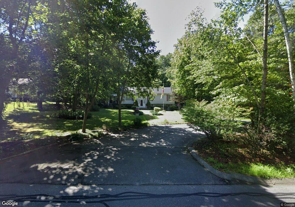
This home is located at 81 Brookdale Rd, Salem, NH 03079 and is currently estimated at $681,108, approximately $570 per square foot. 81 Brookdale Rd is a home located in Rockingham County with nearby schools including Mary A. Fisk Elementary School, Woodbury School, and Salem High School.
Ownership History
Date
Name
Owned For
Owner Type
Purchase Details
Closed on
Jul 27, 2000
Sold by
Young William M
Bought by
Avallone Daniel W and Avallone Pamela J
Current Estimated Value
Home Financials for this Owner
Home Financials are based on the most recent Mortgage that was taken out on this home.
Original Mortgage
$186,400
Interest Rate
8.18%
Create a Home Valuation Report for This Property
The Home Valuation Report is an in-depth analysis detailing your home's value as well as a comparison with similar homes in the area
Home Values in the Area
Average Home Value in this Area
Purchase History
| Date | Buyer | Sale Price | Title Company |
|---|---|---|---|
| Avallone Daniel W | $233,000 | -- |
Source: Public Records
Mortgage History
| Date | Status | Borrower | Loan Amount |
|---|---|---|---|
| Open | Avallone Daniel W | $208,000 | |
| Closed | Avallone Daniel W | $220,000 | |
| Closed | Avallone Daniel W | $186,400 |
Source: Public Records
Tax History Compared to Growth
Tax History
| Year | Tax Paid | Tax Assessment Tax Assessment Total Assessment is a certain percentage of the fair market value that is determined by local assessors to be the total taxable value of land and additions on the property. | Land | Improvement |
|---|---|---|---|---|
| 2024 | $8,200 | $465,900 | $182,300 | $283,600 |
| 2023 | $7,902 | $465,900 | $182,300 | $283,600 |
| 2022 | $7,478 | $465,900 | $182,300 | $283,600 |
| 2021 | $7,445 | $465,900 | $182,300 | $283,600 |
| 2020 | $7,042 | $319,800 | $130,300 | $189,500 |
| 2019 | $7,029 | $319,800 | $130,300 | $189,500 |
| 2018 | $6,706 | $310,300 | $130,300 | $180,000 |
| 2017 | $6,467 | $310,300 | $130,300 | $180,000 |
| 2016 | $6,339 | $310,300 | $130,300 | $180,000 |
| 2015 | $5,923 | $276,900 | $128,800 | $148,100 |
| 2014 | $5,757 | $276,900 | $128,800 | $148,100 |
| 2013 | $5,665 | $276,900 | $128,800 | $148,100 |
Source: Public Records
Map
Nearby Homes
- 72 Brookdale Rd
- 3 S Shore Rd
- 114 S Shore Rd
- 56 Pelham Rd
- 95 Lake Shore Rd
- 6-18 Mary Anthony Dr
- 17 Clinton St
- 4 Mckinstry Cir
- 14 Marianna Rd
- 11 Sullivan Ct
- 2 Hall Ave
- 7 Therese Rd
- 8 Joseph Rd
- 9 Rena Ave
- 1 Squire Armour Rd
- 92 Lowell Rd
- 75 S Policy St Unit 45
- 22 Chianti Dr
- 60 Horseshoe Rd
- 79 Lancaster Farm Rd
- 79 Brookdale Rd
- 83 Brookdale Rd
- 000 Brookdale Rd Unit 79-12600
- 76 Brookdale Rd
- 78 Brookdale Rd
- 85 Brookdale Rd Unit 2
- 85 Brookdale Rd Unit 1
- 85 Brookdale Rd
- 80 Brookdale Rd
- 72 Brookdale Rd Unit 72A
- 82 Brookdale Rd
- 84 Brookdale Rd
- 87 Brookdale Rd
- 70 Brookdale Rd
- 86 Brookdale Rd
- 91 Brookdale Rd
- 90 Brookdale Rd
- 88 Brookdale Rd
- 95 Brookdale Rd
- 92 Brookdale Rd Unit 92