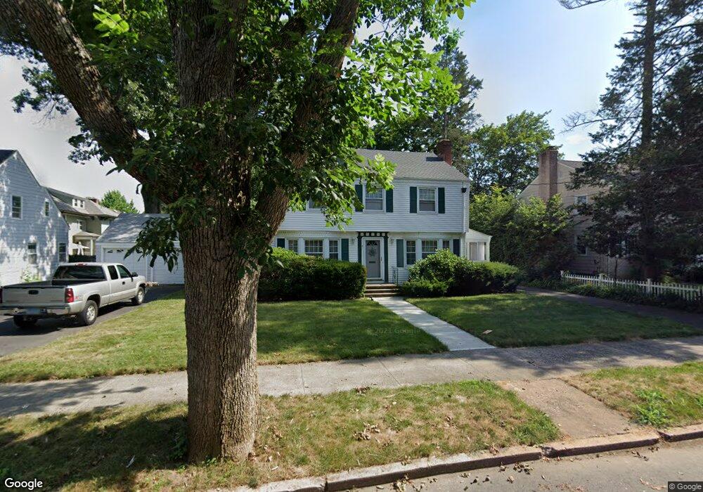
81 Cleveland Rd New Haven, CT 06515
Westville NeighborhoodEstimated Value: $472,314 - $496,000
3
Beds
2
Baths
1,757
Sq Ft
$276/Sq Ft
Est. Value
About This Home
This home is located at 81 Cleveland Rd, New Haven, CT 06515 and is currently estimated at $484,579, approximately $275 per square foot. 81 Cleveland Rd is a home located in New Haven County.
Ownership History
Date
Name
Owned For
Owner Type
Purchase Details
Closed on
Dec 24, 1992
Sold by
Albert Beatrice R
Bought by
Crosby William
Current Estimated Value
Home Financials for this Owner
Home Financials are based on the most recent Mortgage that was taken out on this home.
Original Mortgage
$106,000
Interest Rate
8.31%
Mortgage Type
Unknown
Create a Home Valuation Report for This Property
The Home Valuation Report is an in-depth analysis detailing your home's value as well as a comparison with similar homes in the area
Home Values in the Area
Average Home Value in this Area
Purchase History
| Date | Buyer | Sale Price | Title Company |
|---|---|---|---|
| Crosby William | $115,000 | -- |
Source: Public Records
Mortgage History
| Date | Status | Borrower | Loan Amount |
|---|---|---|---|
| Closed | Crosby William | $70,000 | |
| Closed | Crosby William | $94,000 | |
| Closed | Crosby William | $106,000 |
Source: Public Records
Tax History Compared to Growth
Tax History
| Year | Tax Paid | Tax Assessment Tax Assessment Total Assessment is a certain percentage of the fair market value that is determined by local assessors to be the total taxable value of land and additions on the property. | Land | Improvement |
|---|---|---|---|---|
| 2025 | $8,646 | $219,450 | $74,200 | $145,250 |
| 2024 | $8,449 | $219,450 | $74,200 | $145,250 |
| 2023 | $8,164 | $219,450 | $74,200 | $145,250 |
| 2022 | $8,723 | $219,450 | $74,200 | $145,250 |
| 2021 | $8,659 | $197,330 | $57,890 | $139,440 |
| 2020 | $8,659 | $197,330 | $57,890 | $139,440 |
| 2019 | $8,481 | $197,330 | $57,890 | $139,440 |
| 2018 | $8,481 | $197,330 | $57,890 | $139,440 |
| 2017 | $7,633 | $197,330 | $57,890 | $139,440 |
| 2016 | $8,472 | $203,910 | $68,530 | $135,380 |
| 2015 | $8,472 | $203,910 | $68,530 | $135,380 |
| 2014 | $8,472 | $203,910 | $68,530 | $135,380 |
Source: Public Records
Map
Nearby Homes
- 1975 Chapel St
- 119 Westwood Rd
- 699 Forest Rd
- 55 Marvel Rd
- 690 Forest Rd Unit 702
- 690 Forest Rd Unit 392
- 690 Forest Rd Unit 511
- 206 W Rock Ave
- 11 Priscilla Rd
- 36 Forest Hills Rd
- 56 Highview Ave
- 126 Willard St
- 96 Hubinger St
- 595 Central Ave
- 55 Irving St
- 907 Elm St
- 36 Birch Dr
- 30 Ellsworth Ave
- 360 Fountain St Unit 5
- 868 Elm St