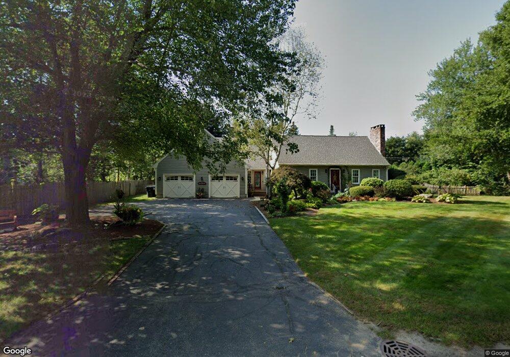
81 Hall Rd Sturbridge, MA 01566
Estimated Value: $606,000 - $746,000
3
Beds
3
Baths
2,501
Sq Ft
$262/Sq Ft
Est. Value
About This Home
This home is located at 81 Hall Rd, Sturbridge, MA 01566 and is currently estimated at $654,820, approximately $261 per square foot. 81 Hall Rd is a home located in Worcester County with nearby schools including Burgess Elementary School, Tantasqua Regional Junior High School, and Tantasqua Regional High School.
Ownership History
Date
Name
Owned For
Owner Type
Purchase Details
Closed on
Aug 1, 1994
Sold by
Fantaroni Anthony V
Bought by
Broughton Richard A and Broughton Robin
Current Estimated Value
Home Financials for this Owner
Home Financials are based on the most recent Mortgage that was taken out on this home.
Original Mortgage
$100,000
Interest Rate
8.25%
Mortgage Type
Purchase Money Mortgage
Create a Home Valuation Report for This Property
The Home Valuation Report is an in-depth analysis detailing your home's value as well as a comparison with similar homes in the area
Home Values in the Area
Average Home Value in this Area
Purchase History
| Date | Buyer | Sale Price | Title Company |
|---|---|---|---|
| Broughton Richard A | $168,500 | -- |
Source: Public Records
Mortgage History
| Date | Status | Borrower | Loan Amount |
|---|---|---|---|
| Open | Broughton Richard A | $160,000 | |
| Closed | Broughton Richard A | $85,000 | |
| Closed | Broughton Richard A | $100,000 |
Source: Public Records
Tax History Compared to Growth
Tax History
| Year | Tax Paid | Tax Assessment Tax Assessment Total Assessment is a certain percentage of the fair market value that is determined by local assessors to be the total taxable value of land and additions on the property. | Land | Improvement |
|---|---|---|---|---|
| 2025 | $8,394 | $526,900 | $84,500 | $442,400 |
| 2024 | $8,037 | $487,400 | $82,800 | $404,600 |
| 2023 | $7,586 | $419,800 | $71,900 | $347,900 |
| 2022 | $7,317 | $382,100 | $64,900 | $317,200 |
| 2021 | $6,878 | $361,600 | $61,900 | $299,700 |
| 2020 | $6,878 | $361,600 | $61,900 | $299,700 |
| 2019 | $6,463 | $337,500 | $63,600 | $273,900 |
| 2018 | $6,215 | $319,700 | $60,500 | $259,200 |
| 2017 | $5,923 | $305,300 | $58,400 | $246,900 |
| 2016 | $5,859 | $305,000 | $56,600 | $248,400 |
| 2015 | $5,770 | $299,900 | $56,600 | $243,300 |
Source: Public Records
Map
Nearby Homes
- 1 Chase Rd
- 0 Fiske Hill Rd
- 14 Maple St
- 20 Audubon Way
- 7 Haynes St
- 9 Haynes St
- 73 New Boston Rd
- 6 Mcgilpin Rd
- 101 Mcgilpin Rd
- 6 Jerry Rd
- 22 Mountain Brook Rd
- 43 Mountain Brook Rd
- 368 Main St
- 2 Sprucedale Dr
- 51-A Seneca Ln
- 6 Cedar Pond Dr
- 7 Woodlawn Dr
- 8 Blueberry Ln
- 28 Woodside Cir
- 3 Berry Farms Road - Jv
- 226 Charlton Rd
- 69 Hall Rd Unit 4
- 69 Hall Rd Unit 3
- 69 Hall Rd
- 90 Hall Rd
- 216 Charlton Rd
- 209 Charlton Rd
- 212 Charlton Rd
- 214 Charlton Rd
- 210 Charlton Rd
- 208 Charlton Rd
- 208 Charlton Rd
- 00 Confidential
- 38 & 40 Hamilton Rd
- lots Podunk Rd
- LOT 61 -8 Old Brook Cir
- 201 Charlton Rd
- 197 Charlton Rd
- 195 Charlton Rd
- 46 Hall Rd