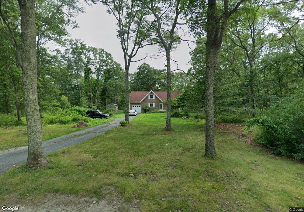
81 Maple Dr Tiverton, RI 02878
South Tiverton NeighborhoodEstimated Value: $519,000 - $575,000
3
Beds
2
Baths
1,582
Sq Ft
$349/Sq Ft
Est. Value
About This Home
This home is located at 81 Maple Dr, Tiverton, RI 02878 and is currently estimated at $551,540, approximately $348 per square foot. 81 Maple Dr is a home located in Newport County with nearby schools including Tiverton High School.
Ownership History
Date
Name
Owned For
Owner Type
Purchase Details
Closed on
Oct 27, 2010
Sold by
Citimortgage Inc
Bought by
Brash Colin S
Current Estimated Value
Home Financials for this Owner
Home Financials are based on the most recent Mortgage that was taken out on this home.
Original Mortgage
$331,500
Outstanding Balance
$219,200
Interest Rate
4.39%
Mortgage Type
Reverse Mortgage Home Equity Conversion Mortgage
Estimated Equity
$332,340
Purchase Details
Closed on
May 17, 2010
Sold by
Miles Eric and Yabroudy Robin
Bought by
Citimortgage Inc
Purchase Details
Closed on
May 26, 2004
Sold by
Skultety Stephanie and Skultety Steven
Bought by
Robin Miles Eric and Robin Yabroody
Purchase Details
Closed on
Apr 29, 2003
Sold by
Litton Brent and Litton Julie
Bought by
Skultety Stephanie and Skultety Steven
Purchase Details
Closed on
Aug 22, 2000
Sold by
Duclos James R and Duclos Patricia
Bought by
Litton Brent R and Litton Julie
Create a Home Valuation Report for This Property
The Home Valuation Report is an in-depth analysis detailing your home's value as well as a comparison with similar homes in the area
Home Values in the Area
Average Home Value in this Area
Purchase History
| Date | Buyer | Sale Price | Title Company |
|---|---|---|---|
| Brash Colin S | $221,000 | -- | |
| Citimortgage Inc | $199,500 | -- | |
| Robin Miles Eric | $350,000 | -- | |
| Skultety Stephanie | $270,000 | -- | |
| Litton Brent R | $189,500 | -- |
Source: Public Records
Mortgage History
| Date | Status | Borrower | Loan Amount |
|---|---|---|---|
| Open | Litton Brent R | $331,500 | |
| Previous Owner | Litton Brent R | $40,000 | |
| Previous Owner | Litton Brent R | $389,500 |
Source: Public Records
Tax History
| Year | Tax Paid | Tax Assessment Tax Assessment Total Assessment is a certain percentage of the fair market value that is determined by local assessors to be the total taxable value of land and additions on the property. | Land | Improvement |
|---|---|---|---|---|
| 2025 | $4,644 | $420,300 | $147,200 | $273,100 |
| 2024 | $4,644 | $420,300 | $147,200 | $273,100 |
| 2023 | $4,321 | $290,000 | $116,100 | $173,900 |
| 2022 | $4,243 | $290,000 | $116,100 | $173,900 |
| 2021 | $4,138 | $290,000 | $116,100 | $173,900 |
| 2020 | $4,143 | $255,900 | $114,100 | $141,800 |
| 2019 | $4,041 | $255,900 | $114,100 | $141,800 |
| 2018 | $4,194 | $255,900 | $114,100 | $141,800 |
| 2017 | $4,540 | $238,300 | $114,100 | $124,200 |
| 2016 | $4,561 | $238,300 | $114,100 | $124,200 |
| 2015 | $4,561 | $238,300 | $114,100 | $124,200 |
| 2014 | $4,223 | $218,800 | $114,100 | $104,700 |
Source: Public Records
Map
Nearby Homes
- 00 Lake Rd
- 240 Brayton Rd
- 1070 Crandall Rd Unit 4
- 374 Crandall Rd
- 3118 Main Rd
- 0 Seapowet Ave
- 3622 Main Rd
- 24 Cala Ave
- 50 Tower Hill Rd
- 720 Bulgarmarsh Rd
- 10 Elise Michelle Way
- 46 Arrowhead Dr
- 32 Arrowhead Dr
- 214 Sawdy Dr
- 89 North Ct
- 8 Campion Ave
- 0 Riverscape Ln Unit 73452278
- 0 Riverscape Ln Unit 1399502
- 47 Robert St
- 0 S Lake Rd Unit 73361665
Your Personal Tour Guide
Ask me questions while you tour the home.