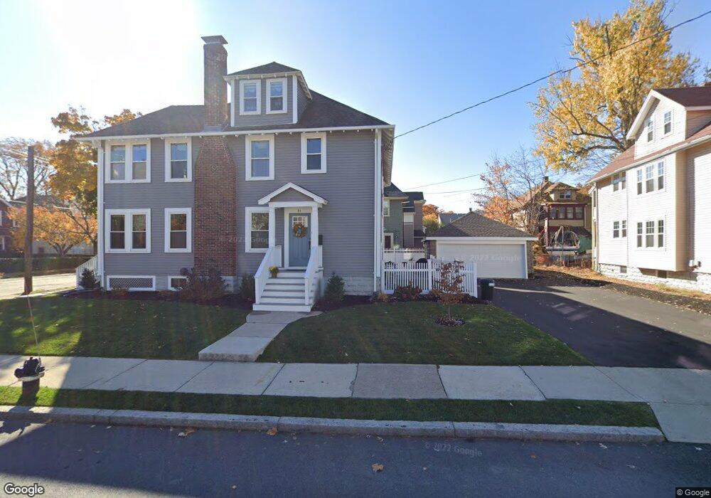
81 Maynard St Unit 2,81 Arlington, MA 02474
Arlington Center NeighborhoodEstimated Value: $921,000 - $961,000
3
Beds
2
Baths
1,590
Sq Ft
$588/Sq Ft
Est. Value
About This Home
This home is located at 81 Maynard St Unit 2,81, Arlington, MA 02474 and is currently estimated at $935,062, approximately $588 per square foot. 81 Maynard St Unit 2,81 is a home located in Middlesex County with nearby schools including Thompson School, Ottoson Middle School, and Arlington High School.
Ownership History
Date
Name
Owned For
Owner Type
Purchase Details
Closed on
Jun 4, 2025
Sold by
81 Maynard Street Rt and Bowes
Bought by
Epstein Elizabeth and Epsteinkraus Connor
Current Estimated Value
Home Financials for this Owner
Home Financials are based on the most recent Mortgage that was taken out on this home.
Original Mortgage
$703,000
Outstanding Balance
$701,195
Interest Rate
6.81%
Mortgage Type
Purchase Money Mortgage
Estimated Equity
$233,867
Purchase Details
Closed on
Feb 18, 2022
Sold by
Bowes Terry A
Bought by
81 Maynard Street Rt
Purchase Details
Closed on
Apr 17, 2001
Sold by
Eagan John B
Bought by
Tiley Carolyn
Home Financials for this Owner
Home Financials are based on the most recent Mortgage that was taken out on this home.
Original Mortgage
$275,000
Interest Rate
6.97%
Mortgage Type
Purchase Money Mortgage
Create a Home Valuation Report for This Property
The Home Valuation Report is an in-depth analysis detailing your home's value as well as a comparison with similar homes in the area
Home Values in the Area
Average Home Value in this Area
Purchase History
| Date | Buyer | Sale Price | Title Company |
|---|---|---|---|
| Epstein Elizabeth | $960,000 | None Available | |
| Epstein Elizabeth | $960,000 | None Available | |
| 81 Maynard Street Rt | -- | None Available | |
| 81 Maynard Street Rt | -- | None Available | |
| Tiley Carolyn | $348,000 | -- |
Source: Public Records
Mortgage History
| Date | Status | Borrower | Loan Amount |
|---|---|---|---|
| Open | Epstein Elizabeth | $703,000 | |
| Closed | Epstein Elizabeth | $703,000 | |
| Previous Owner | Tiley Carolyn | $275,000 | |
| Closed | Tiley Carolyn | $44,000 |
Source: Public Records
Tax History Compared to Growth
Tax History
| Year | Tax Paid | Tax Assessment Tax Assessment Total Assessment is a certain percentage of the fair market value that is determined by local assessors to be the total taxable value of land and additions on the property. | Land | Improvement |
|---|---|---|---|---|
| 2025 | $7,986 | $741,500 | $0 | $741,500 |
| 2024 | $7,640 | $721,400 | $0 | $721,400 |
| 2023 | $7,807 | $696,400 | $0 | $696,400 |
| 2022 | $7,731 | $677,000 | $0 | $677,000 |
| 2021 | $7,458 | $657,700 | $0 | $657,700 |
| 2020 | $7,168 | $648,100 | $0 | $648,100 |
| 2019 | $6,515 | $578,600 | $0 | $578,600 |
| 2018 | $6,496 | $535,500 | $0 | $535,500 |
| 2017 | $6,147 | $489,400 | $0 | $489,400 |
| 2016 | $6,264 | $489,400 | $0 | $489,400 |
| 2015 | $6,144 | $453,400 | $0 | $453,400 |
Source: Public Records
Map
Nearby Homes
- 167 Franklin St Unit 167
- 0 Jerome St Unit 72734260
- 69 Arlington St
- 97 Mystic St Unit B
- 31 Sharon St
- 51 Sagamore Ave
- 132 Rawson Rd Unit 132
- 94 Rawson Rd Unit 94
- 35 Grove St
- 3 Victoria Rd Unit 3
- 3 Victoria Rd Unit 5
- 29 Dartmouth St Unit 29
- 41 Palmer St Unit 43
- 7 Court Street Place Unit 7
- 111 Sharon St Unit 1
- 42-44 Warren St Unit 42
- 29 Harvard Ave Unit 29
- 166 Arlington St
- 23 Yale Rd
- 211 Grove St
- 81 Maynard St
- 156 Medford St
- 156 Medford St Unit 1
- 152 Medford St
- 75 Maynard St Unit 77
- 75-77 Maynard St Unit 1
- 75 Maynard St Unit 2
- 148 Medford St Unit 150
- 80 Maynard St
- 150 Medford St Unit 2
- 9 Orchard Terrace
- 157 Medford St
- 64 Maynard St Unit 66
- 71 Maynard St Unit 73
- 73 Maynard St Unit 73
- 73 Maynard St Unit 1
- 73 Maynard St
- 153 Medford St Unit 2
- 153 Medford St Unit 1
- 164 Medford St Unit 166