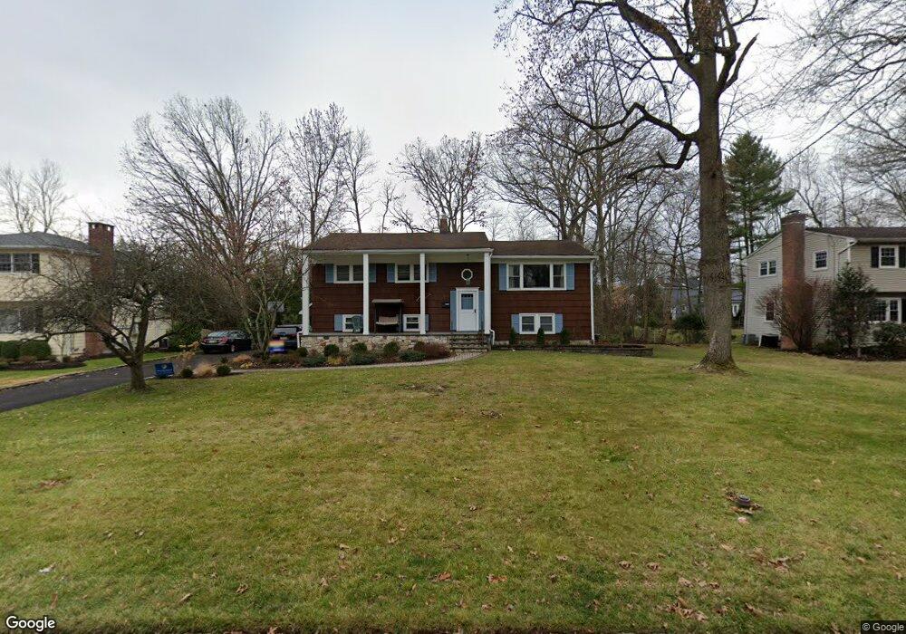
81 Robbins Ave Berkeley Heights, NJ 07922
Estimated Value: $862,596 - $987,000
--
Bed
--
Bath
2,634
Sq Ft
$356/Sq Ft
Est. Value
About This Home
This home is located at 81 Robbins Ave, Berkeley Heights, NJ 07922 and is currently estimated at $937,899, approximately $356 per square foot. 81 Robbins Ave is a home located in Union County with nearby schools including Columbia Middle School, Governor Livingston High School, and The Academy of Our Lady of Peace.
Ownership History
Date
Name
Owned For
Owner Type
Purchase Details
Closed on
Oct 31, 2001
Sold by
Warshawsky Larry David
Bought by
Bass Michael F and Bass Judith M
Current Estimated Value
Home Financials for this Owner
Home Financials are based on the most recent Mortgage that was taken out on this home.
Original Mortgage
$57,000
Outstanding Balance
$22,360
Interest Rate
6.77%
Mortgage Type
Stand Alone Second
Estimated Equity
$915,539
Purchase Details
Closed on
Nov 30, 2000
Sold by
Warshawsky Larry and Warshawsky Nancy
Bought by
Warshawsky Larry David
Purchase Details
Closed on
Aug 22, 2000
Sold by
Gonzales Milton H and Gonzales Margaret H
Bought by
Warshawsky Larry and Warshawsky Nancy
Home Financials for this Owner
Home Financials are based on the most recent Mortgage that was taken out on this home.
Original Mortgage
$200,000
Interest Rate
8.07%
Create a Home Valuation Report for This Property
The Home Valuation Report is an in-depth analysis detailing your home's value as well as a comparison with similar homes in the area
Home Values in the Area
Average Home Value in this Area
Purchase History
| Date | Buyer | Sale Price | Title Company |
|---|---|---|---|
| Bass Michael F | $415,000 | -- | |
| Warshawsky Larry David | -- | -- | |
| Warshawsky Larry | $387,000 | -- |
Source: Public Records
Mortgage History
| Date | Status | Borrower | Loan Amount |
|---|---|---|---|
| Open | Bass Michael F | $57,000 | |
| Open | Bass Michael F | $275,000 | |
| Previous Owner | Warshawsky Larry | $200,000 |
Source: Public Records
Tax History Compared to Growth
Tax History
| Year | Tax Paid | Tax Assessment Tax Assessment Total Assessment is a certain percentage of the fair market value that is determined by local assessors to be the total taxable value of land and additions on the property. | Land | Improvement |
|---|---|---|---|---|
| 2025 | $14,353 | $334,800 | $164,600 | $170,200 |
| 2024 | $14,145 | $334,800 | $164,600 | $170,200 |
| 2023 | $14,145 | $334,800 | $164,600 | $170,200 |
| 2022 | $14,058 | $334,800 | $164,600 | $170,200 |
| 2021 | $13,981 | $334,800 | $164,600 | $170,200 |
| 2020 | $14,055 | $334,800 | $164,600 | $170,200 |
| 2019 | $13,985 | $334,800 | $164,600 | $170,200 |
| 2018 | $13,693 | $334,800 | $164,600 | $170,200 |
| 2017 | $13,526 | $334,800 | $164,600 | $170,200 |
| 2016 | $13,264 | $334,200 | $164,600 | $169,600 |
| 2015 | $13,191 | $334,200 | $164,600 | $169,600 |
| 2014 | $12,847 | $334,200 | $164,600 | $169,600 |
Source: Public Records
Map
Nearby Homes
- 30 Robbins Ave
- 41 Meadowview Ln
- 12 Park Edge
- 34 Meadowview Ln
- 93 Park Edge Unit 3H
- 19 Guenevere Way Ondo
- 132 Fairview Ave
- 33 Bristol Ct
- 43 Kuntz Ave
- 126 Snyder Ave
- 61 Kuntz Ave
- 63 Snyder Ave
- 46 Snyder Ave
- 11 Earl Place
- 27 Angela Way Unit 727
- 28 Peacock Ln Unit 28
- 45 Wilson Dr
- 3 Cottage Ct Unit 3
- 66 Evergreen Ave
- 217 Lincoln St
- 73 Robbins Ave
- 89 Robbins Ave
- 80 Lawrence Dr
- 65 Robbins Ave
- 90 Lawrence Dr
- 72 Lawrence Dr
- 88 Robbins Ave
- 102 Lawrence Dr
- 78 Robbins Ave
- 97 Robbins Ave
- 70 Robbins Ave
- 98 Robbins Ave
- 57 Robbins Ave
- 110 Lawrence Dr
- 64 Lawrence Dr
- 62 Robbins Ave
- 105 Robbins Ave
- 75 Lawrence Dr
- 106 Robbins Ave
- 49 Robbins Ave