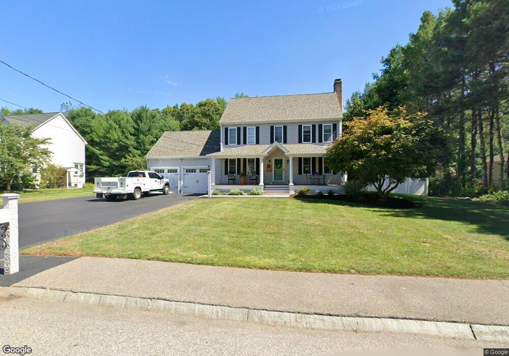
81 Scout Ln North Attleboro, MA 02760
North Attleboro NeighborhoodEstimated Value: $653,365 - $807,000
3
Beds
3
Baths
1,600
Sq Ft
$441/Sq Ft
Est. Value
About This Home
This home is located at 81 Scout Ln, North Attleboro, MA 02760 and is currently estimated at $705,841, approximately $441 per square foot. 81 Scout Ln is a home located in Bristol County with nearby schools including North Attleboro High School, Cadence Academy Preschool - North Attleborough, and St John The Evangelist School.
Ownership History
Date
Name
Owned For
Owner Type
Purchase Details
Closed on
Dec 20, 2022
Sold by
Weiner Scott and Weiner Kimberly
Bought by
Weiner Ft
Current Estimated Value
Purchase Details
Closed on
Jun 23, 2003
Sold by
Allen Mark E and Allen Kelly L
Bought by
Weiner Scott and Weiner Kimberly
Home Financials for this Owner
Home Financials are based on the most recent Mortgage that was taken out on this home.
Original Mortgage
$250,000
Interest Rate
5.71%
Mortgage Type
Purchase Money Mortgage
Purchase Details
Closed on
May 15, 1996
Sold by
Whatmough Corp
Bought by
Allen Mark E and Allen Kelly L
Home Financials for this Owner
Home Financials are based on the most recent Mortgage that was taken out on this home.
Original Mortgage
$157,700
Interest Rate
7.77%
Mortgage Type
Purchase Money Mortgage
Create a Home Valuation Report for This Property
The Home Valuation Report is an in-depth analysis detailing your home's value as well as a comparison with similar homes in the area
Home Values in the Area
Average Home Value in this Area
Purchase History
| Date | Buyer | Sale Price | Title Company |
|---|---|---|---|
| Weiner Ft | -- | None Available | |
| Weiner Scott | $397,500 | -- | |
| Allen Mark E | $197,235 | -- |
Source: Public Records
Mortgage History
| Date | Status | Borrower | Loan Amount |
|---|---|---|---|
| Previous Owner | Allen Mark E | $350,400 | |
| Previous Owner | Weiner Scott | $250,000 | |
| Previous Owner | Allen Mark E | $148,000 | |
| Previous Owner | Allen Mark E | $157,700 |
Source: Public Records
Tax History Compared to Growth
Tax History
| Year | Tax Paid | Tax Assessment Tax Assessment Total Assessment is a certain percentage of the fair market value that is determined by local assessors to be the total taxable value of land and additions on the property. | Land | Improvement |
|---|---|---|---|---|
| 2025 | $6,475 | $549,200 | $159,600 | $389,600 |
| 2024 | $6,579 | $570,100 | $166,300 | $403,800 |
| 2023 | $6,339 | $495,600 | $166,300 | $329,300 |
| 2022 | $6,157 | $442,000 | $172,900 | $269,100 |
| 2021 | $6,078 | $425,900 | $172,900 | $253,000 |
| 2019 | $5,781 | $406,000 | $157,300 | $248,700 |
| 2018 | $5,304 | $397,600 | $163,300 | $234,300 |
| 2017 | $5,256 | $397,600 | $163,300 | $234,300 |
| 2016 | $5,194 | $392,900 | $188,200 | $204,700 |
| 2015 | $5,008 | $381,100 | $188,200 | $192,900 |
| 2014 | $4,626 | $349,400 | $156,500 | $192,900 |
Source: Public Records
Map
Nearby Homes
- 115 Westfield Dr
- 546 Towne St
- 20 Sperry Ln
- 70 Sperry Ln Unit Lot 11
- 21 Shady Ln
- 6 Colts Way
- 36 Cranberry Rd
- 57 Vine St
- 59 Laurelwood Dr
- 613 Lindsey St
- 122 Mary Ann Way
- 18 Quincy Way
- 158 Ivy St
- 11 Landry Ave
- Lot 2 Jeffrey Dr
- 17 Peters Way
- 10 Sleepy Hollow Cir
- 6 Cedar Creek Dr
- Lot 5 Jeffrey Dr
- 29 Lyman St