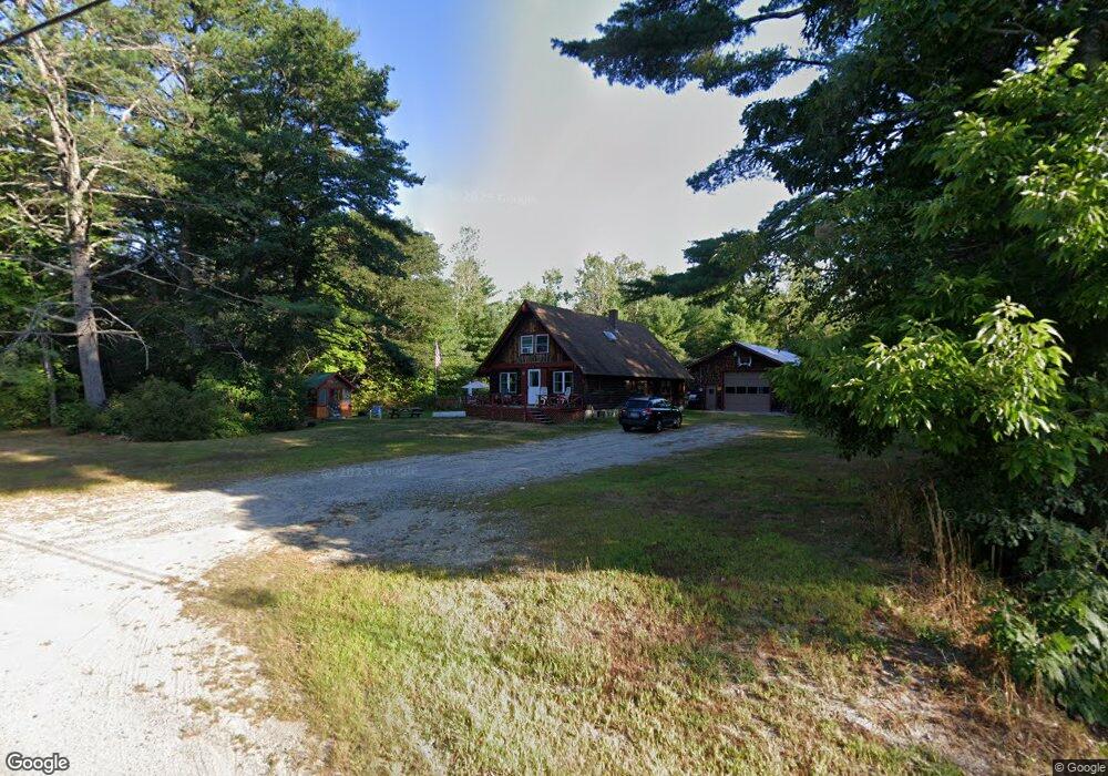
81 Spur Rd Cornish, ME 04020
Estimated Value: $325,707 - $426,000
2
Beds
1
Bath
1,584
Sq Ft
$240/Sq Ft
Est. Value
About This Home
This home is located at 81 Spur Rd, Cornish, ME 04020 and is currently estimated at $380,427, approximately $240 per square foot. 81 Spur Rd is a home located in York County with nearby schools including Ossipee Valley Christian School.
Ownership History
Date
Name
Owned For
Owner Type
Purchase Details
Closed on
Apr 30, 2018
Sold by
Hart Randall F
Bought by
Lc Real Estate Properties
Current Estimated Value
Home Financials for this Owner
Home Financials are based on the most recent Mortgage that was taken out on this home.
Original Mortgage
$18,000
Outstanding Balance
$15,446
Interest Rate
4.44%
Mortgage Type
New Conventional
Estimated Equity
$364,981
Purchase Details
Closed on
Feb 27, 2018
Sold by
Lane Rodney A
Bought by
Hart Randall F
Purchase Details
Closed on
May 23, 2011
Sold by
Doherty Joan M and Doherty Paul E
Bought by
Lane Rodney A
Purchase Details
Closed on
May 27, 2005
Sold by
Lane Bessie F and Tibbetts Dorothy J
Bought by
Lane Rodney A
Create a Home Valuation Report for This Property
The Home Valuation Report is an in-depth analysis detailing your home's value as well as a comparison with similar homes in the area
Home Values in the Area
Average Home Value in this Area
Purchase History
| Date | Buyer | Sale Price | Title Company |
|---|---|---|---|
| Lc Real Estate Properties | -- | -- | |
| Lc Real Estate Properties | -- | -- | |
| Lc Real Estate Properties | -- | -- | |
| Lc Real Estate Properties | -- | -- | |
| Hart Randall F | -- | -- | |
| Hart Randall F | -- | -- | |
| Hart Randall F | -- | -- | |
| Hart Randall F | -- | -- | |
| Lane Rodney A | -- | -- | |
| Lane Rodney A | -- | -- | |
| Lane Rodney A | -- | -- | |
| Lane Rodney A | -- | -- |
Source: Public Records
Mortgage History
| Date | Status | Borrower | Loan Amount |
|---|---|---|---|
| Open | Lc Real Estate Properties | $18,000 | |
| Closed | Lc Real Estate Properties | $18,000 | |
| Previous Owner | Lane Rodney A | $80,000 |
Source: Public Records
Tax History
| Year | Tax Paid | Tax Assessment Tax Assessment Total Assessment is a certain percentage of the fair market value that is determined by local assessors to be the total taxable value of land and additions on the property. | Land | Improvement |
|---|---|---|---|---|
| 2025 | $2,394 | $253,300 | $79,800 | $173,500 |
| 2024 | $2,649 | $287,900 | $76,200 | $211,700 |
| 2023 | $2,650 | $185,300 | $43,900 | $141,400 |
| 2022 | $2,557 | $185,300 | $43,900 | $141,400 |
| 2021 | $2,502 | $185,300 | $43,900 | $141,400 |
| 2020 | $2,483 | $185,300 | $43,900 | $141,400 |
| 2019 | $2,483 | $185,300 | $43,900 | $141,400 |
| 2018 | $2,502 | $185,300 | $43,900 | $141,400 |
| 2016 | $2,389 | $185,300 | $43,900 | $141,400 |
| 2015 | $2,430 | $188,400 | $43,900 | $144,500 |
| 2014 | $2,129 | $165,000 | $43,900 | $121,100 |
Source: Public Records
Map
Nearby Homes
- 1882 North Rd
- 1783 North Rd
- R13/038 Weeks Rd
- TBD Sokokis Trail N
- 27 Nocturne Rd
- Lot 11 Quarry Rd
- 424 Maplecrest Rd
- 71 Quarry Rd
- 24 Emery Corner Rd
- 16 Whiteley Rd
- 5 Wescott St
- 761 Pendexter Rd
- 33 Maple St
- 110 Pleasant Hill Rd
- 0 Quarry Rd
- 50AC Sawyer Mountain Rd
- 14 Pleasant Hill Rd
- Lot #4 Jordan Heights Rd
- Lot #8 Jordan Heights Rd
- Lot #2 Jordan Heights Rd
- 88 Spur Rd
- 69 Spur Rd
- 91 Spur Rd
- 76 Spur Rd
- 68 Spur Rd
- 62 Spur Rd
- 100 Spur Rd
- 321 Joe Berry Rd
- 55 Spur Rd
- 28 Brown Brook Dr
- 299 Joe Berry Rd
- 37 Spur Rd
- 43C Brown Brook Rd
- 291 Joe Berry Rd
- 1 Spur Rd
- 126 Spur Rd
- 27 Spur Rd
- 0 Hessian Hill Rd Unit 466679
- 0 Hessian Hill Rd Unit 280882
- 0 Hessian Hill Rd Unit 543161
Your Personal Tour Guide
Ask me questions while you tour the home.