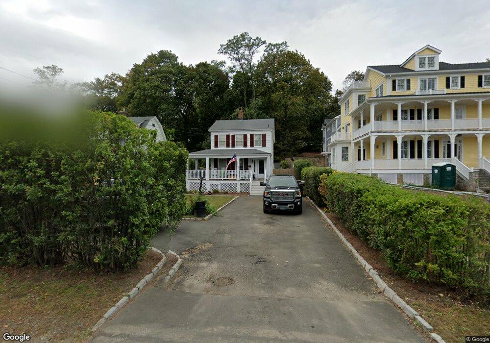
81 Strickland Rd Cos Cob, CT 06807
Estimated Value: $879,000 - $1,424,000
3
Beds
2
Baths
1,240
Sq Ft
$962/Sq Ft
Est. Value
About This Home
This home is located at 81 Strickland Rd, Cos Cob, CT 06807 and is currently estimated at $1,192,530, approximately $961 per square foot. 81 Strickland Rd is a home located in Fairfield County with nearby schools including Cos Cob School, Central Middle School, and Greenwich High School.
Ownership History
Date
Name
Owned For
Owner Type
Purchase Details
Closed on
Oct 4, 2005
Sold by
Rathgeber Jeffrey and Rathgeber Annette
Bought by
Green Anthony and Lavalette Jennifer
Current Estimated Value
Purchase Details
Closed on
Aug 27, 2001
Sold by
Gallagher Thomas L
Bought by
Rathgeber Jeffrey
Purchase Details
Closed on
Jul 3, 1995
Sold by
Marsh John B
Bought by
Gallagher Thomas Leo and Gallagher Amy Joy
Create a Home Valuation Report for This Property
The Home Valuation Report is an in-depth analysis detailing your home's value as well as a comparison with similar homes in the area
Home Values in the Area
Average Home Value in this Area
Purchase History
| Date | Buyer | Sale Price | Title Company |
|---|---|---|---|
| Green Anthony | $505,000 | -- | |
| Rathgeber Jeffrey | $413,000 | -- | |
| Gallagher Thomas Leo | $250,000 | -- |
Source: Public Records
Mortgage History
| Date | Status | Borrower | Loan Amount |
|---|---|---|---|
| Closed | Gallagher Thomas Leo | $119,000 | |
| Open | Gallagher Thomas Leo | $506,000 |
Source: Public Records
Tax History Compared to Growth
Tax History
| Year | Tax Paid | Tax Assessment Tax Assessment Total Assessment is a certain percentage of the fair market value that is determined by local assessors to be the total taxable value of land and additions on the property. | Land | Improvement |
|---|---|---|---|---|
| 2025 | $6,262 | $506,660 | $413,350 | $93,310 |
| 2024 | $6,047 | $506,660 | $413,350 | $93,310 |
| 2023 | $5,895 | $506,660 | $413,350 | $93,310 |
| 2022 | $5,842 | $506,660 | $413,350 | $93,310 |
| 2021 | $5,332 | $442,890 | $345,870 | $97,020 |
| 2020 | $5,324 | $442,890 | $345,870 | $97,020 |
| 2019 | $5,377 | $442,890 | $345,870 | $97,020 |
| 2018 | $5,223 | $440,020 | $345,870 | $94,150 |
| 2017 | $5,289 | $440,020 | $345,870 | $94,150 |
| 2016 | $5,205 | $440,020 | $345,870 | $94,150 |
| 2015 | $5,038 | $422,450 | $401,240 | $21,210 |
| 2014 | $4,911 | $422,450 | $401,240 | $21,210 |
Source: Public Records
Map
Nearby Homes
- 7 River Rd Unit Boat Slip A-2
- 7 River Rd Unit Boat Slip D-14
- 15 River Rd Unit 210
- 4 Sound Shore Dr Unit 24
- 37 Miltiades Ave
- 3 Relay Ct
- 7 Stanwich Rd
- 6 Gilliam Ln
- 24 Valley Rd
- 41 Valley Rd
- 47 Valley Rd Unit B3
- 203 Riverside Ave
- 105 Woodside Dr
- 40 Bruce Park Dr
- 32 Meyer Place
- 52 Carriglea Dr
- 24 Harold St Unit E
- 48 Meyer Place
- 92 Orchard Dr
- 88 Valleywood Rd
- 79 Strickland Rd
- 79 Strickland Rd Unit B
- 83 Strickland Rd Unit 2
- 83 Strickland Rd Unit 1
- 83 Strickland Rd Unit 83A
- 83 Strickland Rd
- 83 Strickland Rd Unit A
- 85 Strickland Rd Unit 2
- 85 Strickland Rd Unit 1
- 77 Strickland Rd
- 77 Strickland Rd Unit A
- 77 Strickland Rd Unit B
- 75 Strickland Rd
- 75 Strickland Rd Unit D
- 75 Strickland Rd Unit B
- 75 Strickland Rd Unit A
- 75 Strickland Rd Unit F
- 75 Strickland Rd Unit E
- 89 Strickland Rd