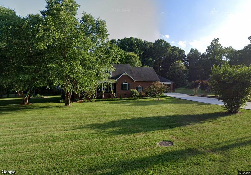
81 Thomas St Manchester, TN 37355
Estimated Value: $412,000 - $512,000
--
Bed
3
Baths
3,653
Sq Ft
$131/Sq Ft
Est. Value
About This Home
This home is located at 81 Thomas St, Manchester, TN 37355 and is currently estimated at $478,222, approximately $130 per square foot. 81 Thomas St is a home located in Coffee County with nearby schools including Westwood Middle School and Temple Baptist Christian School.
Ownership History
Date
Name
Owned For
Owner Type
Purchase Details
Closed on
Aug 10, 2005
Sold by
Umbarger Mitch
Bought by
Putman James A
Current Estimated Value
Home Financials for this Owner
Home Financials are based on the most recent Mortgage that was taken out on this home.
Original Mortgage
$160,000
Outstanding Balance
$83,563
Interest Rate
5.57%
Estimated Equity
$394,659
Purchase Details
Closed on
Jun 24, 2003
Sold by
Short Sam A
Bought by
Umbarger Mitch
Create a Home Valuation Report for This Property
The Home Valuation Report is an in-depth analysis detailing your home's value as well as a comparison with similar homes in the area
Home Values in the Area
Average Home Value in this Area
Purchase History
| Date | Buyer | Sale Price | Title Company |
|---|---|---|---|
| Putman James A | $239,500 | -- | |
| Umbarger Mitch | $15,000 | -- |
Source: Public Records
Mortgage History
| Date | Status | Borrower | Loan Amount |
|---|---|---|---|
| Open | Umbarger Mitch | $160,000 |
Source: Public Records
Tax History Compared to Growth
Tax History
| Year | Tax Paid | Tax Assessment Tax Assessment Total Assessment is a certain percentage of the fair market value that is determined by local assessors to be the total taxable value of land and additions on the property. | Land | Improvement |
|---|---|---|---|---|
| 2024 | $3,882 | $92,075 | $4,700 | $87,375 |
| 2023 | $3,882 | $92,075 | $0 | $0 |
| 2022 | $3,342 | $92,075 | $4,700 | $87,375 |
| 2021 | $3,208 | $70,050 | $3,750 | $66,300 |
| 2020 | $3,208 | $70,050 | $3,750 | $66,300 |
| 2019 | $3,208 | $70,050 | $3,750 | $66,300 |
| 2018 | $3,208 | $70,050 | $3,750 | $66,300 |
| 2017 | $3,138 | $59,825 | $3,750 | $56,075 |
| 2016 | $3,138 | $59,825 | $3,750 | $56,075 |
| 2015 | $3,138 | $59,825 | $3,750 | $56,075 |
| 2014 | $3,138 | $59,817 | $0 | $0 |
Source: Public Records
Map
Nearby Homes
- 158 Dogwood Dr
- 272 Belmar Cir
- 75 Belmar Rd
- 0 Expressway Dr
- 141 Doak Rd
- Lot 76 Philips
- 108 Belmar Cir
- 216 Spring House Dr
- 383 Doak Rd
- 401 Doak Rd
- 248 Doak Rd
- 31 Spring House Dr
- 58 Brooklyn Ave
- 31 Brooklyn Ave
- 42 Brooklyn Ave
- 57 Brooklyn Ave
- 71 Brooklyn Ave
- 43 Brooklyn Ave
- 30 Brooklyn Ave
- 0 Sherwood Dr
- 417 Dogwood Dr
- 103 Thomas St
- 82 Thomas St
- 40 Thomas St
- 19 Thomas St
- 127 Thomas St
- 108 Thomas St
- 215 Dogwood Dr
- 406 Dogwood Dr
- 373 Dogwood Dr
- 140 Thomas St
- 291 Dogwood Dr
- 173 Dogwood Dr
- 39 White Oak Dr
- 65 White Oak Dr
- 140 Scott Swinney Dr
- 370 Dogwood Dr
- 185 Scott Swinney Dr
- 91 White Oak Dr
- 164 Thomas St