Estimated Value: $587,020
2
Beds
2
Baths
4,700
Sq Ft
$125/Sq Ft
Est. Value
About This Home
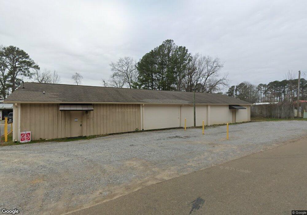
This home is located at 810 Clearmont Dr, Pearl, MS 39208 and is currently priced at $587,020, approximately $124 per square foot. 810 Clearmont Dr is a home located in Rankin County with nearby schools including Pearl Lower Elementary School, Pearl Upper School, and Northside Elementary School.
Ownership History
Date
Name
Owned For
Owner Type
Purchase Details
Closed on
Jun 27, 2023
Sold by
Pace Boyd Charlene J
Bought by
Pace Requel C and Cannon Misty
Current Estimated Value
Purchase Details
Closed on
Mar 31, 2023
Sold by
Insight Group Llc
Bought by
Pearl Warehousing Llc
Home Financials for this Owner
Home Financials are based on the most recent Mortgage that was taken out on this home.
Original Mortgage
$475,976
Interest Rate
6.65%
Mortgage Type
New Conventional
Purchase Details
Closed on
May 27, 2011
Sold by
William L William L and Leamond Jan E
Bought by
Clark Land Development Company Llc
Create a Home Valuation Report for This Property
The Home Valuation Report is an in-depth analysis detailing your home's value as well as a comparison with similar homes in the area
Home Values in the Area
Average Home Value in this Area
Purchase History
| Date | Buyer | Sale Price | Title Company |
|---|---|---|---|
| Pace Requel C | -- | None Listed On Document | |
| Pearl Warehousing Llc | -- | None Listed On Document | |
| Clark Land Development Company Llc | -- | -- |
Source: Public Records
Mortgage History
| Date | Status | Borrower | Loan Amount |
|---|---|---|---|
| Previous Owner | Pearl Warehousing Llc | $475,976 |
Source: Public Records
Tax History Compared to Growth
Tax History
| Year | Tax Paid | Tax Assessment Tax Assessment Total Assessment is a certain percentage of the fair market value that is determined by local assessors to be the total taxable value of land and additions on the property. | Land | Improvement |
|---|---|---|---|---|
| 2024 | $4,044 | $30,590 | $0 | $0 |
| 2023 | $3,910 | $29,467 | $0 | $0 |
| 2022 | $3,866 | $29,467 | $0 | $0 |
| 2021 | $3,866 | $29,467 | $0 | $0 |
| 2020 | $3,866 | $29,467 | $0 | $0 |
| 2019 | $3,518 | $30,327 | $0 | $0 |
| 2018 | $4,030 | $30,327 | $0 | $0 |
| 2017 | $3,745 | $28,178 | $0 | $0 |
| 2016 | $3,844 | $28,923 | $0 | $0 |
| 2015 | $3,844 | $28,923 | $0 | $0 |
| 2014 | $1,799 | $13,537 | $0 | $0 |
| 2013 | $982 | $13,537 | $0 | $0 |
Source: Public Records
Map
Nearby Homes
- 741 Sandy Ln
- 2524 Highway 468
- 201 Richard Cove
- 742 Grandmont St
- 1923 Carolyn Ln
- 1966 Gloria Dr
- 1902 Edwin Ave
- 502 Vista Pointe Dr
- 530 Vista Pointe Dr
- 532 Vista Pointe Dr
- 534 Vista Pointe Dr
- 536 Vista Pointe Dr
- 544 Vista Pointe Dr
- 515 Vista Pointe Dr
- 517 Vista Pointe Dr
- 521 Vista Pointe Dr
- 527 Vista Pointe Dr
- 1904 Gloria Dr
- 1119 St Augustine Dr
- 519 Vista Pointe Dr
- 810 Clearmont Dr Unit C
- 810 Clearmont Dr Unit B
- 810 Clearmont Dr Unit A
- 774 Sandy Ln
- 778 Sandy Ln
- 770 Sandy Ln
- 782 Sandy Ln
- 768 Sandy Ln
- 935 S Pearson Rd
- 766 Sandy Ln
- 786 Sandy Ln
- 764 Sandy Ln
- 1004 S Pearson Rd
- 762 Sandy Ln
- 771 Clearmont Dr
- 772 Clearmont Dr
- 790 Sandy Ln
- 775 Sandy Ln
- 760 Sandy Ln
- 1029 S Pearson Rd