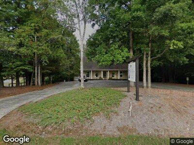
810 N Tibbs Rd Dalton, GA 30720
Estimated Value: $436,000 - $642,496
--
Bed
--
Bath
1,875
Sq Ft
$269/Sq Ft
Est. Value
About This Home
This home is located at 810 N Tibbs Rd, Dalton, GA 30720 and is currently estimated at $503,624, approximately $268 per square foot. 810 N Tibbs Rd is a home with nearby schools including City Park Elementary School, Dalton Middle School, and Dalton High School.
Ownership History
Date
Name
Owned For
Owner Type
Purchase Details
Closed on
Aug 16, 2024
Sold by
Ellis Kathryn L
Bought by
Ldy Holdings Llc
Current Estimated Value
Purchase Details
Closed on
Oct 18, 2023
Sold by
Lefevers Ellis Kathryn
Bought by
Jmec Holding Llc and Moore
Home Financials for this Owner
Home Financials are based on the most recent Mortgage that was taken out on this home.
Original Mortgage
$375,000
Interest Rate
7.12%
Mortgage Type
Seller Take Back
Create a Home Valuation Report for This Property
The Home Valuation Report is an in-depth analysis detailing your home's value as well as a comparison with similar homes in the area
Home Values in the Area
Average Home Value in this Area
Purchase History
| Date | Buyer | Sale Price | Title Company |
|---|---|---|---|
| Ldy Holdings Llc | $675,000 | Cumberland Title & Guaranty | |
| Jmec Holding Llc | $625,000 | None Listed On Document |
Source: Public Records
Mortgage History
| Date | Status | Borrower | Loan Amount |
|---|---|---|---|
| Open | Ldy Holdings Llc | $595,000 | |
| Previous Owner | Jmec Holding Llc | $375,000 | |
| Previous Owner | Ellis Kevin D | $100,000 |
Source: Public Records
Tax History Compared to Growth
Tax History
| Year | Tax Paid | Tax Assessment Tax Assessment Total Assessment is a certain percentage of the fair market value that is determined by local assessors to be the total taxable value of land and additions on the property. | Land | Improvement |
|---|---|---|---|---|
| 2024 | $2,700 | $188,750 | $129,370 | $59,380 |
| 2023 | $3,796 | $128,713 | $48,384 | $80,329 |
| 2022 | $3,368 | $114,206 | $48,384 | $65,822 |
| 2021 | $3,370 | $114,206 | $48,384 | $65,822 |
| 2020 | $3,484 | $114,206 | $48,384 | $65,822 |
| 2019 | $3,541 | $114,206 | $48,384 | $65,822 |
| 2018 | $3,598 | $114,206 | $48,384 | $65,822 |
| 2017 | $3,600 | $114,206 | $48,384 | $65,822 |
| 2016 | $3,364 | $110,953 | $48,384 | $62,569 |
| 2014 | $3,119 | $115,865 | $53,296 | $62,569 |
| 2013 | -- | $115,865 | $53,296 | $62,568 |
Source: Public Records
Map
Nearby Homes
- 2204 Old Ivy Way
- 2204 Old Ivy Way Unit 3
- 1230 Covie Dr
- 1202 Covie Dr
- 00 Shugart Rd
- 1315 Walston St
- 137 Lisa Ln
- 1006 Willowdale Rd NW Unit 2
- 302 Davidson Dr
- Tract 2 Willowdale Rd Unit TRACT 2
- 1521 Ashton Woods Way Unit 11
- 1521 Ashton Woods Way
- 0 Battleline Dr Unit 120625
- 108/109 Battleline Dr
- 116 Battleline Dr
- 111 Roslyn Ct
- 1101 Manly St
- 906 Sierra Place
- 1406 Cleo Way
- 432 Castle Rd
- 810 N Tibbs Rd
- 2200 Rocky Face Cir
- 2203 Rocky Face Cir
- 813 N Tibbs Rd
- 2202 Rocky Face Cir
- 2111 Club Dr
- 2111 Club Dr
- 2201 Mathis Ln
- 2205 Rocky Face Cir
- 2203 Mathis Ln
- 2204 Rocky Face Cir
- 805 N Tibbs Rd Unit 73,74,75
- 805 N Tibbs Rd Unit 73-75
- 2200 Mathis Ln
- 2125 Arbordale Place
- 2207 Rocky Face Cir
- 2205 Mathis Ln
- 2209 Rocky Face Cir
- 807 N Tibbs Rd
- 807 N Tibbs Rd