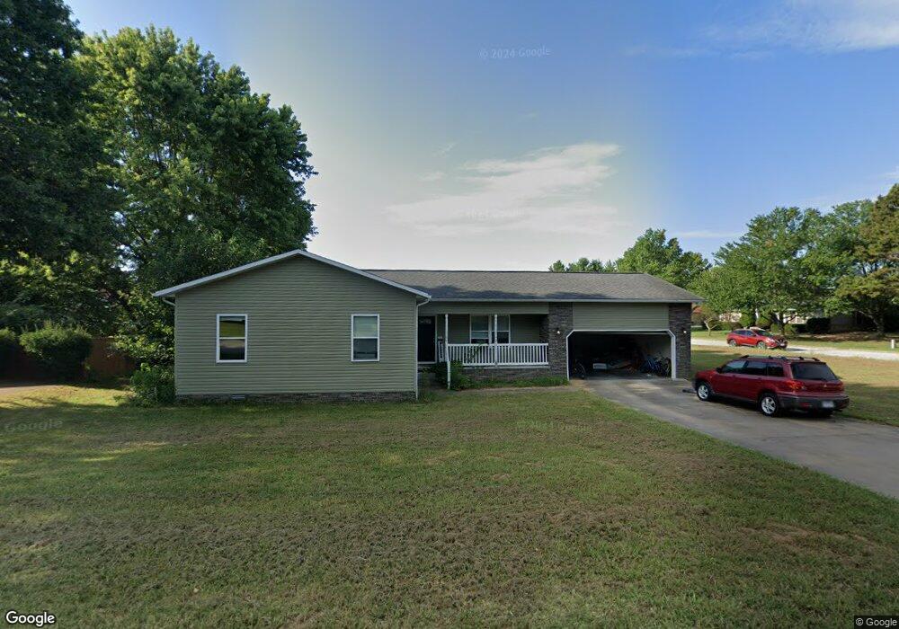
810 Robin St Harrison, AR 72601
Estimated Value: $213,604 - $278,000
Studio
--
Bath
1,584
Sq Ft
$148/Sq Ft
Est. Value
About This Home
This home is located at 810 Robin St, Harrison, AR 72601 and is currently estimated at $234,151, approximately $147 per square foot. 810 Robin St is a home with nearby schools including Skyline Heights Elementary School, Harrison Jr. High School, and Harrison High School.
Ownership History
Date
Name
Owned For
Owner Type
Purchase Details
Closed on
Mar 13, 2012
Sold by
Northwest Regional Housing Authority
Bought by
Lunn Leonard Earl and Lunn Tamara Dawn
Current Estimated Value
Home Financials for this Owner
Home Financials are based on the most recent Mortgage that was taken out on this home.
Original Mortgage
$110,360
Outstanding Balance
$81,583
Interest Rate
4.05%
Mortgage Type
USDA
Estimated Equity
$152,568
Purchase Details
Closed on
Nov 18, 2011
Sold by
Dodson Jim Bob and Dodson Mary Jean
Bought by
Nortrhwest Regional Housing Authority
Purchase Details
Closed on
Apr 18, 2003
Bought by
Gipson and Dodson
Purchase Details
Closed on
Apr 17, 2001
Bought by
Gipson
Create a Home Valuation Report for This Property
The Home Valuation Report is an in-depth analysis detailing your home's value as well as a comparison with similar homes in the area
Purchase History
| Date | Buyer | Sale Price | Title Company |
|---|---|---|---|
| Lunn Leonard Earl | $13,000 | None Available | |
| Nortrhwest Regional Housing Authority | $50,000 | -- | |
| Gipson | -- | -- | |
| Gipson | -- | -- |
Source: Public Records
Mortgage History
| Date | Status | Borrower | Loan Amount |
|---|---|---|---|
| Open | Lunn Leonard Earl | $110,360 |
Source: Public Records
Tax History
| Year | Tax Paid | Tax Assessment Tax Assessment Total Assessment is a certain percentage of the fair market value that is determined by local assessors to be the total taxable value of land and additions on the property. | Land | Improvement |
|---|---|---|---|---|
| 2025 | $1,422 | $27,880 | $2,000 | $25,880 |
| 2024 | $1,422 | $27,880 | $2,000 | $25,880 |
| 2023 | $1,422 | $27,880 | $2,000 | $25,880 |
| 2022 | $1,422 | $27,880 | $2,000 | $25,880 |
| 2021 | $1,341 | $27,880 | $2,000 | $25,880 |
| 2020 | $1,219 | $23,910 | $2,000 | $21,910 |
| 2019 | $1,237 | $23,910 | $2,000 | $21,910 |
| 2018 | $1,237 | $23,910 | $2,000 | $21,910 |
| 2017 | $1,219 | $23,910 | $2,000 | $21,910 |
| 2016 | $1,219 | $23,910 | $2,000 | $21,910 |
| 2015 | $1,144 | $22,430 | $750 | $21,680 |
| 2014 | $1,144 | $22,430 | $750 | $21,680 |
Source: Public Records
Map
Nearby Homes
- 0 Gipson Rd
- 203 Glenview St
- 26 Ozark Dr
- Lot 3 Cornerstone Way
- Lot 1 Cornerstone Way
- Lot 4 Cornerstone Way
- Lot 2 Cornerstone Way
- 307 Prestonwood St
- 3605 W Hill Ave
- 107 Nancy St
- 0 Corner of Airport Rd & Hwy 65n Unit 146774
- 1825 Forward Dr
- 1800 Airport Rd
- 115 Russell Dr
- Lot 1 Rains Rd S
- Lot 2 Rains Rd S
- 3116 Brinkley Ave
- 0 W Hwy 43 Unit 1298701
- 3000 Belmont Ave
- 3008 Belmont Ave
Your Personal Tour Guide
Ask me questions while you tour the home.