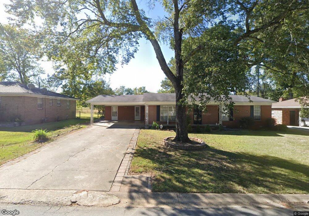
8104 Mcdaniel Dr Little Rock, AR 72209
65th Street West NeighborhoodEstimated Value: $121,000 - $151,000
3
Beds
2
Baths
1,550
Sq Ft
$87/Sq Ft
Est. Value
About This Home
This home is located at 8104 Mcdaniel Dr, Little Rock, AR 72209 and is currently estimated at $134,354, approximately $86 per square foot. 8104 Mcdaniel Dr is a home located in Pulaski County with nearby schools including Mabelvale Middle School, Little Rock Southwest High School, and Exalt Academy of Southwest Little Rock.
Ownership History
Date
Name
Owned For
Owner Type
Purchase Details
Closed on
Nov 10, 2010
Sold by
Hargrove Harvey Lynn and Hargrove Carol Rich
Bought by
Chirinos Eduardo E Peralta and Deperalta Sonia Leonor
Current Estimated Value
Home Financials for this Owner
Home Financials are based on the most recent Mortgage that was taken out on this home.
Original Mortgage
$90,678
Outstanding Balance
$59,828
Interest Rate
4.27%
Mortgage Type
FHA
Estimated Equity
$74,526
Purchase Details
Closed on
May 30, 1997
Sold by
Behr Russell A and Behr Dorothy L
Bought by
Hargrove Harvey Lynn and Hargrove Carol Rich
Home Financials for this Owner
Home Financials are based on the most recent Mortgage that was taken out on this home.
Original Mortgage
$60,235
Interest Rate
8.1%
Mortgage Type
FHA
Create a Home Valuation Report for This Property
The Home Valuation Report is an in-depth analysis detailing your home's value as well as a comparison with similar homes in the area
Home Values in the Area
Average Home Value in this Area
Purchase History
| Date | Buyer | Sale Price | Title Company |
|---|---|---|---|
| Chirinos Eduardo E Peralta | $92,000 | None Available | |
| Hargrove Harvey Lynn | $60,000 | -- |
Source: Public Records
Mortgage History
| Date | Status | Borrower | Loan Amount |
|---|---|---|---|
| Open | Chirinos Eduardo E Peralta | $90,678 | |
| Previous Owner | Hargrove Harvey Lynn | $60,235 |
Source: Public Records
Tax History Compared to Growth
Tax History
| Year | Tax Paid | Tax Assessment Tax Assessment Total Assessment is a certain percentage of the fair market value that is determined by local assessors to be the total taxable value of land and additions on the property. | Land | Improvement |
|---|---|---|---|---|
| 2025 | $956 | $22,715 | $4,000 | $18,715 |
| 2024 | $956 | $22,715 | $4,000 | $18,715 |
| 2023 | $956 | $22,715 | $4,000 | $18,715 |
| 2022 | $956 | $22,715 | $4,000 | $18,715 |
| 2021 | $963 | $13,660 | $1,600 | $12,060 |
| 2020 | $581 | $13,660 | $1,600 | $12,060 |
| 2019 | $581 | $13,660 | $1,600 | $12,060 |
| 2018 | $606 | $13,660 | $1,600 | $12,060 |
| 2017 | $606 | $13,660 | $1,600 | $12,060 |
| 2016 | $823 | $16,760 | $3,660 | $13,100 |
| 2015 | $1,175 | $16,760 | $3,660 | $13,100 |
| 2014 | $1,175 | $16,760 | $3,660 | $13,100 |
Source: Public Records
Map
Nearby Homes
- 7808 Mcdaniel Dr
- 3 Renee Cove
- 8523 Mabelvale Pike
- 7317 Mabelvale Pike
- 6917 Baseline Rd
- 9115 Merrivale Dr
- 9119 Tedburn Cir
- 9108 Tedburn Cir
- 16 Terrace Place
- 6701 Juniper Rd
- 9520 Wilderness Rd
- 8601 Winston Dr
- 9619 Southwest Dr
- 7307 Knollwood Rd
- TBD Spring Creek Cove
- Lot 1 Little West Addition
- TBD Springtree Cir
- Lot 3 Little West Addition
- Lot 2 Little West Addition
- Lot 5 Little West Addition
- 8108 Mcdaniel Dr
- 8100 Mcdaniel Dr
- 8004 Mcdaniel Dr
- 8112 Mcdaniel Dr
- 8105 Mcdaniel Dr
- 8109 Mcdaniel Dr
- 8101 Mcdaniel Dr
- 8115 Mcdaniel Dr
- 1 Malcolm Cove
- 8009 Mcdaniel Dr
- 7 Malcolm Cove
- 5 Malcolm Cove
- 5 Malcom Cove
- 8005 Mcdaniel Dr
- 9 Malcolm Cove
- 10 Curtis Cove
- 14 Curtis Cove
- 8 Curtis Cove
- 12 Curtis Cove
- 2 Malcolm Cove