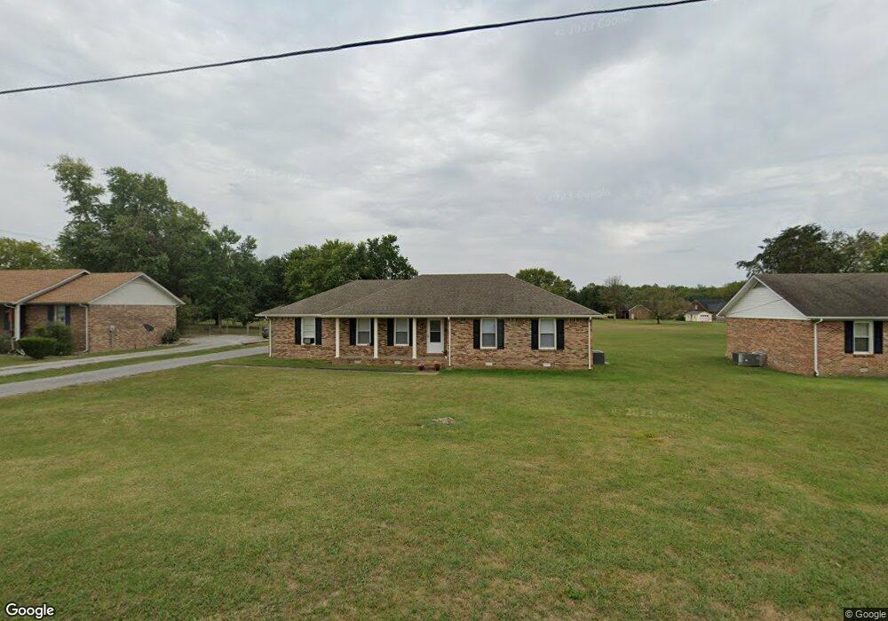
811 Alford Rd Murfreesboro, TN 37129
Estimated Value: $287,610 - $357,000
--
Bed
2
Baths
1,275
Sq Ft
$255/Sq Ft
Est. Value
About This Home
This home is located at 811 Alford Rd, Murfreesboro, TN 37129 and is currently estimated at $325,403, approximately $255 per square foot. 811 Alford Rd is a home located in Rutherford County with nearby schools including Walter Hill Elementary School, Siegel Middle School, and Siegel High School.
Ownership History
Date
Name
Owned For
Owner Type
Purchase Details
Closed on
Dec 27, 2019
Sold by
Jordan William P and Jordan Mary Ann
Bought by
Jordan William P and Jordan Mary Ann
Current Estimated Value
Purchase Details
Closed on
May 26, 1995
Sold by
Duane Lyle Lorin
Bought by
Jordan William P and Jordan Edward
Purchase Details
Closed on
Apr 7, 1995
Sold by
Lyle Lorin N
Bought by
Duane Lyle Lorin
Create a Home Valuation Report for This Property
The Home Valuation Report is an in-depth analysis detailing your home's value as well as a comparison with similar homes in the area
Home Values in the Area
Average Home Value in this Area
Purchase History
| Date | Buyer | Sale Price | Title Company |
|---|---|---|---|
| Jordan William P | -- | None Available | |
| Jordan William P | -- | None Available | |
| Jordan William P | -- | None Available | |
| Jordan William P | -- | None Available | |
| Jordan William P | $68,000 | -- | |
| Duane Lyle Lorin | -- | -- |
Source: Public Records
Tax History Compared to Growth
Tax History
| Year | Tax Paid | Tax Assessment Tax Assessment Total Assessment is a certain percentage of the fair market value that is determined by local assessors to be the total taxable value of land and additions on the property. | Land | Improvement |
|---|---|---|---|---|
| 2025 | $1,205 | $64,250 | $13,750 | $50,500 |
| 2024 | $1,205 | $64,250 | $13,750 | $50,500 |
| 2023 | $1,205 | $64,250 | $13,750 | $50,500 |
| 2022 | $1,038 | $64,250 | $13,750 | $50,500 |
| 2021 | $924 | $41,650 | $8,750 | $32,900 |
| 2020 | $924 | $41,650 | $8,750 | $32,900 |
| 2019 | $924 | $41,650 | $8,750 | $32,900 |
| 2018 | $874 | $41,650 | $0 | $0 |
| 2017 | $781 | $29,125 | $0 | $0 |
| 2016 | $781 | $29,125 | $0 | $0 |
| 2015 | $781 | $29,125 | $0 | $0 |
| 2014 | $724 | $29,125 | $0 | $0 |
| 2013 | -- | $29,225 | $0 | $0 |
Source: Public Records
Map
Nearby Homes
- 3543 John Richards Dr
- 3533 John Richards Dr
- 3417 Leanna Rd Unit LT 10A
- 3433 Cortona Way
- 0 Unit RTC3002253
- 3538 Winterfell Dr
- 3534 Winterfell Dr
- 3530 Winterfell Dr
- 3526 Winterfell Dr
- 3522 Winterfell Dr
- 3432 Winterfell Dr
- Bancroft Plan at Kings Landing
- Alamont Plan at Kings Landing
- Chelsey Plan at Kings Landing
- 3428 Winterfell Dr
- 3424 Winterfell Dr
- 3420 Winterfell Dr
- 3187 N Thompson Ln
- 3508 Pershing Dr
- 1831 Pennington Dr
- 821 Alford Rd
- 801 Alford Rd
- 3499 Leanna Rd
- 3497 Leanna Rd
- 831 Alford Rd
- 3489 Leanna Rd
- 841 Alford Rd
- 3487 Leanna Rd Unit 3487
- 3487 Leanna Rd
- 0 Alford Rd
- 3507 Leanna Rd
- 851 Alford Rd
- 3477 Leanna Rd Unit 3479
- 861 Alford Rd
- 3469 Leanna Rd Unit 71
- 808 Henry Ln
- 814 Henry Ln
- 852 Alford Rd
- 3484 Meadow Ct
- 3488 Leanna Rd