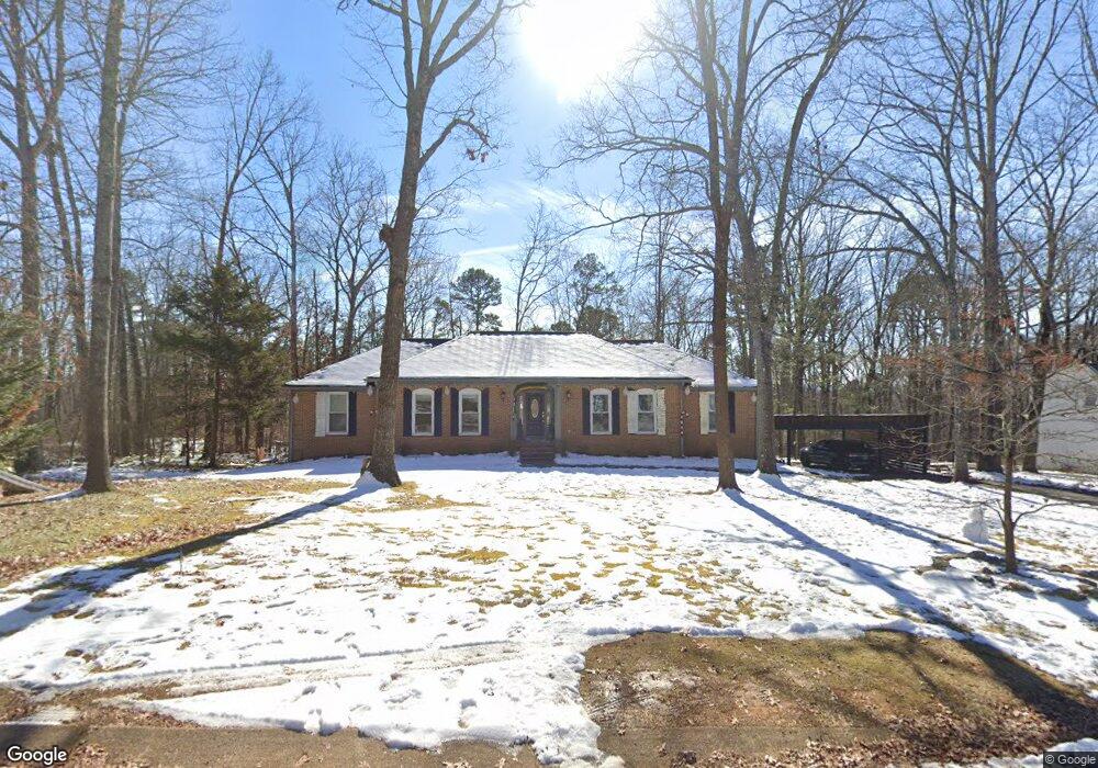
811 Crown Point Rd W Signal Mountain, TN 37377
Estimated Value: $542,000 - $767,000
3
Beds
2
Baths
2,094
Sq Ft
$310/Sq Ft
Est. Value
About This Home
This home is located at 811 Crown Point Rd W, Signal Mountain, TN 37377 and is currently estimated at $648,645, approximately $309 per square foot. 811 Crown Point Rd W is a home located in Hamilton County with nearby schools including Thrasher Elementary School, Signal Mountain Middle/High School, and Signal Mountain Christian School.
Ownership History
Date
Name
Owned For
Owner Type
Purchase Details
Closed on
Mar 12, 2021
Sold by
Cairns Roy William and Cairns Diana Kilian
Bought by
Meredith Bryn T and Meredith Lori H
Current Estimated Value
Home Financials for this Owner
Home Financials are based on the most recent Mortgage that was taken out on this home.
Original Mortgage
$436,950
Outstanding Balance
$391,695
Interest Rate
2.7%
Mortgage Type
VA
Estimated Equity
$256,950
Purchase Details
Closed on
Jun 15, 1998
Sold by
Marie Evans Inger
Bought by
Cairns Roy William and Cairns Diana Kilian
Home Financials for this Owner
Home Financials are based on the most recent Mortgage that was taken out on this home.
Original Mortgage
$55,300
Interest Rate
6.77%
Create a Home Valuation Report for This Property
The Home Valuation Report is an in-depth analysis detailing your home's value as well as a comparison with similar homes in the area
Home Values in the Area
Average Home Value in this Area
Purchase History
| Date | Buyer | Sale Price | Title Company |
|---|---|---|---|
| Meredith Bryn T | $485,500 | Jones Title Ins Agcy Inc | |
| Cairns Roy William | $163,500 | Title Services Tennessee Inc |
Source: Public Records
Mortgage History
| Date | Status | Borrower | Loan Amount |
|---|---|---|---|
| Open | Meredith Bryn T | $436,950 | |
| Previous Owner | Cairns Roy William | $55,300 |
Source: Public Records
Tax History Compared to Growth
Tax History
| Year | Tax Paid | Tax Assessment Tax Assessment Total Assessment is a certain percentage of the fair market value that is determined by local assessors to be the total taxable value of land and additions on the property. | Land | Improvement |
|---|---|---|---|---|
| 2024 | $1,958 | $87,525 | $0 | $0 |
| 2023 | $1,958 | $87,525 | $0 | $0 |
| 2022 | $1,958 | $87,525 | $0 | $0 |
| 2021 | $1,958 | $87,525 | $0 | $0 |
| 2020 | $1,934 | $69,925 | $0 | $0 |
| 2019 | $1,934 | $69,925 | $0 | $0 |
| 2018 | $1,934 | $69,925 | $0 | $0 |
| 2017 | $1,934 | $69,925 | $0 | $0 |
| 2016 | $1,710 | $0 | $0 | $0 |
| 2015 | $1,710 | $61,825 | $0 | $0 |
| 2014 | $1,710 | $0 | $0 | $0 |
Source: Public Records
Map
Nearby Homes
- 422 Timberlinks Dr
- 421 Timberlinks Dr
- 102 Sunnybrook Trail
- 907 Kentucky Ave
- 779 James Blvd
- 853 Kentucky Ave
- 1018 Ridgeway Ave
- 5734 U S 127
- 905 Ridgeway Ave
- 928 Ridgeway Ave
- 958 Signal Rd
- 533 Fern Trail
- 16 Northfield Rd
- 12 Mountain Orchard Path
- 185 Woodcliff Cir
- 321 Signal Mountain Blvd
- 0 Majestic Oaks Dr Unit 24033570
- 10 Acres Majestic Oaks Dr
- 714 Berry Spring Path
- 10 Majestic Oaks Dr
- 809 Crown Point Rd W Unit 5
- 812 Crown Point Rd W
- 810 Crown Point Rd W
- 807 Crown Point Rd W
- 807 Crown Point Rd W Unit 5
- 300 Ferncliff Dr
- 202 Ferncliff Dr Unit 2
- 808 Crown Point Rd W
- 807 Glamis Cir
- 805 Crown Point Rd W
- 302 Ferncliff Dr
- 302 Ferncliff Dr Unit 2
- 805 Glamis Cir
- 200 Ferncliff Dr
- 3 Primrose Cir
- 806 Crown Point Rd W
- 900 Crown Point Rd W
- 208 Primrose Way
- 803 Crown Point Rd W
- 303 Ferncliff Dr Unit 2