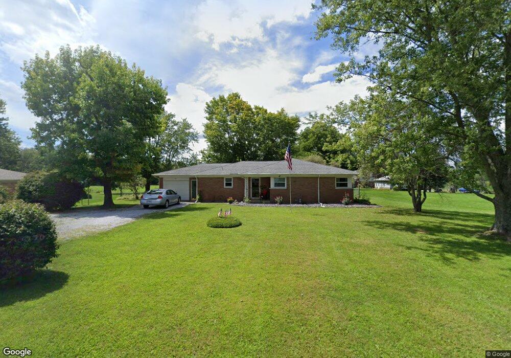
811 S Airport Rd Rushville, IN 46173
Estimated Value: $225,000 - $249,000
3
Beds
2
Baths
2,806
Sq Ft
$85/Sq Ft
Est. Value
About This Home
This home is located at 811 S Airport Rd, Rushville, IN 46173 and is currently estimated at $237,651, approximately $84 per square foot. 811 S Airport Rd is a home located in Rush County with nearby schools including Rushville Consolidated High School and St. Mary Catholic School.
Ownership History
Date
Name
Owned For
Owner Type
Purchase Details
Closed on
Apr 9, 2020
Sold by
Chandler Misty and Estate Of Ruby P Hauk
Bought by
Sterrett James and Sterrett Mary K
Current Estimated Value
Purchase Details
Closed on
Mar 17, 2006
Sold by
Gasper Timothy Lee
Bought by
Wells Fargo Bank Na
Purchase Details
Closed on
Mar 8, 2006
Sold by
Wells Fargo Bank Na
Bought by
Secretary Of Hud
Create a Home Valuation Report for This Property
The Home Valuation Report is an in-depth analysis detailing your home's value as well as a comparison with similar homes in the area
Home Values in the Area
Average Home Value in this Area
Purchase History
| Date | Buyer | Sale Price | Title Company |
|---|---|---|---|
| Sterrett James | -- | None Available | |
| Wells Fargo Bank Na | -- | None Available | |
| Secretary Of Hud | -- | None Available |
Source: Public Records
Tax History Compared to Growth
Tax History
| Year | Tax Paid | Tax Assessment Tax Assessment Total Assessment is a certain percentage of the fair market value that is determined by local assessors to be the total taxable value of land and additions on the property. | Land | Improvement |
|---|---|---|---|---|
| 2024 | $748 | $184,800 | $23,200 | $161,600 |
| 2023 | $734 | $175,800 | $21,500 | $154,300 |
| 2022 | $719 | $161,400 | $19,800 | $141,600 |
| 2021 | $710 | $137,800 | $17,200 | $120,600 |
| 2020 | $834 | $130,000 | $16,200 | $113,800 |
| 2019 | $1,885 | $123,200 | $16,200 | $107,000 |
| 2018 | $672 | $120,300 | $16,200 | $104,100 |
| 2017 | $577 | $116,400 | $16,200 | $100,200 |
| 2016 | $521 | $112,000 | $15,600 | $96,400 |
| 2014 | $360 | $110,500 | $15,600 | $94,900 |
| 2013 | $360 | $118,300 | $15,600 | $102,700 |
Source: Public Records
Map
Nearby Homes
- 904 E State Road 44
- 1350 S Ruth St
- 1364 S Ruth St
- 190 E Willard Ave
- 1112 U S Route 52
- 1157 S State Road 3
- 136 E 3rd St
- 316 E 5th St
- 341 E 6th St
- 331 E 8th St
- 520 E 9th St
- 605 N Perkins St
- 335 N Morgan St
- 229 W 3rd St
- 0 Eric South Ln
- 210 E 7th St
- 324 W 1st St
- 336 E 9th St
- 428 W Lawton Cir
- 902 N Willow St
- 831 S Airport Rd
- 771 S Airport Rd
- 818 S Airport Rd
- 883 S Airport Rd
- 00 S Airport Rd
- 767 S Airport Rd
- 897 S Airport Rd
- 0 Co Rd 700 Rd E Unit 202315805
- 1003 S Airport Rd
- 961 S Airport Rd
- 1011 S Airport Rd
- 1053 S Smith Dr
- 1067 S Smith Dr
- 1075 S Smith Dr
- 1035 S Airport Rd
- 1087 S Smith Dr
- 1056 S Smith Dr
- 1051 S Airport Rd
- 998 S Colorado St
- 1065 S Airport Rd