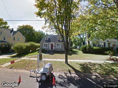
811 Sherman Ave W Fort Atkinson, WI 53538
Estimated Value: $223,000 - $248,000
4
Beds
1
Bath
1,232
Sq Ft
$193/Sq Ft
Est. Value
About This Home
This home is located at 811 Sherman Ave W, Fort Atkinson, WI 53538 and is currently estimated at $237,378, approximately $192 per square foot. 811 Sherman Ave W is a home located in Jefferson County with nearby schools including Barrie Elementary School, Fort Atkinson Middle School, and Fort Atkinson High School.
Ownership History
Date
Name
Owned For
Owner Type
Purchase Details
Closed on
Aug 22, 2014
Sold by
Mike Foerster Real Estate Group Llc
Bought by
Kracht Jonathon and Langcuyan Elvie A
Current Estimated Value
Home Financials for this Owner
Home Financials are based on the most recent Mortgage that was taken out on this home.
Original Mortgage
$118,513
Outstanding Balance
$93,435
Interest Rate
4.5%
Mortgage Type
FHA
Estimated Equity
$141,612
Create a Home Valuation Report for This Property
The Home Valuation Report is an in-depth analysis detailing your home's value as well as a comparison with similar homes in the area
Home Values in the Area
Average Home Value in this Area
Purchase History
| Date | Buyer | Sale Price | Title Company |
|---|---|---|---|
| Kracht Jonathon | $120,700 | None Available |
Source: Public Records
Mortgage History
| Date | Status | Borrower | Loan Amount |
|---|---|---|---|
| Open | Kracht Jonathon | $118,513 | |
| Previous Owner | Bosteder Kenneth R | $50,000 |
Source: Public Records
Tax History Compared to Growth
Tax History
| Year | Tax Paid | Tax Assessment Tax Assessment Total Assessment is a certain percentage of the fair market value that is determined by local assessors to be the total taxable value of land and additions on the property. | Land | Improvement |
|---|---|---|---|---|
| 2024 | $3,504 | $188,400 | $37,500 | $150,900 |
| 2023 | $3,150 | $188,400 | $37,500 | $150,900 |
| 2022 | $3,112 | $123,100 | $25,500 | $97,600 |
| 2021 | $2,742 | $123,100 | $25,500 | $97,600 |
| 2020 | $2,964 | $123,100 | $25,500 | $97,600 |
| 2019 | $2,795 | $123,100 | $25,500 | $97,600 |
| 2018 | $2,675 | $123,100 | $25,500 | $97,600 |
| 2017 | $2,589 | $123,100 | $25,500 | $97,600 |
| 2016 | $2,635 | $120,200 | $23,800 | $96,400 |
| 2015 | $2,620 | $120,200 | $23,800 | $96,400 |
| 2014 | $2,278 | $108,600 | $23,800 | $84,800 |
| 2013 | $2,338 | $108,600 | $23,800 | $84,800 |
Source: Public Records
Map
Nearby Homes
- 817 Van Buren St
- 351 Monroe St
- 1222 Sherman Ave W
- 916 Madison Ave
- 336 Jones Ave
- 320 Grove St
- 407 Janesville Ave
- 521 Adams St
- 716 Messmer St
- 401 S 5th St
- 311 N Main St
- 1313 Commonwealth Dr
- 100 Edward St Unit 6
- 102 Clarence St
- 101 N 4th St Unit 103
- 617 Grant St
- 613 Grove St
- 609 Grove St
- 233 S Water St E
- 622 Maple St
- 811 Sherman Ave W
- 813 Sherman Ave W
- 805 Sherman Ave W
- 118 Roosevelt St
- 801 Sherman Ave W
- 117 Council St
- 112 Roosevelt St
- 123 Roosevelt St
- 113 Council St
- 810 Sherman Ave W
- 812 Sherman Ave W
- 804 Sherman Ave W
- 108 Roosevelt St
- 119 Roosevelt St
- 800 Sherman Ave W
- 111 Council St
- 905 Sherman Ave W
- 113 Roosevelt St
- 210 Roosevelt St