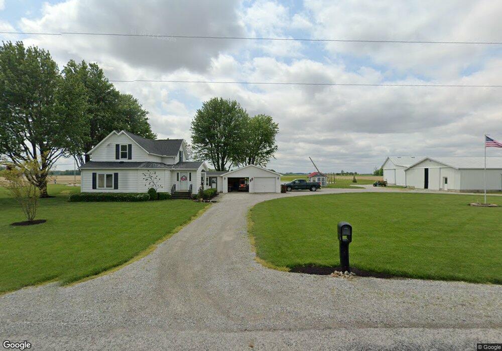
8110 Sampson Rd Monroeville, IN 46773
Estimated Value: $293,959
2
Beds
1
Bath
3,396
Sq Ft
$87/Sq Ft
Est. Value
About This Home
This home is located at 8110 Sampson Rd, Monroeville, IN 46773 and is currently priced at $293,959, approximately $86 per square foot. 8110 Sampson Rd is a home located in Allen County with nearby schools including Heritage Junior/Senior High School and St Rose of Lima Catholic School.
Ownership History
Date
Name
Owned For
Owner Type
Purchase Details
Closed on
Sep 21, 2018
Sold by
Rorick Marietta
Bought by
Rmr Farms Llc
Current Estimated Value
Home Financials for this Owner
Home Financials are based on the most recent Mortgage that was taken out on this home.
Interest Rate
4.65%
Purchase Details
Closed on
Jan 29, 2016
Sold by
Rorick Dennis L
Bought by
Rorick Lynn E and Rorick Roselyn A
Home Financials for this Owner
Home Financials are based on the most recent Mortgage that was taken out on this home.
Original Mortgage
$108,800
Interest Rate
3.97%
Mortgage Type
VA
Create a Home Valuation Report for This Property
The Home Valuation Report is an in-depth analysis detailing your home's value as well as a comparison with similar homes in the area
Home Values in the Area
Average Home Value in this Area
Purchase History
| Date | Buyer | Sale Price | Title Company |
|---|---|---|---|
| Rmr Farms Llc | -- | -- | |
| Rorick Lynn E | -- | Trademark Title |
Source: Public Records
Mortgage History
| Date | Status | Borrower | Loan Amount |
|---|---|---|---|
| Closed | Rmr Farms Llc | -- | |
| Previous Owner | Rorick Lynn E | $108,800 |
Source: Public Records
Tax History Compared to Growth
Tax History
| Year | Tax Paid | Tax Assessment Tax Assessment Total Assessment is a certain percentage of the fair market value that is determined by local assessors to be the total taxable value of land and additions on the property. | Land | Improvement |
|---|---|---|---|---|
| 2022 | $26 | $1,600 | $1,600 | -- |
| 2021 | $25 | $1,400 | $1,400 | $0 |
| 2020 | $22 | $1,400 | $1,400 | $0 |
| 2019 | $32 | $1,700 | $1,700 | $0 |
| 2018 | $30 | $1,800 | $1,800 | $0 |
| 2017 | $34 | $2,000 | $2,000 | $0 |
| 2016 | $988 | $125,800 | $44,000 | $81,800 |
| 2014 | $933 | $118,700 | $44,000 | $74,700 |
| 2013 | $924 | $116,100 | $44,000 | $72,100 |
Source: Public Records
Map
Nearby Homes
- 318 W Barnhart St
- 214 Railroad St
- 422 Monroe St
- 19900 Dawkins Rd
- 10750 Bookcliff Cove
- 5135 Buffay Ct
- 5065 Buffay Ct
- 5057 Buffay Ct
- 4701 Heathermoor Ln
- 2424 N Berthaud Rd
- 5048 Beechmont Ln
- 5011 Beechmont Ln
- 5040 Beechmont Ln
- 5024 Beechmont Ln
- 5016 Beechmont Ln
- 5008 Beechmont Ln
- Chatham Plan at Kennebec
- Stamford Plan at Kennebec
- Pine Plan at Kennebec
- Elder Plan at Kennebec
- 8109 Sampson Rd
- 7421 Sampson Rd
- 7322 Sampson Rd
- 7513 Ternet Rd
- 7503 Ternet Rd
- 7429 Ternet Rd
- 8107 Ternet Rd
- 20008 Lincoln Hwy E
- 8131 Ternet Rd
- 20106 Lincoln Hwy E
- 8119 Ternet Rd
- 20003 Lincoln Hwy E
- 8110 Ternet Rd
- 19118 Tillman Rd
- 7334 Ternet Rd
- 20009 Lincoln Hwy E
- 18980 Tillman Rd
- 19603 Lincoln Hwy E
- 7216 Ternet Rd
- 18904 Tillman Rd