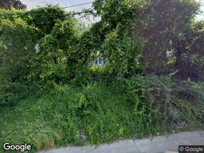
8110 State Route 69 Oriskany, NY 13424
Estimated Value: $233,000 - $437,000
4
Beds
2
Baths
2,802
Sq Ft
$121/Sq Ft
Est. Value
About This Home
This home is located at 8110 State Route 69, Oriskany, NY 13424 and is currently estimated at $338,156, approximately $120 per square foot. 8110 State Route 69 is a home located in Oneida County with nearby schools including N.A. Walbran Elementary School and Oriskany Junior/Senior High School.
Ownership History
Date
Name
Owned For
Owner Type
Purchase Details
Closed on
Dec 12, 2024
Sold by
Bolos John J Est and Bolos
Bought by
Candels Katherine L and Cook Stephen M
Current Estimated Value
Home Financials for this Owner
Home Financials are based on the most recent Mortgage that was taken out on this home.
Original Mortgage
$357,525
Outstanding Balance
$357,223
Interest Rate
6.84%
Mortgage Type
Purchase Money Mortgage
Estimated Equity
-$144,223
Purchase Details
Closed on
Jul 23, 2015
Sold by
Bolos John
Bought by
Bolos John
Home Financials for this Owner
Home Financials are based on the most recent Mortgage that was taken out on this home.
Original Mortgage
$161,250
Interest Rate
4.01%
Mortgage Type
Unknown
Create a Home Valuation Report for This Property
The Home Valuation Report is an in-depth analysis detailing your home's value as well as a comparison with similar homes in the area
Home Values in the Area
Average Home Value in this Area
Purchase History
| Date | Buyer | Sale Price | Title Company |
|---|---|---|---|
| Candels Katherine L | $350,000 | None Available | |
| Bolos John | -- | Malorie Bolos | |
| Bolos John | -- | Malorie Bolos |
Source: Public Records
Mortgage History
| Date | Status | Borrower | Loan Amount |
|---|---|---|---|
| Open | Candels Katherine L | $357,525 | |
| Closed | Cook Stephen M | $357,525 | |
| Previous Owner | Bolos John S | $161,250 | |
| Previous Owner | Bolos John | $50,000 | |
| Previous Owner | Bolos John | $125,000 |
Source: Public Records
Tax History Compared to Growth
Tax History
| Year | Tax Paid | Tax Assessment Tax Assessment Total Assessment is a certain percentage of the fair market value that is determined by local assessors to be the total taxable value of land and additions on the property. | Land | Improvement |
|---|---|---|---|---|
| 2024 | -- | $126,000 | $63,500 | $62,500 |
| 2023 | $6,190 | $126,000 | $63,500 | $62,500 |
| 2022 | $6,203 | $126,000 | $63,500 | $62,500 |
| 2021 | $6,077 | $126,000 | $63,500 | $62,500 |
| 2020 | $5,909 | $126,000 | $63,500 | $62,500 |
| 2019 | $4,896 | $126,000 | $63,500 | $62,500 |
| 2018 | $5,034 | $126,000 | $63,500 | $62,500 |
| 2017 | $4,896 | $126,000 | $63,500 | $62,500 |
| 2016 | $4,858 | $126,000 | $63,500 | $62,500 |
| 2015 | -- | $126,000 | $63,500 | $62,500 |
| 2014 | -- | $126,000 | $63,500 | $62,500 |
Source: Public Records
Map
Nearby Homes
- 8130 New York 69
- 113 Paradise Ln
- 109 Marino St
- 707 Utica St
- 704 Utica St
- 105 Park Ave
- 8460 Old River Rd
- 00 Airport Rd
- 311 Hillside Dr
- 327 Hillside Dr
- 46 Walnut Dr
- 7752 Sandy Cir
- 7713 Sandy Cir
- 7690 Kilbourn Rd Unit SS
- 7900 New Floyd Rd Unit SS
- 5019 County Seat Rd
- 8110 New Floyd Rd
- 8040 Middle Rd Unit SS
- 6545 Fox Rd Unit NS
- 7965 Hillside Ct
- 8110 State Route 69
- 8110 State Route 69
- 8133 State Route 69
- 8100 State Route 69
- 1505 Utica St
- 8050 State Route 69
- 8037 State Route 69
- 1478 Utica St
- 8034 State Route 69
- 1470 Utica St
- 8218 State Route 69
- 1464 Utica St
- 6388 Reid Ln
- 6460 Thomas Rd
- 8005 State Route 69
- 6490 Thomas Rd
- 6387 Reid Ln
- 1435 Utica St
- 6154 Thomas Rd
- 7999 New York 69
