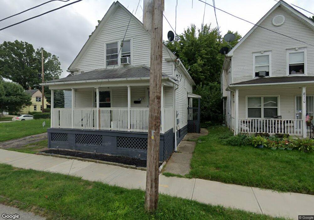
8112 Townsend Ave Cleveland, OH 44104
Fairfax NeighborhoodEstimated Value: $69,000 - $96,000
2
Beds
1
Bath
1,085
Sq Ft
$78/Sq Ft
Est. Value
About This Home
This home is located at 8112 Townsend Ave, Cleveland, OH 44104 and is currently estimated at $85,064, approximately $78 per square foot. 8112 Townsend Ave is a home located in Cuyahoga County with nearby schools including Bolton, Anton Grdina School, and Andrew J. Rickoff School.
Ownership History
Date
Name
Owned For
Owner Type
Purchase Details
Closed on
Aug 2, 2019
Sold by
Brown Laverne
Bought by
Dancy Darius
Current Estimated Value
Purchase Details
Closed on
Mar 6, 1999
Sold by
Stewart Patrick
Bought by
Brown Laverne
Purchase Details
Closed on
Feb 2, 1993
Sold by
Stewart B J
Bought by
Jones Juanita 1 and Jones 8
Purchase Details
Closed on
May 15, 1979
Sold by
Sims Louise
Bought by
Stewart B J
Purchase Details
Closed on
May 1, 1978
Sold by
Sims George and Sims Louise
Bought by
Sims Louise
Purchase Details
Closed on
Jan 1, 1975
Bought by
Sims George and Sims Louise
Create a Home Valuation Report for This Property
The Home Valuation Report is an in-depth analysis detailing your home's value as well as a comparison with similar homes in the area
Home Values in the Area
Average Home Value in this Area
Purchase History
| Date | Buyer | Sale Price | Title Company |
|---|---|---|---|
| Dancy Darius | $29,400 | None Available | |
| Brown Laverne | -- | -- | |
| Brown Laverne | -- | -- | |
| Jones Juanita 1 | -- | -- | |
| Stewart B J | $1,000 | -- | |
| Sims Louise | -- | -- | |
| Sims George | -- | -- |
Source: Public Records
Tax History Compared to Growth
Tax History
| Year | Tax Paid | Tax Assessment Tax Assessment Total Assessment is a certain percentage of the fair market value that is determined by local assessors to be the total taxable value of land and additions on the property. | Land | Improvement |
|---|---|---|---|---|
| 2024 | $1,819 | $27,195 | $2,450 | $24,745 |
| 2023 | $863 | $11,130 | $2,240 | $8,890 |
| 2022 | $858 | $11,130 | $2,240 | $8,890 |
| 2021 | $850 | $11,130 | $2,240 | $8,890 |
| 2020 | $910 | $10,290 | $2,070 | $8,230 |
| 2019 | $124 | $29,400 | $5,900 | $23,500 |
| 2018 | $62 | $10,290 | $2,070 | $8,230 |
| 2017 | $0 | $5,360 | $1,120 | $4,240 |
| 2016 | $0 | $5,360 | $1,120 | $4,240 |
| 2015 | -- | $5,360 | $1,120 | $4,240 |
| 2014 | -- | $5,110 | $1,050 | $4,060 |
Source: Public Records
Map
Nearby Homes
- 2437 E 84th St
- 2429 E 84th St
- 0 E 86th St Unit 5150892
- 7305 Montgomery Ave
- 2622 E 75th St
- 2256 E 85th St
- 2254 E 81st St
- 7207 Otis Ct
- 7211 Chamberlain Ave
- 2246 E 86th St
- 2221 E 76th St
- 2292 E 90th St
- 2451 E 89th St
- 2201 E 86th St
- 2194 E 80th St
- 2237 E 73rd St
- 2181 E 82nd St
- 2309 E 93rd St
- 2288 E 95th St
- 2216 E 71st St
- 8110 Townsend Ave
- 2476 E 82nd St
- 8106 Townsend Ave
- 2464 E 82nd St
- 2460 E 82nd St
- 2488 E 82nd St
- 8102 Townsend Ave
- 8107 Townsend Ave
- 8101 Townsend Ave
- 2477 E 82nd St
- 2458 E 82nd St
- 2492 E 82nd St
- 8014 Townsend Ave
- 2471 E 82nd St
- 8109 Platt Ave
- 8017 Townsend Ave
- 2481 E 82nd St
- 8010 Townsend Ave
- 8013 Townsend Ave
- 8113 Platt Ave