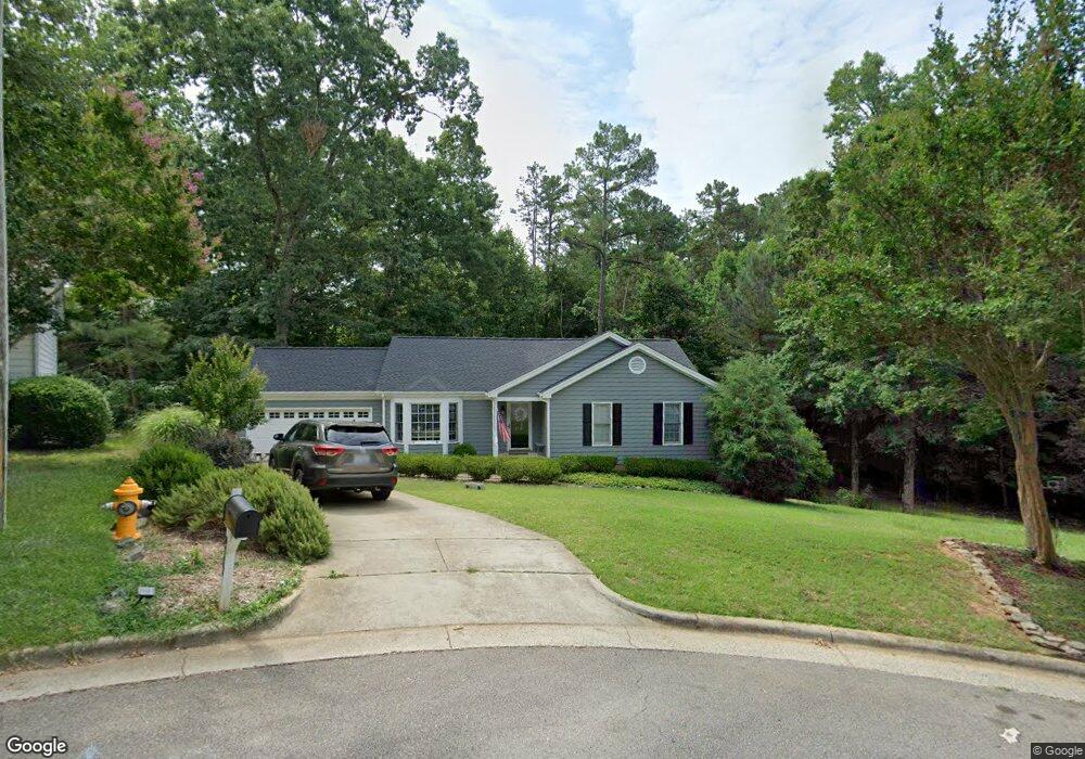
8117 Owenston Ct Raleigh, NC 27612
Northwest Raleigh NeighborhoodEstimated Value: $432,000 - $450,000
3
Beds
2
Baths
1,380
Sq Ft
$320/Sq Ft
Est. Value
About This Home
This home is located at 8117 Owenston Ct, Raleigh, NC 27612 and is currently estimated at $441,414, approximately $319 per square foot. 8117 Owenston Ct is a home located in Wake County with nearby schools including Leesville Road Elementary School, Oberlin Middle School, and Broughton Magnet High School.
Ownership History
Date
Name
Owned For
Owner Type
Purchase Details
Closed on
Sep 12, 2008
Sold by
Duzs Coleen and Duzs John Paul
Bought by
Koster Stephen Frank and Koster Anne Stuart
Current Estimated Value
Home Financials for this Owner
Home Financials are based on the most recent Mortgage that was taken out on this home.
Original Mortgage
$190,000
Outstanding Balance
$118,443
Interest Rate
5.25%
Mortgage Type
Purchase Money Mortgage
Estimated Equity
$322,971
Purchase Details
Closed on
May 27, 1999
Sold by
Myrick Construction Co Of Raleigh Inc
Bought by
Commander Coleen K
Home Financials for this Owner
Home Financials are based on the most recent Mortgage that was taken out on this home.
Original Mortgage
$118,300
Interest Rate
6.62%
Create a Home Valuation Report for This Property
The Home Valuation Report is an in-depth analysis detailing your home's value as well as a comparison with similar homes in the area
Home Values in the Area
Average Home Value in this Area
Purchase History
| Date | Buyer | Sale Price | Title Company |
|---|---|---|---|
| Koster Stephen Frank | $190,000 | None Available | |
| Commander Coleen K | $139,500 | -- |
Source: Public Records
Mortgage History
| Date | Status | Borrower | Loan Amount |
|---|---|---|---|
| Open | Koster Stephen Frank | $190,000 | |
| Previous Owner | Commander Coleen K | $118,300 |
Source: Public Records
Tax History Compared to Growth
Tax History
| Year | Tax Paid | Tax Assessment Tax Assessment Total Assessment is a certain percentage of the fair market value that is determined by local assessors to be the total taxable value of land and additions on the property. | Land | Improvement |
|---|---|---|---|---|
| 2025 | $3,687 | $420,426 | $200,000 | $220,426 |
| 2024 | $3,671 | $420,426 | $200,000 | $220,426 |
| 2023 | $3,129 | $285,200 | $90,000 | $195,200 |
| 2022 | $2,908 | $285,200 | $90,000 | $195,200 |
| 2021 | $2,795 | $285,200 | $90,000 | $195,200 |
| 2020 | $2,744 | $285,200 | $90,000 | $195,200 |
| 2019 | $2,562 | $219,310 | $90,000 | $129,310 |
| 2018 | $2,416 | $219,310 | $90,000 | $129,310 |
| 2017 | $2,301 | $219,310 | $90,000 | $129,310 |
| 2016 | $2,254 | $219,310 | $90,000 | $129,310 |
| 2015 | $2,059 | $196,942 | $65,000 | $131,942 |
| 2014 | $1,954 | $196,942 | $65,000 | $131,942 |
Source: Public Records
Map
Nearby Homes
- 8005 Thomasville Ct
- 8009 Tobin Place
- 8012 Thomasville Ct
- 6233 Pesta Ct
- 6307 Pesta Ct
- 6246 Pesta Ct
- 6230 Pesta Ct
- 6321 Pesta Ct
- 6212 Pesta Ct
- 7879 Allscott Way
- 7851 Allscott Way
- 8223 Ortin Ln
- 7809 Lillyhurst Dr
- 7802 Allscott Way
- 5927 Hourglass Ct
- 6005 History Trail
- 6025 History Trail
- 6064 Viking Dr
- 5912 Hourglass Ct
- 5026 Celtic Ct
- 8113 Owenston Ct
- 8121 Owenston Ct
- 6017 Westborough Dr
- 8109 Owenston Ct
- 8012 Elderson Ln
- 8120 Owenston Ct
- 8008 Elderson Ln
- 8105 Owenston Ct
- 8016 Elderson Ln
- 8112 Owenston Ct
- 8004 Elderson Ln
- 8101 Owenston Ct
- 8108 Owenston Ct
- 8017 Elderson Ln
- 8104 Owenston Ct
- 8113 Tuxford Dr
- 8013 Elderson Ln
- 8009 Elderson Ln
- 8100 Owenston Ct
- 8005 Elderson Ln
