Estimated Value: $73,000 - $184,000
--
Bed
1
Bath
1,248
Sq Ft
$109/Sq Ft
Est. Value
About This Home
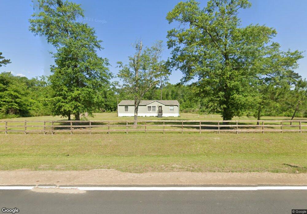
This home is located at 8119 Airline Rd, Pavo, GA 31778 and is currently estimated at $136,333, approximately $109 per square foot. 8119 Airline Rd is a home located in Thomas County with nearby schools including Hand in Hand Primary School, Cross Creek Elementary School, and Garrison-Pilcher Elementary School.
Ownership History
Date
Name
Owned For
Owner Type
Purchase Details
Closed on
Oct 7, 2020
Sold by
King Anthony B
Bought by
Heath Sophia D
Current Estimated Value
Home Financials for this Owner
Home Financials are based on the most recent Mortgage that was taken out on this home.
Original Mortgage
$83,482
Outstanding Balance
$69,153
Interest Rate
2.8%
Mortgage Type
New Conventional
Estimated Equity
$67,180
Purchase Details
Closed on
Jun 15, 2012
Sold by
Heath Sophia D
Bought by
Hart Randall R
Purchase Details
Closed on
Dec 9, 2004
Sold by
Maxwell Joycelyn G
Bought by
Heath Sophia Delores
Purchase Details
Closed on
Apr 30, 1987
Bought by
Givens James F
Create a Home Valuation Report for This Property
The Home Valuation Report is an in-depth analysis detailing your home's value as well as a comparison with similar homes in the area
Home Values in the Area
Average Home Value in this Area
Purchase History
| Date | Buyer | Sale Price | Title Company |
|---|---|---|---|
| Heath Sophia D | -- | -- | |
| Hart Randall R | $26,375 | -- | |
| Heath Sophia Delores | -- | -- | |
| Stringer Samantha Givens | -- | -- | |
| Givens James F | -- | -- |
Source: Public Records
Mortgage History
| Date | Status | Borrower | Loan Amount |
|---|---|---|---|
| Open | Heath Sophia D | $83,482 |
Source: Public Records
Tax History Compared to Growth
Tax History
| Year | Tax Paid | Tax Assessment Tax Assessment Total Assessment is a certain percentage of the fair market value that is determined by local assessors to be the total taxable value of land and additions on the property. | Land | Improvement |
|---|---|---|---|---|
| 2024 | $722 | $34,995 | $31,750 | $3,245 |
| 2023 | $577 | $28,659 | $25,400 | $3,259 |
| 2022 | $627 | $28,200 | $25,400 | $2,800 |
| 2021 | $609 | $24,887 | $22,087 | $2,800 |
| 2020 | $637 | $25,386 | $22,087 | $3,299 |
| 2019 | $644 | $25,386 | $22,087 | $3,299 |
| 2018 | $747 | $25,386 | $22,087 | $3,299 |
| 2017 | $745 | $25,386 | $22,087 | $3,299 |
| 2016 | $673 | $25,386 | $22,087 | $3,299 |
| 2015 | $684 | $25,426 | $22,087 | $3,339 |
| 2014 | $687 | $25,426 | $22,087 | $3,339 |
| 2013 | -- | $25,426 | $22,087 | $3,339 |
Source: Public Records
Map
Nearby Homes
- 16343 Ga Hwy 33 - 8 34 Acres Hwy
- 16343 Georgia 33
- 16343 Ga Hwy 33 -8 34 Acres
- 16343
- 1230 Parrish Rd
- 2051 W Pear St
- 2055 S Roberts St
- 813 Vonier Road (6 Acres)
- 13876 Ga Highway 122
- 258
- 102 Morgan Place
- 100 Morgan Place
- 110 Morgan Place
- 112 Morgan Place
- 4016 E Japonica Ave
- 0000 N
- 1136 Nesbitt Rd
- 3812 Ponder Rd
- 21688 U S 319
- 21688 US Highway 319 N
- 2476 Daniels Rd
- 2476 Daniels Rd
- 8435 Airline Rd
- 8447 Airline Rd
- 1764 Daniels Rd
- 8505 Airline Rd
- 1694 Daniels Rd
- 8570 Airline Rd
- 8583 Airline Rd
- 8583 Airline Rd
- 1608 Daniels Rd
- 2785 Daniels Rd
- 7520 Airline Rd
- 2869 Daniels Rd
- 7632 Airline Rd
- 1527 Daniels Rd
- 16609 Ga Highway 33
- 16609 Ga Highway 33
- 8870 Airline Rd
- 6244 Woodhaven Rd