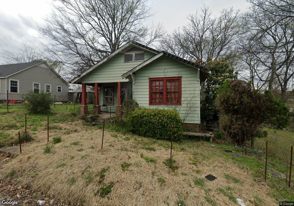
812 Allis St Little Rock, AR 72204
Capitol View NeighborhoodEstimated Value: $120,070 - $140,000
--
Bed
2
Baths
1,700
Sq Ft
$78/Sq Ft
Est. Value
About This Home
This home is located at 812 Allis St, Little Rock, AR 72204 and is currently estimated at $131,768, approximately $77 per square foot. 812 Allis St is a home located in Pulaski County with nearby schools including Stephens Elementary School, Pulaski Heights Middle School, and Central High School.
Ownership History
Date
Name
Owned For
Owner Type
Purchase Details
Closed on
Dec 21, 1998
Sold by
Mcmahon Carey and Mcmahon Lynn
Bought by
Malone Evelyn J and Malone Freddie L
Current Estimated Value
Home Financials for this Owner
Home Financials are based on the most recent Mortgage that was taken out on this home.
Original Mortgage
$27,337
Interest Rate
6.85%
Mortgage Type
Purchase Money Mortgage
Create a Home Valuation Report for This Property
The Home Valuation Report is an in-depth analysis detailing your home's value as well as a comparison with similar homes in the area
Home Values in the Area
Average Home Value in this Area
Purchase History
| Date | Buyer | Sale Price | Title Company |
|---|---|---|---|
| Malone Evelyn J | $33,000 | Lenders Title Company |
Source: Public Records
Mortgage History
| Date | Status | Borrower | Loan Amount |
|---|---|---|---|
| Previous Owner | Malone Evelyn J | $27,337 |
Source: Public Records
Tax History Compared to Growth
Tax History
| Year | Tax Paid | Tax Assessment Tax Assessment Total Assessment is a certain percentage of the fair market value that is determined by local assessors to be the total taxable value of land and additions on the property. | Land | Improvement |
|---|---|---|---|---|
| 2025 | $56 | $800 | $800 | -- |
| 2024 | $867 | $17,619 | $800 | $16,819 |
| 2023 | $867 | $17,619 | $800 | $16,819 |
| 2022 | $827 | $17,619 | $800 | $16,819 |
| 2021 | $794 | $11,260 | $1,200 | $10,060 |
| 2020 | $413 | $11,260 | $1,200 | $10,060 |
| 2019 | $413 | $11,260 | $1,200 | $10,060 |
| 2018 | $438 | $11,260 | $1,200 | $10,060 |
| 2017 | $788 | $11,260 | $1,200 | $10,060 |
| 2016 | $415 | $18,200 | $1,040 | $17,160 |
| 2015 | $674 | $10,490 | $1,040 | $9,450 |
| 2014 | $674 | $9,610 | $1,040 | $8,570 |
Source: Public Records
Map
Nearby Homes
- 3212 Lamar St
- 1004 Johnson St
- 3407 Maryland Ave
- 3224 W 11th St
- 3419 W 10th St
- 923 Booker St
- 3401 W 12th St
- 520 S Martin St Unit S. Martin St. north
- 3700 Maryland Ave
- 903 S Oak St
- 3724 W 10th St
- 400 S Booker St
- 904 S Oak St
- 2717 W Capitol Ave
- 605 S Oak St
- 3705 W 12th St
- 305 Booker St
- 3715 W 12th St
- 306 S Woodrow St
- 1418 S Martin St