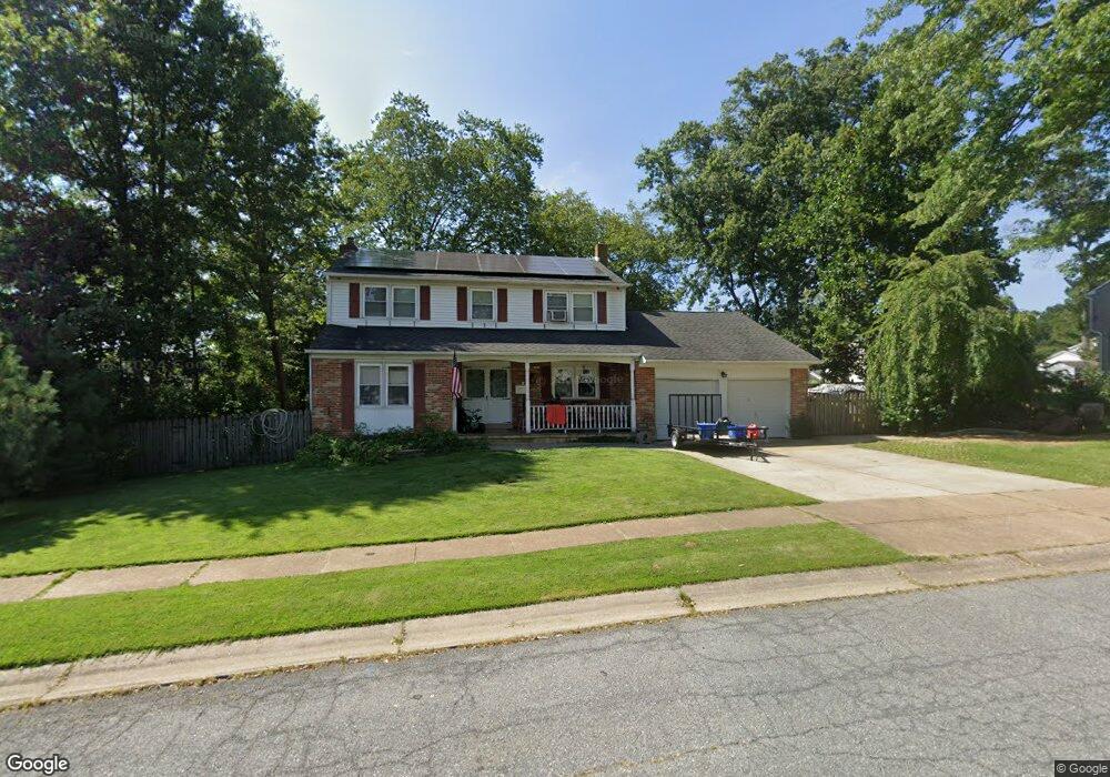
812 Dallam Rd Newark, DE 19711
Estimated Value: $471,000 - $515,000
4
Beds
3
Baths
2,178
Sq Ft
$227/Sq Ft
Est. Value
About This Home
This home is located at 812 Dallam Rd, Newark, DE 19711 and is currently estimated at $495,209, approximately $227 per square foot. 812 Dallam Rd is a home located in New Castle County with nearby schools including Downes (John R.) Elementary School, Shue-Medill Middle School, and Newark High School.
Ownership History
Date
Name
Owned For
Owner Type
Purchase Details
Closed on
Dec 21, 2000
Bought by
Lienig Andre K and Lienig Joyce A
Current Estimated Value
Home Financials for this Owner
Home Financials are based on the most recent Mortgage that was taken out on this home.
Original Mortgage
$149,600
Outstanding Balance
$55,089
Interest Rate
7.69%
Estimated Equity
$440,120
Create a Home Valuation Report for This Property
The Home Valuation Report is an in-depth analysis detailing your home's value as well as a comparison with similar homes in the area
Home Values in the Area
Average Home Value in this Area
Purchase History
| Date | Buyer | Sale Price | Title Company |
|---|---|---|---|
| Lienig Andre K | $157,500 | -- | |
| Lienig Andre K | $157,500 | -- |
Source: Public Records
Mortgage History
| Date | Status | Borrower | Loan Amount |
|---|---|---|---|
| Open | Lienig Andre K | $149,600 | |
| Closed | Lienig Andre K | $7,900 |
Source: Public Records
Tax History Compared to Growth
Tax History
| Year | Tax Paid | Tax Assessment Tax Assessment Total Assessment is a certain percentage of the fair market value that is determined by local assessors to be the total taxable value of land and additions on the property. | Land | Improvement |
|---|---|---|---|---|
| 2024 | $876 | $83,000 | $16,900 | $66,100 |
| 2023 | $3,001 | $83,000 | $16,900 | $66,100 |
| 2022 | $2,969 | $83,000 | $16,900 | $66,100 |
| 2021 | $2,894 | $83,000 | $16,900 | $66,100 |
| 2020 | $2,810 | $83,000 | $16,900 | $66,100 |
| 2019 | $2,463 | $83,000 | $16,900 | $66,100 |
| 2018 | $2,406 | $83,000 | $16,900 | $66,100 |
| 2017 | $2,335 | $83,000 | $16,900 | $66,100 |
| 2016 | $2,328 | $83,000 | $16,900 | $66,100 |
| 2015 | $2,087 | $83,000 | $16,900 | $66,100 |
| 2014 | $2,086 | $83,000 | $16,900 | $66,100 |
Source: Public Records
Map
Nearby Homes
- 9 Amherst Dr
- 914 Quail Ln
- 34 Ethan Allen Ct
- 506 Cambridge Dr
- 3 Julie Ln
- 137 Madison Dr
- 129 W Mill Station Dr
- 181 Madison Dr
- 104 Leahy Dr
- 102 Leahy Dr
- 100 Leahy Dr
- 01a Leahy Dr
- 03a Leahy Dr
- The Reid Plan at Briarcreek North
- The Vincent Plan at Briarcreek North
- The Murray Plan at Briarcreek North
- The Wyeth Plan at Briarcreek North
- 36 Julie Ln
- 3 Kayser Ct
- 405 Leahy Dr