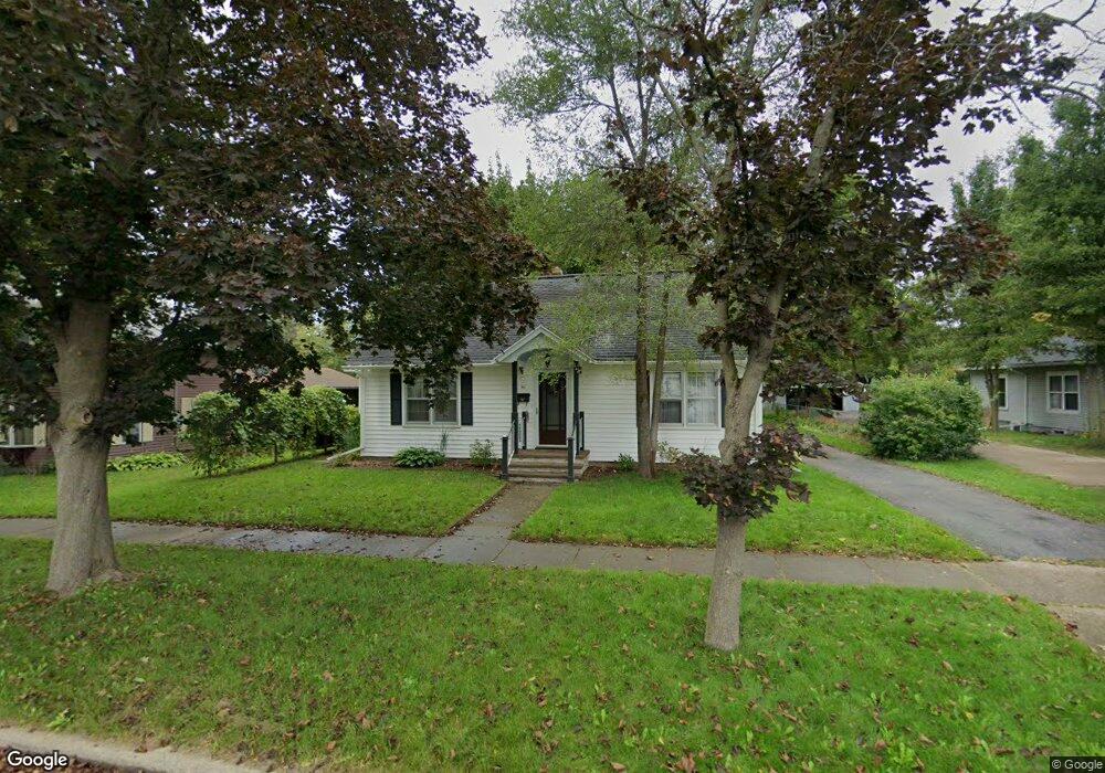
812 Lincoln Lake Lowell, MI 49331
Estimated Value: $289,000 - $359,000
4
Beds
1
Bath
1,554
Sq Ft
$200/Sq Ft
Est. Value
About This Home
This home is located at 812 Lincoln Lake, Lowell, MI 49331 and is currently estimated at $310,574, approximately $199 per square foot. 812 Lincoln Lake is a home located in Kent County with nearby schools including Bushnell Elementary School, Cherry Creek Elementary School, and Lowell Middle School.
Ownership History
Date
Name
Owned For
Owner Type
Purchase Details
Closed on
Dec 12, 2003
Sold by
Ohaire Patricia J
Bought by
Ohaire Thomas J
Current Estimated Value
Purchase Details
Closed on
Jul 26, 2000
Sold by
Maloney Roman E and Maloney Rosella M
Bought by
Ohaire Tom and Ohaire Patricia
Home Financials for this Owner
Home Financials are based on the most recent Mortgage that was taken out on this home.
Original Mortgage
$121,700
Interest Rate
7.58%
Create a Home Valuation Report for This Property
The Home Valuation Report is an in-depth analysis detailing your home's value as well as a comparison with similar homes in the area
Home Values in the Area
Average Home Value in this Area
Purchase History
| Date | Buyer | Sale Price | Title Company |
|---|---|---|---|
| Ohaire Thomas J | -- | -- | |
| Ohaire Tom | -- | -- | |
| O'Haire Maloney>O'Haire | $125,500 | -- |
Source: Public Records
Mortgage History
| Date | Status | Borrower | Loan Amount |
|---|---|---|---|
| Previous Owner | O'Haire Maloney>O'Haire | $121,700 |
Source: Public Records
Tax History Compared to Growth
Tax History
| Year | Tax Paid | Tax Assessment Tax Assessment Total Assessment is a certain percentage of the fair market value that is determined by local assessors to be the total taxable value of land and additions on the property. | Land | Improvement |
|---|---|---|---|---|
| 2025 | $3,121 | $140,900 | $0 | $0 |
| 2024 | $3,121 | $140,100 | $0 | $0 |
| 2023 | $2,980 | $124,500 | $0 | $0 |
| 2022 | $3,385 | $108,400 | $0 | $0 |
| 2021 | $3,289 | $95,800 | $0 | $0 |
| 2020 | $2,726 | $90,900 | $0 | $0 |
| 2019 | $3,201 | $87,500 | $0 | $0 |
| 2018 | $3,133 | $85,000 | $0 | $0 |
| 2017 | $3,055 | $77,300 | $0 | $0 |
| 2016 | $2,970 | $74,400 | $0 | $0 |
| 2015 | -- | $74,400 | $0 | $0 |
| 2013 | -- | $65,000 | $0 | $0 |
Source: Public Records
Map
Nearby Homes
- 510 N Hudson St SE
- 610 Birchwood Ct SE
- 521 Spring St
- 725 N Lafayette St SE
- 220 King St Unit 10
- 220 King St Unit 6
- 913 N Monroe St
- 216 W Main St Unit 6
- 926 N Washington St
- 414 N Jefferson St
- 1060 N Washington St
- 1550 Carol Lynne Dr
- 780 Bowes Rd
- 1080 N Washington St SE
- Cedarwood Plan at Flat River Estates
- Sycamore Plan at Flat River Estates
- Elmwood Plan at Flat River Estates
- Chestnut Plan at Flat River Estates
- Redwood Plan at Flat River Estates
- Whitby Plan at Flat River Estates
- 812 Lincoln Lake
- 804 Lincoln Lake
- 818 Lincoln Lake
- 818 Lincoln Lake
- 818 Lincoln Lake
- 726 Lincoln Lake
- 726 Lincoln Lake
- 824 Lincoln Lake
- 514 Suffolk St
- 726 Lincoln Lake
- 824 Lincoln Lake
- 423 Suffolk St
- 821 Lincoln Lake
- 512 Foreman St
- 523 Suffolk St
- 512 Foreman St SE
- 718 Lincoln Lake
- 481 Lincoln Lake
- 524 Suffolk St
- 534 Foreman St SE