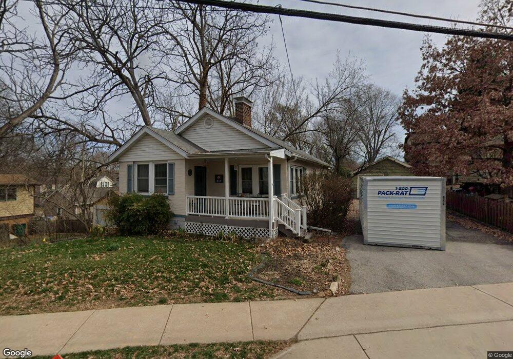
812 N Bompart Ave Saint Louis, MO 63119
Estimated Value: $283,000 - $322,269
2
Beds
2
Baths
1,077
Sq Ft
$288/Sq Ft
Est. Value
About This Home
This home is located at 812 N Bompart Ave, Saint Louis, MO 63119 and is currently estimated at $310,567, approximately $288 per square foot. 812 N Bompart Ave is a home located in St. Louis County with nearby schools including Avery Elementary School, Hixson Middle School, and Webster Groves High School.
Ownership History
Date
Name
Owned For
Owner Type
Purchase Details
Closed on
Sep 20, 2005
Sold by
Hampton Allen A and Hampton Antoinette C
Bought by
Cacciabando Jill L
Current Estimated Value
Home Financials for this Owner
Home Financials are based on the most recent Mortgage that was taken out on this home.
Original Mortgage
$123,200
Outstanding Balance
$65,248
Interest Rate
5.69%
Mortgage Type
Fannie Mae Freddie Mac
Estimated Equity
$245,319
Purchase Details
Closed on
Apr 15, 2005
Sold by
Hampton Allen A and Hampton Antoinette C
Bought by
Hampton Allen A and Hampton Antoinette C
Create a Home Valuation Report for This Property
The Home Valuation Report is an in-depth analysis detailing your home's value as well as a comparison with similar homes in the area
Home Values in the Area
Average Home Value in this Area
Purchase History
| Date | Buyer | Sale Price | Title Company |
|---|---|---|---|
| Cacciabando Jill L | $154,000 | Copper Land & Title | |
| Hampton Allen A | -- | -- |
Source: Public Records
Mortgage History
| Date | Status | Borrower | Loan Amount |
|---|---|---|---|
| Open | Cacciabando Jill L | $123,200 |
Source: Public Records
Tax History Compared to Growth
Tax History
| Year | Tax Paid | Tax Assessment Tax Assessment Total Assessment is a certain percentage of the fair market value that is determined by local assessors to be the total taxable value of land and additions on the property. | Land | Improvement |
|---|---|---|---|---|
| 2025 | $3,478 | $48,830 | $37,450 | $11,380 |
| 2024 | $3,478 | $49,730 | $27,250 | $22,480 |
| 2023 | $3,461 | $49,730 | $27,250 | $22,480 |
| 2022 | $3,177 | $42,340 | $27,250 | $15,090 |
| 2021 | $3,166 | $42,340 | $27,250 | $15,090 |
| 2020 | $3,155 | $39,300 | $27,250 | $12,050 |
| 2019 | $3,132 | $39,300 | $27,250 | $12,050 |
| 2018 | $3,072 | $34,220 | $19,080 | $15,140 |
| 2017 | $3,051 | $34,220 | $19,080 | $15,140 |
| 2016 | $2,624 | $28,140 | $16,340 | $11,800 |
| 2015 | $2,630 | $28,140 | $16,340 | $11,800 |
| 2014 | $2,373 | $24,680 | $10,490 | $14,190 |
Source: Public Records
Map
Nearby Homes
- 619 N Bompart Ave
- 716 Clark Ave
- 610 Cornelia Ave
- 808 Greeley Ave
- 544 Summit Ave
- 840 Marshall Ave
- 400 Marion Ave
- 441 Park Rd
- 835 N Forest Ave
- 946 Marshall Ave Unit D
- 940 Brookside Ave
- 2911 Brazeau Ave
- 2905 Brazeau Ave
- 814 Holland Ave
- 2829 Brazeau Ave
- 546 Holland Ave
- 946 Newport Ave
- 2655 Salem Rd
- 2904 Collier Ave
- 8908 W Pendleton Ave
- 816 N Bompart Ave
- 639 Clark Ave
- 643 Clark Ave
- 640 Atalanta Ave
- 645 Clark Ave
- 627 Clark Ave
- 822 N Bompart Ave
- 644 Atalanta Ave
- 649 Clark Ave
- 621 Clark Ave
- 648 Atalanta Ave
- 819 N Bompart Ave
- 628 Clark Ave
- 653 Clark Ave
- 617 Clark Ave
- 652 Atalanta Ave
- 624 Clark Ave
- 642 Clark Ave
- 642 Clark Ave Unit 642 Clark Apartment
- 657 Clark Ave