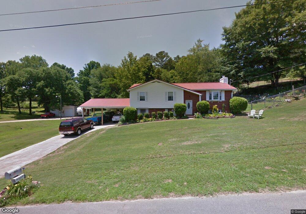
812 Rock Ridge Rd Weaver, AL 36277
Estimated Value: $203,000 - $216,000
--
Bed
1
Bath
1,856
Sq Ft
$114/Sq Ft
Est. Value
About This Home
This home is located at 812 Rock Ridge Rd, Weaver, AL 36277 and is currently estimated at $210,885, approximately $113 per square foot. 812 Rock Ridge Rd is a home located in Calhoun County with nearby schools including Weaver Elementary School and Weaver High School.
Ownership History
Date
Name
Owned For
Owner Type
Purchase Details
Closed on
Feb 24, 2017
Bought by
Woolfolk Ursula and Woolfolk Guillermo
Current Estimated Value
Home Financials for this Owner
Home Financials are based on the most recent Mortgage that was taken out on this home.
Original Mortgage
$130,000
Outstanding Balance
$107,773
Interest Rate
4.16%
Estimated Equity
$103,112
Create a Home Valuation Report for This Property
The Home Valuation Report is an in-depth analysis detailing your home's value as well as a comparison with similar homes in the area
Home Values in the Area
Average Home Value in this Area
Purchase History
| Date | Buyer | Sale Price | Title Company |
|---|---|---|---|
| Woolfolk Ursula | -- | -- |
Source: Public Records
Mortgage History
| Date | Status | Borrower | Loan Amount |
|---|---|---|---|
| Open | Woolfolk Ursula | $130,000 | |
| Closed | Woolfolk Ursula | -- | |
| Previous Owner | Woolfolk Ursula | $50,000 |
Source: Public Records
Tax History Compared to Growth
Tax History
| Year | Tax Paid | Tax Assessment Tax Assessment Total Assessment is a certain percentage of the fair market value that is determined by local assessors to be the total taxable value of land and additions on the property. | Land | Improvement |
|---|---|---|---|---|
| 2024 | $786 | $18,570 | $2,200 | $16,370 |
| 2023 | $786 | $19,552 | $2,200 | $17,352 |
| 2022 | $798 | $18,834 | $2,200 | $16,634 |
| 2021 | $629 | $15,116 | $2,200 | $12,916 |
| 2020 | $659 | $15,758 | $2,200 | $13,558 |
| 2019 | $607 | $14,626 | $2,200 | $12,426 |
| 2018 | $665 | $15,900 | $0 | $0 |
| 2017 | $639 | $14,200 | $0 | $0 |
| 2016 | $588 | $14,200 | $0 | $0 |
| 2013 | -- | $14,320 | $0 | $0 |
Source: Public Records
Map
Nearby Homes
- 921 Princess Dr
- 718 Bain Ave
- 715 Cedar Springs Rd
- 707 Cedar Springs Rd
- 1018 Hillcrest Dr
- 1104 Edgewood Dr
- 409 Russell Ln
- 1103 Alexandria Rd
- 504 Maumee Blvd
- 0 Sunset Dr Unit 21432181
- 500 Maumee Blvd
- 420 Maumee Blvd
- 0 Peaceburg Rd Unit 21429801
- 0 Peaceburg Rd Unit 9 1283726
- 1516 Maple Dr
- 705 Valley Dr
- 001 Main St Unit 1 & 2
- 0 Hilltop Rd
- 550 Meharg St Unit 550
- 306 Hilltop Rd
- 814 Rock Ridge Rd
- 810 Rock Ridge Rd
- 813 Rock Ridge Rd
- 817 Rock Ridge Rd
- 811 Rock Ridge Rd
- 808 Rock Ridge Rd
- 819 Rock Ridge Rd
- 917 Princess Dr
- 809 Rock Ridge Rd
- 923 Princess Dr
- 818 Rock Ridge Rd
- 821 Rock Ridge Rd
- 806 Rock Ridge Rd
- 925 Princess Dr
- 807 Rock Ridge Rd
- 927 Princess Dr
- 800 Shady Ln
- 811 Cedar Springs Rd
- 820 Rock Ridge Rd
- 823 Rock Ridge Rd