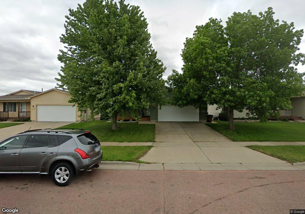
812 S Wheatland Ave Sioux Falls, SD 57106
Northwest Sioux Falls NeighborhoodEstimated Value: $269,000 - $323,000
3
Beds
2
Baths
1,545
Sq Ft
$188/Sq Ft
Est. Value
About This Home
This home is located at 812 S Wheatland Ave, Sioux Falls, SD 57106 and is currently estimated at $291,062, approximately $188 per square foot. 812 S Wheatland Ave is a home located in Minnehaha County with nearby schools including Discovery Elementary School, Memorial Middle School, and Jefferson High School - 67.
Ownership History
Date
Name
Owned For
Owner Type
Purchase Details
Closed on
Jan 10, 2020
Sold by
Besta Brian and Besta Patricia
Bought by
Gall Dustin Wayne
Current Estimated Value
Home Financials for this Owner
Home Financials are based on the most recent Mortgage that was taken out on this home.
Original Mortgage
$185,257
Outstanding Balance
$162,271
Interest Rate
3.6%
Mortgage Type
VA
Estimated Equity
$128,791
Purchase Details
Closed on
Apr 18, 2017
Sold by
Britton Christopher B and Britton Kayla L
Bought by
Besta Brian and Besta Patricia
Create a Home Valuation Report for This Property
The Home Valuation Report is an in-depth analysis detailing your home's value as well as a comparison with similar homes in the area
Home Values in the Area
Average Home Value in this Area
Purchase History
| Date | Buyer | Sale Price | Title Company |
|---|---|---|---|
| Gall Dustin Wayne | $203,000 | None Available | |
| Besta Brian | $191,000 | -- |
Source: Public Records
Mortgage History
| Date | Status | Borrower | Loan Amount |
|---|---|---|---|
| Open | Gall Dustin Wayne | $185,257 |
Source: Public Records
Tax History
| Year | Tax Paid | Tax Assessment Tax Assessment Total Assessment is a certain percentage of the fair market value that is determined by local assessors to be the total taxable value of land and additions on the property. | Land | Improvement |
|---|---|---|---|---|
| 2024 | $3,581 | $265,600 | $22,300 | $243,300 |
| 2023 | $3,408 | $243,100 | $22,300 | $220,800 |
| 2022 | $3,359 | $226,100 | $22,300 | $203,800 |
| 2021 | $2,689 | $197,400 | $0 | $0 |
| 2020 | $2,689 | $172,900 | $0 | $0 |
| 2019 | $2,556 | $161,235 | $0 | $0 |
| 2018 | $2,343 | $157,739 | $0 | $0 |
| 2017 | $2,240 | $148,347 | $21,375 | $126,972 |
| 2016 | $2,240 | $141,722 | $21,375 | $120,347 |
| 2015 | $2,202 | $133,909 | $20,187 | $113,722 |
| 2014 | $2,109 | $129,493 | $20,187 | $109,306 |
Source: Public Records
Map
Nearby Homes
- 824 S Tanglewood Ave
- 1107 S President Ct
- 7816 W Kelsey Cir
- 8709 W Rathburn St
- 1209 S Wheatland Ave
- 516 S Mary Gene Ave
- 8016 W Browning St
- 811 S Discovery Ave
- 521 S Big Stone Ave
- 1100 S Maria Ave
- 1301 S Hyannis Port Ln
- 1501 S Wheatland Ave
- 701 S Gill Ave
- 1201 S Montpelier Ave Ave
- 7512 W Stoney Creek St
- 1516 S Kinderhook Ave
- 1305 S Gill Ave
- 7505 W 15th St
- 8101 W 24th St
- 1508 S Kathryn Ave
- 808 S Wheatland Ave
- 816 S Wheatland Ave
- 804 S Wheatland Ave
- 820 S Wheatland Ave
- 801 S Whitewood Ave
- 805 S Whitewood Ave
- 725 S Whitewood Ave
- 809 S Whitewood Ave
- 800 S Wheatland Ave
- 824 S Wheatland Ave
- 813 S Wheatland Ave
- 809 S Wheatland Ave
- 817 S Wheatland Ave
- 721 S Whitewood Ave
- 805 S Wheatland Ave
- 821 S Wheatland Ave
- 813 S Whitewood Ave
- 716 S Wheatland Ave
- 828 S Wheatland Ave
- 717 S Whitewood Ave
Your Personal Tour Guide
Ask me questions while you tour the home.