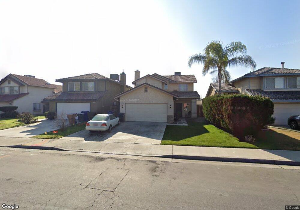
8121 Woodside St Unit B Bakersfield, CA 93311
The Oaks NeighborhoodEstimated Value: $362,000 - $389,233
4
Beds
3
Baths
1,000
Sq Ft
$378/Sq Ft
Est. Value
About This Home
This home is located at 8121 Woodside St Unit B, Bakersfield, CA 93311 and is currently estimated at $378,058, approximately $378 per square foot. 8121 Woodside St Unit B is a home located in Kern County with nearby schools including Christa McAuliffe Elementary School, Tevis Junior High School, and Stockdale High School.
Ownership History
Date
Name
Owned For
Owner Type
Purchase Details
Closed on
Feb 3, 2020
Sold by
Moorer Dana A
Bought by
Moorer Arthur E
Current Estimated Value
Purchase Details
Closed on
Feb 17, 2017
Sold by
Moorer Dana A
Bought by
Moorer Dana A
Home Financials for this Owner
Home Financials are based on the most recent Mortgage that was taken out on this home.
Original Mortgage
$100,000
Interest Rate
4.12%
Mortgage Type
Purchase Money Mortgage
Purchase Details
Closed on
Sep 15, 2016
Sold by
Moorer Arthur
Bought by
Moorer Dana A
Purchase Details
Closed on
Dec 9, 2002
Sold by
Turner Edward D and Turner Rebecca L
Bought by
Moorer Arthur
Create a Home Valuation Report for This Property
The Home Valuation Report is an in-depth analysis detailing your home's value as well as a comparison with similar homes in the area
Home Values in the Area
Average Home Value in this Area
Purchase History
| Date | Buyer | Sale Price | Title Company |
|---|---|---|---|
| Moorer Arthur E | -- | None Listed On Document | |
| Moorer Dana A | -- | First American Title Company | |
| Moorer Dana A | -- | None Available | |
| Moorer Arthur | $145,000 | Fidelity |
Source: Public Records
Mortgage History
| Date | Status | Borrower | Loan Amount |
|---|---|---|---|
| Previous Owner | Moorer Dana A | $100,000 |
Source: Public Records
Tax History Compared to Growth
Tax History
| Year | Tax Paid | Tax Assessment Tax Assessment Total Assessment is a certain percentage of the fair market value that is determined by local assessors to be the total taxable value of land and additions on the property. | Land | Improvement |
|---|---|---|---|---|
| 2025 | $3,767 | $255,322 | $58,026 | $197,296 |
| 2024 | $3,713 | $250,317 | $56,889 | $193,428 |
| 2023 | $3,713 | $245,410 | $55,774 | $189,636 |
| 2022 | $3,567 | $240,599 | $54,681 | $185,918 |
| 2021 | $3,447 | $235,882 | $53,609 | $182,273 |
| 2020 | $3,391 | $233,465 | $53,060 | $180,405 |
| 2019 | $3,349 | $233,465 | $53,060 | $180,405 |
| 2018 | $3,199 | $224,400 | $51,000 | $173,400 |
| 2017 | $3,154 | $220,000 | $50,000 | $170,000 |
| 2016 | $2,521 | $177,393 | $36,699 | $140,694 |
| 2015 | $2,499 | $174,729 | $36,148 | $138,581 |
| 2014 | $2,439 | $171,307 | $35,440 | $135,867 |
Source: Public Records
Map
Nearby Homes
- 7713 Kamloops Dr
- 3505 Boswellia Dr
- 2600 Brookside Dr Unit 40
- 2600 Brookside Dr Unit 46
- 8505 Indian Clover Ct
- 3404 Deming Ct
- 3730 Amur Maple Dr
- 8900 Bridlewood Ln
- 3808 Amur Maple Dr
- 2316 Gosford Rd Unit W
- 8909 Summer Creek Rd
- 3405 Raven Oak Ct
- 7321 Alamosa Ln
- 7804 Revelstoke Way
- 3113 Loveland Way
- 7812 Cibola Dr
- 2601 Manitou Way
- 8416 Crab Apple Ct
- 7512 Lordsburg Dr
- 9101 Broad Oak Ave
- 8117 Woodside St
- 8125 Woodside St
- 8113 Woodside St Unit B
- 8201 Woodside St
- 8205 Woodside St
- 8109 Woodside St Unit B
- 8108 Woodside St
- 8112 Woodside St Unit B
- 8104 Woodside St
- 8116 Woodside St
- 8209 Woodside St
- 8200 Woodside St
- 8105 Woodside St
- 8100 Woodside St
- 3100 Brookfield Loop
- 8204 Woodside St
- 3104 Brookfield Loop
- 8213 Woodside St
- 8101 Woodside St
- 8208 Woodside St Unit A