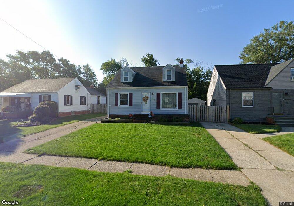
8123 Newport Ave Cleveland, OH 44129
Estimated Value: $172,459 - $193,000
3
Beds
1
Bath
1,092
Sq Ft
$168/Sq Ft
Est. Value
About This Home
This home is located at 8123 Newport Ave, Cleveland, OH 44129 and is currently estimated at $183,365, approximately $167 per square foot. 8123 Newport Ave is a home located in Cuyahoga County with nearby schools including Ridge-Brook Elementary School, Greenbriar Middle School, and Parma High School.
Ownership History
Date
Name
Owned For
Owner Type
Purchase Details
Closed on
Mar 16, 2006
Sold by
Roldan Daniel
Bought by
Roldan Kathy M
Current Estimated Value
Purchase Details
Closed on
Jan 26, 1994
Sold by
Paoli Tomas
Bought by
Roldan Daniel and Roldan Kathy M
Purchase Details
Closed on
Oct 24, 1986
Sold by
Bucer William L and Bucer Stella A
Bought by
Paoli Tomas
Purchase Details
Closed on
Jan 1, 1975
Bought by
Bucer William L and Bucer Stella A
Create a Home Valuation Report for This Property
The Home Valuation Report is an in-depth analysis detailing your home's value as well as a comparison with similar homes in the area
Home Values in the Area
Average Home Value in this Area
Purchase History
| Date | Buyer | Sale Price | Title Company |
|---|---|---|---|
| Roldan Kathy M | -- | None Available | |
| Roldan Daniel | $80,000 | -- | |
| Paoli Tomas | $52,900 | -- | |
| Bucer William L | -- | -- |
Source: Public Records
Tax History Compared to Growth
Tax History
| Year | Tax Paid | Tax Assessment Tax Assessment Total Assessment is a certain percentage of the fair market value that is determined by local assessors to be the total taxable value of land and additions on the property. | Land | Improvement |
|---|---|---|---|---|
| 2024 | $3,045 | $49,280 | $9,940 | $39,340 |
| 2023 | $2,600 | $35,910 | $8,190 | $27,720 |
| 2022 | $2,574 | $35,910 | $8,190 | $27,720 |
| 2021 | $2,646 | $35,910 | $8,190 | $27,720 |
| 2020 | $2,322 | $27,620 | $6,300 | $21,320 |
| 2019 | $2,217 | $78,900 | $18,000 | $60,900 |
| 2018 | $2,080 | $27,620 | $6,300 | $21,320 |
| 2017 | $2,088 | $24,010 | $4,410 | $19,600 |
| 2016 | $2,076 | $24,010 | $4,410 | $19,600 |
| 2015 | $2,039 | $24,010 | $4,410 | $19,600 |
| 2014 | $2,039 | $25,550 | $4,690 | $20,860 |
Source: Public Records
Map
Nearby Homes
- 8206 Newport Ave
- 7707 Liberty Ave
- 5440 W 84th St Unit 42
- 8308 Chesterfield Ave
- 7915 Fernhill Ave
- 9118 Fernhill Ave
- 9012 W Moreland Rd
- 9417 Fernhill Ave
- 6511 Laverne Ave
- 6606 Theota Ave
- 7609 Wooster Pkwy
- 5717 Chestnut Dr
- 6403 Bradley Ave
- 6508 Delora Ave
- 6211 Luelda Ave
- 6106 Merkle Ave
- 7910 Dresden Ave
- 6306 Flowerdale Ave
- 6014 Laverne Ave
- 4830 Autumn Ln
- 8203 Newport Ave
- 8117 Newport Ave
- 8205 Newport Ave
- 8207 Newport Ave
- 8109 Newport Ave
- 8211 Newport Ave
- 8110 Manhattan Ave
- 8215 Newport Ave
- 8202 Newport Ave
- 8118 Newport Ave
- V/L 43 Manhattan Ave
- 8114 Newport Ave
- 8103 Newport Ave
- 8219 Newport Ave
- 8210 Newport Ave
- 8214 Newport Ave
- 8106 Newport Ave
- 8023 Newport Ave
- 8102 Newport Ave
- 8019 Newport Ave