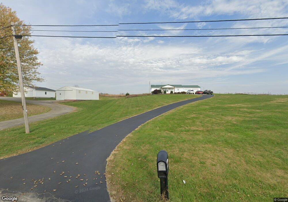
8125 State Route 41 West Union, OH 45693
Estimated Value: $197,782 - $270,000
3
Beds
2
Baths
1,196
Sq Ft
$195/Sq Ft
Est. Value
About This Home
This home is located at 8125 State Route 41, West Union, OH 45693 and is currently estimated at $233,196, approximately $194 per square foot. 8125 State Route 41 is a home located in Adams County with nearby schools including Manchester Elementary School, Manchester High School, and Adams County Christian School.
Ownership History
Date
Name
Owned For
Owner Type
Purchase Details
Closed on
May 17, 2021
Sold by
Wikoff Eric
Bought by
Wright Kearston B and Pointer Shawn Fb
Current Estimated Value
Home Financials for this Owner
Home Financials are based on the most recent Mortgage that was taken out on this home.
Original Mortgage
$176,768
Outstanding Balance
$159,692
Interest Rate
2.9%
Mortgage Type
New Conventional
Estimated Equity
$73,504
Purchase Details
Closed on
May 21, 2015
Sold by
Welch Michael
Bought by
Wikoff Eric
Purchase Details
Closed on
Oct 10, 2012
Sold by
Shelton Patricia M and Perry Catju
Bought by
Welch Michael
Home Financials for this Owner
Home Financials are based on the most recent Mortgage that was taken out on this home.
Original Mortgage
$68,000
Interest Rate
3.57%
Mortgage Type
FHA
Purchase Details
Closed on
Nov 23, 1993
Bought by
Perry W R
Create a Home Valuation Report for This Property
The Home Valuation Report is an in-depth analysis detailing your home's value as well as a comparison with similar homes in the area
Home Values in the Area
Average Home Value in this Area
Purchase History
| Date | Buyer | Sale Price | Title Company |
|---|---|---|---|
| Wright Kearston B | $175,000 | Priority National Title | |
| Wikoff Eric | $90,000 | None Available | |
| Welch Michael | $80,000 | None Available | |
| Perry W R | -- | -- |
Source: Public Records
Mortgage History
| Date | Status | Borrower | Loan Amount |
|---|---|---|---|
| Open | Wright Kearston B | $176,768 | |
| Previous Owner | Welch Michael | $68,000 |
Source: Public Records
Tax History Compared to Growth
Tax History
| Year | Tax Paid | Tax Assessment Tax Assessment Total Assessment is a certain percentage of the fair market value that is determined by local assessors to be the total taxable value of land and additions on the property. | Land | Improvement |
|---|---|---|---|---|
| 2024 | $1,347 | $45,330 | $6,200 | $39,130 |
| 2023 | $1,346 | $45,330 | $6,200 | $39,130 |
| 2022 | $1,346 | $34,340 | $4,550 | $29,790 |
| 2021 | $1,068 | $34,340 | $4,550 | $29,790 |
| 2020 | $1,035 | $34,340 | $4,550 | $29,790 |
| 2019 | $1,018 | $34,340 | $4,550 | $29,790 |
| 2018 | $1,122 | $30,450 | $4,550 | $25,900 |
| 2017 | $968 | $30,450 | $4,550 | $25,900 |
| 2016 | $959 | $30,450 | $4,550 | $25,900 |
| 2015 | $910 | $29,890 | $4,130 | $25,760 |
| 2014 | $909 | $29,890 | $4,130 | $25,760 |
Source: Public Records
Map
Nearby Homes
- 223 Polk St
- 1070 Eagle Creek Rd
- 9598 State Route 41
- 1300 Bentonville Rd
- 126 Robinson Hollow Rd
- 43 Hill Crest Ln
- 43 Hillcrest Ln
- 40 Greenwood Ave
- 271 Crawford Rd
- 333 Crawford Rd
- 81 Evergreen St
- 88 Rayborn Rd
- 0 Old Dutch Rd Unit (Tract 2 at Old Dutc
- 0 Old Dutch Rd Unit 25463381
- 0 Old Dutch Rd Unit (Tract 3 at Old Dutc
- 0 Old Dutch Rd Unit 25041806
- 0 Old Dutch Rd Unit 25463405
- 0 Old Dutch Rd Unit (Tract 1 at Old Dutc
- 0 State Route 136 Lot Unit Wp001
- 0 Cic Blvd
- 8085 State Route 41
- 7925 State Route 41
- 8293 St Rt 41
- 8293 State Route 41
- 7949 State Route 41
- 7949 State Route 41
- 7949 State Route 41
- 7887 State Route 41
- 89 Polk St
- 7869 State Route 41
- 7855 State Route 41
- 7845 State Route 41
- 99 Texas St
- 163 Benton St
- 7801 State Route 41
- 6 New Market St
- 275 Poplar Flat Rd
- 7782 Sr 41
- 110 Polk St
- 275 Poplar Flat Rd