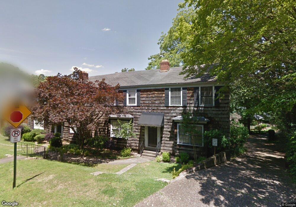
813 Beechwood St Unit A Little Rock, AR 72205
Hillcrest NeighborhoodEstimated Value: $490,000 - $545,000
--
Bed
3
Baths
2,167
Sq Ft
$242/Sq Ft
Est. Value
About This Home
This home is located at 813 Beechwood St Unit A, Little Rock, AR 72205 and is currently estimated at $524,032, approximately $241 per square foot. 813 Beechwood St Unit A is a home located in Pulaski County with nearby schools including Pulaski Heights Elementary School, Pulaski Heights Middle School, and Central High School.
Ownership History
Date
Name
Owned For
Owner Type
Purchase Details
Closed on
Apr 20, 2006
Sold by
Green Cheryl L and The Green Living Trust
Bought by
Prange George A and Glaser Eric W
Current Estimated Value
Home Financials for this Owner
Home Financials are based on the most recent Mortgage that was taken out on this home.
Original Mortgage
$68,850
Outstanding Balance
$39,497
Interest Rate
6.33%
Mortgage Type
Stand Alone Second
Estimated Equity
$484,535
Purchase Details
Closed on
Jul 15, 1999
Sold by
Boyeskie John A
Bought by
Green Cheryl
Home Financials for this Owner
Home Financials are based on the most recent Mortgage that was taken out on this home.
Original Mortgage
$200,000
Interest Rate
6.62%
Mortgage Type
Purchase Money Mortgage
Create a Home Valuation Report for This Property
The Home Valuation Report is an in-depth analysis detailing your home's value as well as a comparison with similar homes in the area
Home Values in the Area
Average Home Value in this Area
Purchase History
| Date | Buyer | Sale Price | Title Company |
|---|---|---|---|
| Prange George A | $345,000 | Lenders Title Company | |
| Green Cheryl | $200,000 | Lenders Title Company |
Source: Public Records
Mortgage History
| Date | Status | Borrower | Loan Amount |
|---|---|---|---|
| Open | Prange George A | $68,850 | |
| Open | Prange George A | $275,400 | |
| Previous Owner | Green Cheryl | $200,000 |
Source: Public Records
Tax History Compared to Growth
Tax History
| Year | Tax Paid | Tax Assessment Tax Assessment Total Assessment is a certain percentage of the fair market value that is determined by local assessors to be the total taxable value of land and additions on the property. | Land | Improvement |
|---|---|---|---|---|
| 2025 | $5,125 | $104,789 | $60,000 | $44,789 |
| 2024 | $5,125 | $104,789 | $60,000 | $44,789 |
| 2023 | $5,125 | $104,789 | $60,000 | $44,789 |
| 2022 | $5,125 | $104,789 | $60,000 | $44,789 |
| 2021 | $4,915 | $69,720 | $41,800 | $27,920 |
| 2020 | $4,505 | $69,720 | $41,800 | $27,920 |
| 2019 | $4,321 | $69,720 | $41,800 | $27,920 |
| 2018 | $4,141 | $69,720 | $41,800 | $27,920 |
| 2017 | $3,937 | $69,720 | $41,800 | $27,920 |
| 2016 | $3,732 | $58,320 | $9,600 | $48,720 |
| 2015 | $4,088 | $58,320 | $9,600 | $48,720 |
| 2014 | $4,088 | $58,320 | $9,600 | $48,720 |
Source: Public Records
Map
Nearby Homes
- 1100 N Palm St
- 416 N Spruce St
- 1109 N Spruce St
- 131 Fairview Rd
- 2501 Kavanaugh Blvd
- 501 N Palm St
- 314 N Walnut St
- 2423 Kavanaugh Blvd Unit 4
- 326 Ash St
- 5101 G St
- 4819 Lee Ave
- 5120 F St
- 4119 Lee Ave
- 5124 Woodlawn Dr
- 214 N Spruce St
- 5015 E Crestwood Dr
- 5101 Lee Ave
- 3901 Cedar Hill #23 Rd
- 324 N Jackson St
- 201 Beechwood St