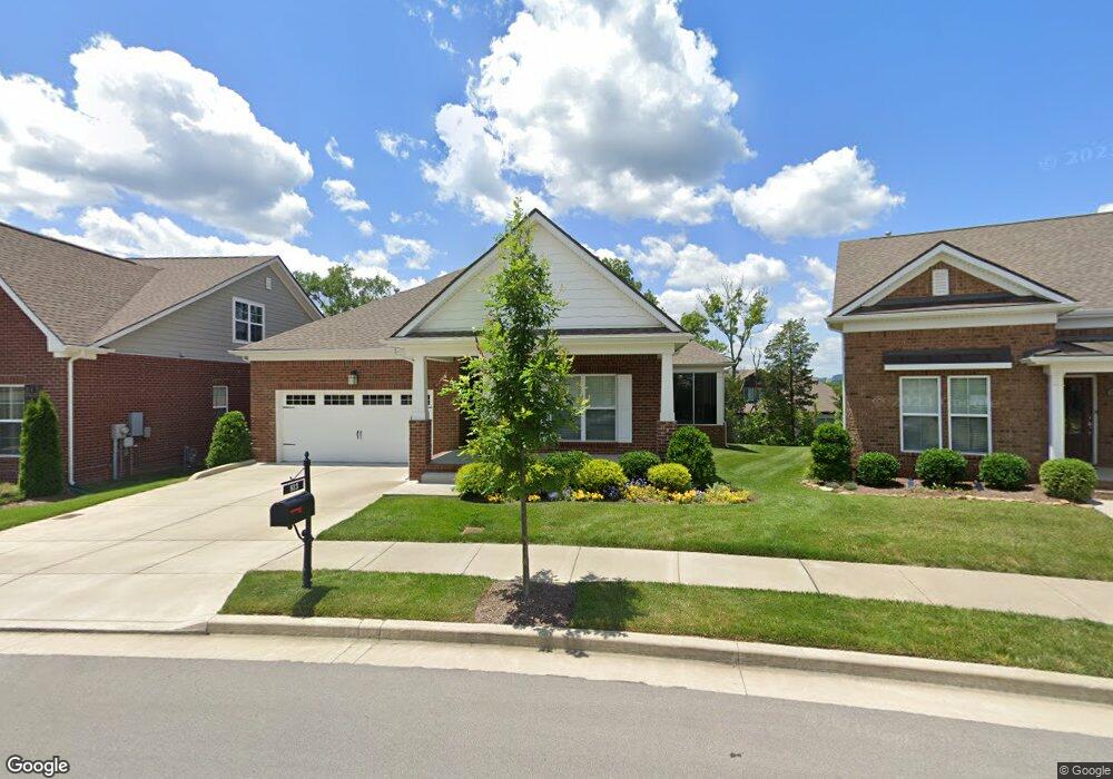
813 Branchside Trail Unit 114 Nolensville, TN 37135
Estimated Value: $543,000 - $567,000
3
Beds
2
Baths
1,716
Sq Ft
$322/Sq Ft
Est. Value
About This Home
This home is located at 813 Branchside Trail Unit 114, Nolensville, TN 37135 and is currently estimated at $553,089, approximately $322 per square foot. 813 Branchside Trail Unit 114 is a home located in Davidson County with nearby schools including Henry Maxwell Elementary School, Thurgood Marshall Middle School, and Cane Ridge High School.
Ownership History
Date
Name
Owned For
Owner Type
Purchase Details
Closed on
Apr 16, 2024
Sold by
Yaeger Steven A
Bought by
Whisler Stephen Mark and Whisler Barbara Ann
Current Estimated Value
Purchase Details
Closed on
Jun 2, 2019
Sold by
Mcalhany Robert E and Mcalhany Geraldine
Bought by
Yaeger Steven A
Home Financials for this Owner
Home Financials are based on the most recent Mortgage that was taken out on this home.
Original Mortgage
$295,920
Interest Rate
3.9%
Mortgage Type
New Conventional
Purchase Details
Closed on
May 26, 2016
Sold by
Regent Homes Llc
Bought by
Mcalhany Robert E and Mcalhany Geraldine
Create a Home Valuation Report for This Property
The Home Valuation Report is an in-depth analysis detailing your home's value as well as a comparison with similar homes in the area
Home Values in the Area
Average Home Value in this Area
Purchase History
| Date | Buyer | Sale Price | Title Company |
|---|---|---|---|
| Whisler Stephen Mark | $525,000 | Chapman & Rosenthal Title | |
| Yaeger Steven A | $369,900 | Memorial Title Llc | |
| Mcalhany Robert E | $301,628 | None Available |
Source: Public Records
Mortgage History
| Date | Status | Borrower | Loan Amount |
|---|---|---|---|
| Previous Owner | Yaeger Steven A | $295,920 |
Source: Public Records
Tax History Compared to Growth
Tax History
| Year | Tax Paid | Tax Assessment Tax Assessment Total Assessment is a certain percentage of the fair market value that is determined by local assessors to be the total taxable value of land and additions on the property. | Land | Improvement |
|---|---|---|---|---|
| 2024 | $2,803 | $95,925 | $16,750 | $79,175 |
| 2023 | $2,803 | $95,925 | $16,750 | $79,175 |
| 2022 | $3,634 | $95,925 | $16,750 | $79,175 |
| 2021 | $2,833 | $95,925 | $16,750 | $79,175 |
| 2020 | $2,908 | $76,775 | $14,500 | $62,275 |
| 2019 | $2,115 | $76,775 | $14,500 | $62,275 |
Source: Public Records
Map
Nearby Homes
- 625 Westcott Ln
- 3108 Celt Alley
- 747 Westcott Ln
- 301 Whitman Ct
- 1113 Frewin St
- 1121 Frewin St
- 413 Marlowe Ct
- 9021 Macauley Ln
- 9133 Macauley Ln
- 208 Foxley Ct
- 1147 Frewin St
- 1341 Duns Ln
- 2140 Kirkwall Dr
- 2138 Kirkwall Dr
- 2126 Kirkwall Dr
- 4516 Dumfries Alley
- 109 Hartley Ct
- 2064 Kirkwall Dr
- 821 Westcott Ln
- 2186 Kirkwall Dr
- 813 Branch Side Trail
- 813 Branch Side Trail
- 809 Branch Side Trail
- 817 Branch Side Trail
- 817 Branch Unit Trl
- 821 Branch Side Trail
- 821 Branch Side Trail
- 808 Branchside Trail Unit 118
- 808 Branch Side Trail
- 639 Westcott Ln
- 0 Lot 168 Alva Ln Unit 1612126
- 635 Westcott Ln
- 808 Branch Side Trail
- 9061 Macauley Ln Unit 382
- 9065 Macauley Ln
- 9065 Macauley Ln Unit 381
- 9065 Macauley Ln Unit 396
- 9065 Macauley Ln
- 9065 Macauley Ln
- 9061 Macauley Ln