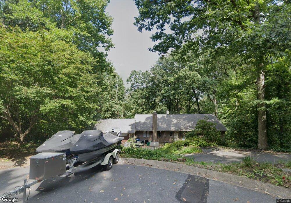
813 Colony Cir Lancaster, PA 17601
Oyster Point NeighborhoodEstimated Value: $498,000 - $599,000
4
Beds
3
Baths
3,175
Sq Ft
$171/Sq Ft
Est. Value
About This Home
This home is located at 813 Colony Cir, Lancaster, PA 17601 and is currently estimated at $543,428, approximately $171 per square foot. 813 Colony Cir is a home located in Lancaster County with nearby schools including Rohrerstown Elementary School, Centerville Middle School, and Hempfield Senior High School.
Ownership History
Date
Name
Owned For
Owner Type
Purchase Details
Closed on
Aug 28, 2009
Sold by
Henderson David D and Henderson Nancy F
Bought by
Fannin James C and Fannin Mandy R
Current Estimated Value
Home Financials for this Owner
Home Financials are based on the most recent Mortgage that was taken out on this home.
Original Mortgage
$283,176
Outstanding Balance
$185,008
Interest Rate
5.17%
Mortgage Type
FHA
Estimated Equity
$358,420
Create a Home Valuation Report for This Property
The Home Valuation Report is an in-depth analysis detailing your home's value as well as a comparison with similar homes in the area
Home Values in the Area
Average Home Value in this Area
Purchase History
| Date | Buyer | Sale Price | Title Company |
|---|---|---|---|
| Fannin James C | $288,400 | None Available |
Source: Public Records
Mortgage History
| Date | Status | Borrower | Loan Amount |
|---|---|---|---|
| Open | Fannin James C | $283,176 |
Source: Public Records
Tax History Compared to Growth
Tax History
| Year | Tax Paid | Tax Assessment Tax Assessment Total Assessment is a certain percentage of the fair market value that is determined by local assessors to be the total taxable value of land and additions on the property. | Land | Improvement |
|---|---|---|---|---|
| 2025 | $6,094 | $282,000 | $105,800 | $176,200 |
| 2024 | $6,094 | $282,000 | $105,800 | $176,200 |
| 2023 | $5,972 | $282,000 | $105,800 | $176,200 |
| 2022 | $5,808 | $282,000 | $105,800 | $176,200 |
| 2021 | $5,716 | $282,000 | $105,800 | $176,200 |
| 2020 | $5,716 | $282,000 | $105,800 | $176,200 |
| 2019 | $5,619 | $282,000 | $105,800 | $176,200 |
| 2018 | $1,106 | $282,000 | $105,800 | $176,200 |
| 2017 | $5,862 | $232,800 | $68,900 | $163,900 |
| 2016 | $5,862 | $232,800 | $68,900 | $163,900 |
| 2015 | $1,177 | $232,800 | $68,900 | $163,900 |
| 2014 | $4,406 | $232,800 | $68,900 | $163,900 |
Source: Public Records
Map
Nearby Homes
- 2778 Spring Valley Rd
- 2504 Brookside Dr
- 910 Pennwood Cir
- 916 Dorsea Rd
- 151 Pinnacle Point Dr
- 3 Spring Walk Ct
- 9 Spring Walk Ct
- 242 Bethel Dr
- 2411 Spring Water Cir
- 1315 Sylvan Rd
- 0 Spring Water Cir
- 2457 Spring Water Cir
- 2457 Spring Water Cir Unit 112
- 306 Country Place Dr Unit 306
- 880 Corvair Rd
- 2417 Spring Water Cir
- 189 Ridings Way
- 1313 Hyde Park Dr
- 1928 Pool Forge
- 1816 Mercers Mill
- 817 Colony Cir
- 808 Colony Cir
- 920 Forest Rd
- 924 Forest Rd
- 804 Colony Cir
- 916 Forest Rd
- 2660 Spring Valley Rd
- 928 Forest Rd
- 2654 Spring Valley Rd
- 2648 Spring Valley Rd
- 2640 Spring Valley Rd
- 923 Forest Rd
- 927 Forest Rd
- 2730 Spring Valley Rd
- 912 Forest Rd
- 919 Forest Rd
- 2752 Spring Valley Rd
- 2740 Spring Valley Rd
- 932 Forest Rd
- 2636 Spring Valley Rd