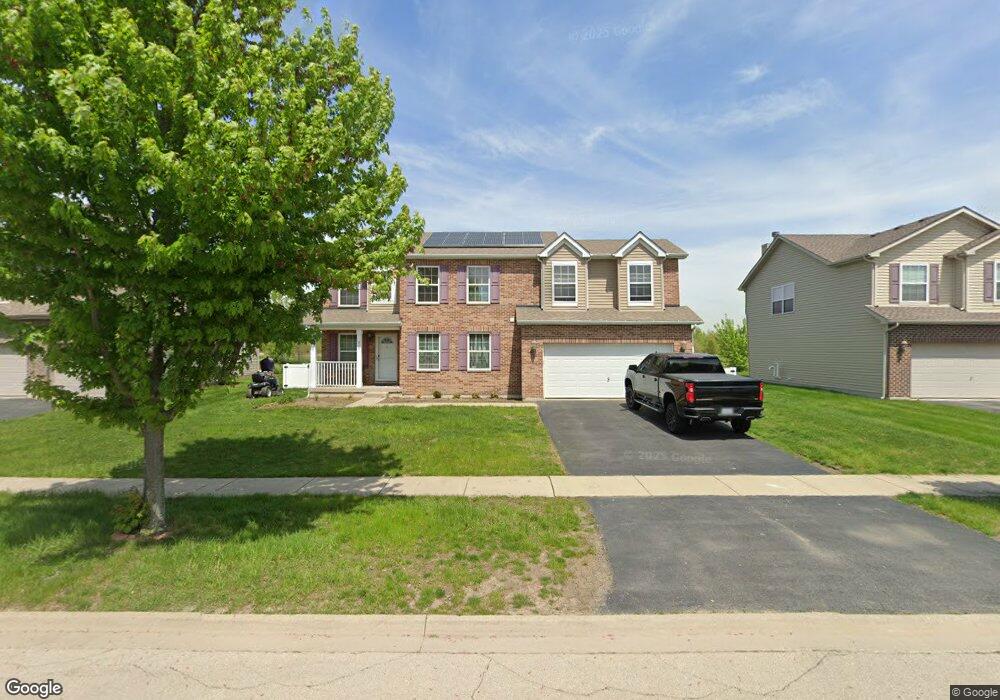
813 Maplewood Dr Unit 31 Minooka, IL 60447
Estimated Value: $371,000 - $389,386
4
Beds
3
Baths
2,150
Sq Ft
$175/Sq Ft
Est. Value
About This Home
This home is located at 813 Maplewood Dr Unit 31, Minooka, IL 60447 and is currently estimated at $377,097, approximately $175 per square foot. 813 Maplewood Dr Unit 31 is a home located in Grundy County with nearby schools including Minooka Primary Center, Minooka Elementary School, and Minooka Junior High School.
Ownership History
Date
Name
Owned For
Owner Type
Purchase Details
Closed on
May 15, 2020
Sold by
Greenwood Anthony R and Greenwood Elizabeth A
Bought by
Beattie Rick and Beattie Stephanie
Current Estimated Value
Home Financials for this Owner
Home Financials are based on the most recent Mortgage that was taken out on this home.
Original Mortgage
$255,647
Outstanding Balance
$226,539
Interest Rate
3.3%
Mortgage Type
VA
Estimated Equity
$150,558
Purchase Details
Closed on
Mar 27, 2015
Sold by
Aram J Aram J and Hill Marisa
Bought by
Greenwood Anthony R and Greenwood Elizabeth A
Create a Home Valuation Report for This Property
The Home Valuation Report is an in-depth analysis detailing your home's value as well as a comparison with similar homes in the area
Home Values in the Area
Average Home Value in this Area
Purchase History
| Date | Buyer | Sale Price | Title Company |
|---|---|---|---|
| Beattie Rick | $250,000 | Chicago Title | |
| Greenwood Anthony R | $229,000 | Fidelity National Title |
Source: Public Records
Mortgage History
| Date | Status | Borrower | Loan Amount |
|---|---|---|---|
| Open | Beattie Rick | $255,647 |
Source: Public Records
Tax History Compared to Growth
Tax History
| Year | Tax Paid | Tax Assessment Tax Assessment Total Assessment is a certain percentage of the fair market value that is determined by local assessors to be the total taxable value of land and additions on the property. | Land | Improvement |
|---|---|---|---|---|
| 2024 | $9,387 | $117,025 | $13,013 | $104,012 |
| 2023 | $8,556 | $106,667 | $11,861 | $94,806 |
| 2022 | $7,474 | $99,179 | $11,028 | $88,151 |
| 2021 | $7,159 | $93,884 | $10,439 | $83,445 |
| 2020 | $7,169 | $89,809 | $9,986 | $79,823 |
| 2019 | $6,598 | $83,156 | $9,246 | $73,910 |
| 2018 | $6,680 | $82,226 | $9,143 | $73,083 |
| 2017 | $6,488 | $78,520 | $8,731 | $69,789 |
| 2016 | $6,063 | $73,707 | $8,196 | $65,511 |
| 2015 | $5,130 | $67,000 | $7,450 | $59,550 |
| 2014 | $4,569 | $61,264 | $11,150 | $50,114 |
| 2013 | $4,695 | $62,090 | $11,300 | $50,790 |
Source: Public Records
Map
Nearby Homes
- 825 Grant Dr
- 1118 Burns Ln
- 802 Joanne Dr
- 605 High Grove Dr
- 1224 Burns Ln
- 703 Stillwater Ct
- 1404 Plantain Dr
- 713 Joanne Dr
- 1074-1080 Clover Dr
- 278,279,280,281 Clover Cir
- Lots 298-301 Clover Cir
- 324 Wabena Ct
- 1935 Waters Edge Dr
- 601 Edgewater Dr
- 1941 Waters Edge Dr
- 1420 Marigold Ln
- 406 Mccoy Ct
- 314 Golden Rod Dr
- 1468 Sedge Pass
- 1413 Sedge Pass
- 813 Maplewood Dr
- 817 Maplewood Dr
- 809 Maplewood Dr
- 834 Maplewood Dr
- 821 Maplewood Dr
- 805 Maplewood Dr
- 804 Maplewood Dr
- 812 Maplewood Dr
- 808 Maplewood Dr
- 816 Maplewood Dr
- 801 Maplewood Dr
- 825 Maplewood Dr
- 820 Maplewood Dr
- 824 Maplewood Dr
- 800 Maplewood Dr
- 745 Oakwood St
- 737 Oakwood St
- 724 Brita Trail
- 736 Maplewood Dr
- 728 Brita Trail