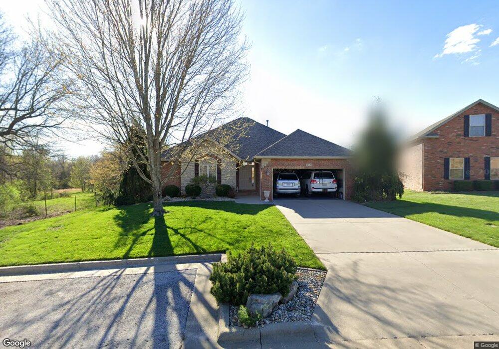
813 N Cedar Ridge Ave Springfield, MO 65802
Southeast Springfield NeighborhoodEstimated Value: $325,000 - $404,000
3
Beds
2
Baths
2,064
Sq Ft
$181/Sq Ft
Est. Value
About This Home
This home is located at 813 N Cedar Ridge Ave, Springfield, MO 65802 and is currently estimated at $372,622, approximately $180 per square foot. 813 N Cedar Ridge Ave is a home located in Greene County with nearby schools including Hickory Hills K-8 School, Glendale High School, and Grace Classical Academy.
Ownership History
Date
Name
Owned For
Owner Type
Purchase Details
Closed on
Mar 31, 2006
Sold by
Sanford Development Group Llc and Schneider Charles
Bought by
Robinson Lois F
Current Estimated Value
Home Financials for this Owner
Home Financials are based on the most recent Mortgage that was taken out on this home.
Original Mortgage
$120,000
Outstanding Balance
$65,977
Interest Rate
5.62%
Mortgage Type
Adjustable Rate Mortgage/ARM
Estimated Equity
$306,645
Purchase Details
Closed on
Mar 11, 2005
Sold by
Craftmaster Properties Llc and Barr Tom B
Bought by
Sanford Development Group Llc
Home Financials for this Owner
Home Financials are based on the most recent Mortgage that was taken out on this home.
Original Mortgage
$234,000
Interest Rate
5.67%
Mortgage Type
Construction
Create a Home Valuation Report for This Property
The Home Valuation Report is an in-depth analysis detailing your home's value as well as a comparison with similar homes in the area
Home Values in the Area
Average Home Value in this Area
Purchase History
| Date | Buyer | Sale Price | Title Company |
|---|---|---|---|
| Robinson Lois F | -- | Fidelity Title Agency | |
| Sanford Development Group Llc | -- | None Available |
Source: Public Records
Mortgage History
| Date | Status | Borrower | Loan Amount |
|---|---|---|---|
| Open | Robinson Lois F | $120,000 | |
| Previous Owner | Sanford Development Group Llc | $234,000 |
Source: Public Records
Tax History
| Year | Tax Paid | Tax Assessment Tax Assessment Total Assessment is a certain percentage of the fair market value that is determined by local assessors to be the total taxable value of land and additions on the property. | Land | Improvement |
|---|---|---|---|---|
| 2025 | $2,649 | $52,550 | $12,350 | $40,200 |
| 2024 | $2,649 | $46,910 | $8,550 | $38,360 |
| 2023 | $2,662 | $46,910 | $8,550 | $38,360 |
| 2022 | $2,672 | $45,790 | $8,550 | $37,240 |
| 2021 | $2,530 | $45,790 | $8,550 | $37,240 |
| 2020 | $2,430 | $41,860 | $8,550 | $33,310 |
| 2019 | $2,365 | $41,860 | $8,550 | $33,310 |
| 2018 | $2,489 | $44,000 | $7,600 | $36,400 |
| 2017 | $2,465 | $36,080 | $7,600 | $28,480 |
| 2016 | $2,021 | $36,080 | $7,600 | $28,480 |
| 2015 | $2,004 | $36,080 | $7,600 | $28,480 |
| 2014 | $1,966 | $35,130 | $7,600 | $27,530 |
Source: Public Records
Map
Nearby Homes
- 4402 E Kanata Ct
- 4460 E Pearson Meadow Dr
- 817 N Grapevine Rd
- 1100 N Farm Road 193
- 700 N Farm Road 193
- 1460 Glade Ave
- 4035 E Brookdale Terrace
- 4566 E Kentbrook Dr
- 4156 E Division St
- 1545 N Oakfair Place
- 4464 E Lancaster Way
- 1581 N Oakfair Place
- 755 N Fallbrooke Terrace
- Lot 23 N Mumford Ct
- Lot 24 N Mumford Ct
- 1527 N Edgemont Cir
- 3912 E Windsmore Dr
- 254 S Mumford Ct
- 1653 N Oakfair Place
- 4818 E Silverado Rd
- 819 N Cedar Ridge Ave
- 814 N Cedar Ridge Ave
- 825 N Cedar Ridge Ave
- 820 N Cedar Ridge Ave
- 4524 E Pearson Meadow Dr
- 4518 E Pearson Meadow Dr
- 4512 E Pearson Meadow Dr
- 4530 E Pearson Meadow Dr
- 831 N Cedar Ridge Ave
- 4535 E Pearson Meadow Dr
- 4519 E Pearson Meadow Dr
- 4536 E Pearson Meadow Dr
- 4513 E Pearson Meadow Dr
- 4542 E Pearson Meadow Dr
- 4570 E Fox Run Dr
- 4556 E Fox Run Dr
- 4568 E Fox Run Dr
- 832 N Cedar Ridge Ave
- 4531 E Pearson Meadow Dr
- 4548 E Pearson Meadow Dr
Your Personal Tour Guide
Ask me questions while you tour the home.