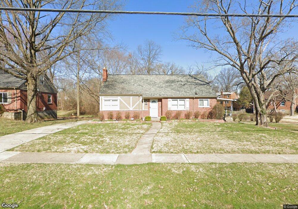
8131 Bobolink Dr Cincinnati, OH 45224
College Hill NeighborhoodEstimated Value: $262,072 - $283,000
3
Beds
2
Baths
1,168
Sq Ft
$235/Sq Ft
Est. Value
About This Home
This home is located at 8131 Bobolink Dr, Cincinnati, OH 45224 and is currently estimated at $274,018, approximately $234 per square foot. 8131 Bobolink Dr is a home located in Hamilton County with nearby schools including Pleasant Hill Elementary School, Western Hills High School, and Gilbert A. Dater High School.
Ownership History
Date
Name
Owned For
Owner Type
Purchase Details
Closed on
Dec 6, 1996
Sold by
Bloomfield Claude R
Bought by
Jeffries Hilliary L
Current Estimated Value
Home Financials for this Owner
Home Financials are based on the most recent Mortgage that was taken out on this home.
Original Mortgage
$82,650
Outstanding Balance
$8,432
Interest Rate
7.74%
Estimated Equity
$265,586
Purchase Details
Closed on
Sep 30, 1994
Sold by
Winne Harris B and Winne Marie M
Bought by
Luedeke Andrew F and Bloomfield Claude R
Home Financials for this Owner
Home Financials are based on the most recent Mortgage that was taken out on this home.
Original Mortgage
$76,100
Interest Rate
8.55%
Create a Home Valuation Report for This Property
The Home Valuation Report is an in-depth analysis detailing your home's value as well as a comparison with similar homes in the area
Home Values in the Area
Average Home Value in this Area
Purchase History
| Date | Buyer | Sale Price | Title Company |
|---|---|---|---|
| Jeffries Hilliary L | $87,000 | -- | |
| Luedeke Andrew F | -- | -- |
Source: Public Records
Mortgage History
| Date | Status | Borrower | Loan Amount |
|---|---|---|---|
| Open | Jeffries Hilliary L | $82,650 | |
| Previous Owner | Luedeke Andrew F | $76,100 |
Source: Public Records
Tax History Compared to Growth
Tax History
| Year | Tax Paid | Tax Assessment Tax Assessment Total Assessment is a certain percentage of the fair market value that is determined by local assessors to be the total taxable value of land and additions on the property. | Land | Improvement |
|---|---|---|---|---|
| 2024 | $4,006 | $66,466 | $17,231 | $49,235 |
| 2023 | $4,096 | $66,466 | $17,231 | $49,235 |
| 2022 | $2,773 | $40,131 | $14,028 | $26,103 |
| 2021 | $2,657 | $40,131 | $14,028 | $26,103 |
| 2020 | $2,736 | $40,131 | $14,028 | $26,103 |
| 2019 | $2,623 | $35,203 | $12,306 | $22,897 |
| 2018 | $2,627 | $35,203 | $12,306 | $22,897 |
| 2017 | $2,495 | $35,203 | $12,306 | $22,897 |
| 2016 | $3,067 | $42,777 | $13,132 | $29,645 |
| 2015 | $2,767 | $42,777 | $13,132 | $29,645 |
| 2014 | $2,787 | $42,777 | $13,132 | $29,645 |
| 2013 | $2,921 | $44,100 | $13,538 | $30,562 |
Source: Public Records
Map
Nearby Homes
- 7923 Bobolink Dr
- 1280 Brushwood Ave
- 7929 Cherrywood Ct
- 6765 Richard Ave
- 6596 S Oak Knoll Dr
- 6586 S Oak Knoll Dr
- 6832 Tarawa Dr
- 6785 Marvin Ave
- 6642 Plantation Way
- 6538 S Oak Knoll Dr
- 1544 W Galbraith Rd
- 1148 Hollywood Ave
- 1140 Hollywood Ave
- 8579 Daly Rd
- 8543 Foxcroft Dr
- 8681 Desoto Dr
- 1025 Eastgate Dr
- 1533 Corcoran Place
- 1478 Foxwood Dr
- 1562 Oak Knoll Dr
- 8077 Bobolink Dr
- 1263 W Galbraith Rd
- 1267 W Galbraith Rd
- 1269 W Galbraith Rd
- 1259 W Galbraith Rd
- 8039 Bobolink Dr
- 1271 W Galbraith Rd
- 8096 Bobolink Dr
- 8140 Bobolink Dr
- 8134 Bobolink Dr
- 8064 Bobolink Dr
- 8144 Bobolink Dr
- 1273 W Galbraith Rd
- 8001 Bobolink Dr
- 8032 Bobolink Dr
- 8000 Bobolink Dr
- 8061 Knollwood Ln
- 1235 W Galbraith Rd
- 7985 Knollwood Ln
- 8041 Knollwood Ln